Login
Register


2A9
Kotlik Airport
Official FAA Data Effective 2026-01-22 0901Z
Chart Supplement

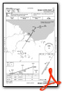
VFR Chart of PFKO
Sectional Charts at SkyVector.com
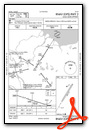
IFR Chart of PFKO
Enroute Charts at SkyVector.com
Location Information for PFKO
Coordinates: N63°1.83' / W163°31.96'Located 01 miles W of Kotlik, Alaska on 185 acres of land. View all Airports in Alaska.
Surveyed Elevation is 13 feet MSL.
Operations Data
|
|
Airport Communications
| AWOS-3P: | 118.1 Tel. 907-269-2701 |
|---|---|
| CTAF: | 122.900 |
| AWOS-3P at ENM (30.0 SW): | 135.35 907-269-2755 |
| AWOS-3P at SMK (47.3 NE): | 119.275 907-923-6480 |
| AWOS-3P at MOU (56.3 S): | 118.35 907-560-7618 |
- APCH/DEP SVC PRVDD BY ANCHORAGE ARTCC ON FREQS 124.0 (ST. MARY'S RCAG).
Nearby Navigation Aids
|
| ||||||||||||||||||||||||


Runway 02/20
| Dimensions: | 4400 x 100 feet / 1341 x 30 meters | |
|---|---|---|
| Surface: | Gravel in Fair Condition | |
| Edge Lighting: | Medium Intensity | |
| Runway 02 | Runway 20 | |
| Coordinates: | N63°1.53' / W163°32.38' | N63°2.14' / W163°31.53' |
| Elevation: | 12.3 | 13.6 |
| Runway Heading: | 32° True | 212° True |
Services Available
| Fuel: | NONE |
|---|---|
| Transient Storage: | Tiedowns |
| Airframe Repair: | NOT AVAILABLE |
| Engine Repair: | NOT AVAILABLE |
| Bottled Oxygen: | NOT AVAILABLE |
| Bulk Oxygen: | NOT AVAILABLE |
Ownership Information
| Ownership: | Publicly owned | |
|---|---|---|
| Owner: | ALASKA DOT&PF NORTHERN REGION | |
| 2301 PEGER RD, 2301 PEGER RD | ||
| FAIRBANKS, AK 99709 | ||
| 907-451-2200 | ||
| Manager: | JOHN WILSON | |
| BOX 192 | ||
| UNALAKLEET, AK 99684 | ||
| (907) 625-1025 | ||
Other Remarks
- RWY COND UNMNT; RCMD VISUAL INSP PRIOR TO LNDG.
- WX CAMERA AVBL ON INTERNET AT HTTPS://WEATHERCAMS.FAA.GOV
- ACTVT MIRL RWY 02/20 - CTAF.
- ACTVT ROTG BCN - CTAF.
Weather Minimums

Instrument Approach Procedure (IAP) Charts
Nearby Airports with Instrument Procedures
| ID | Name | Heading / Distance | ||
|---|---|---|---|---|
 |
PAEM | Emmonak Airport | 241° | 30.1 |
|
PAMK | St Michael Airport | 053° | 47.5 |
|
PAMO | Mountain Village Airport | 184° | 56.5 |
|
PASM | St Mary's Airport | 173° | 58.7 |
|
PADM | Marshall Don Hunter Sr Airport | 148° | 81.8 |
|
PAUN | Unalakleet Airport | 053° | 89.9 |
|
PACM | Scammon Bay Airport | 219° | 91.3 |
|
PAGL | Golovin Airport | 008° | 92.5 |
|
PARS | Russian Mission Airport | 139° | 97.6 |
|
PAWM | White Mountain Airport | 001° | 99.9 |
|
PFEL | Elim Airport | 018° | 101.1 |
|
PFSH | Shaktoolik Airport | 036° | 101.5 |
Airport Images
Do you have a recent image of this airport? Upload it here!


