Login
Register


TBPB
Grantley Adams International Airport
VFR Chart of TBPB
Sectional Charts at SkyVector.com
IFR Chart of TBPB
Enroute Charts at SkyVector.com
Location Information for TBPB
Coordinates: N13°4.48' / W59°29.53'View all Airports in Christ Church, Barbados.
Elevation is 169.0 feet MSL.
Operations Data
|
|
Airport Communications
| ADAMS RADAR Approach: | 129.35 |
|---|---|
| ADAMS ARR Arrival: | 120.70 |
| ADAMS ARR Arrival: | 128.85 |
| ADAMS INFORMATION ATIS: | 132.72 |
| ADAMS DEP Departure: | 120.70 |
| ADAMS DEP Departure: | 128.85 |
| GRANTLEY ADAMS INTL Emergency: | 121.50 |
| ADAMS GND Ground Control: | 121.90 |
| ADAMS TOWER Tower: | 118.70 |
Nearby Navigation Aids
|
| ||||||||||||||||||||||||||||||||||||||||||||||||||||||||||||


Runway 09/27
| Dimensions: | 11017 x 148 feet / 3358 x 45 meters | |
|---|---|---|
| Surface: | Hard | |
| Runway 09 | Runway 27 | |
| Coordinates: | N13°4.26' / W59°30.43' | N13°4.70' / W59°28.62' |
| Elevation: | 169 | 160 |
| Runway Heading: | 091° | 271° |
Nearby Airports with Instrument Procedures
| ID | Name | Heading / Distance | ||
|---|---|---|---|---|
 |
TLPL | Vieuxfort/ Hewanorra - International Airport | 294° | 94.0 |
|
TVSA | Kingstown/Argyle Airport | 273° | 97.1 |
|
TLPC | George F L Charles Airport | 302° | 104.3 |
|
TVSC | Canouan/Canouan Island Airport | 258° | 110.9 |
|
TFFF | Martinique Aime Cesaire Airport | 316° | 126.2 |
|
TTCP | A.N.R. Robinson - International Airport | 214° | 139.4 |
|
TGPY | St. Georges/Maurice Bishop - I Airport | 244° | 149.0 |
Airport Images
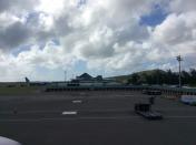
By: Caputomaru


