Login
Register


U79
Chamberlain USFS Airport
Official FAA Data Effective 2025-11-27 0901Z
Chart Supplement

VFR Chart of U79
Sectional Charts at SkyVector.com
IFR Chart of U79
Enroute Charts at SkyVector.com
Location Information for U79
Coordinates: N45°22.74' / W115°11.81'Located 00 miles E of Chamberlain Guard Station, Idaho on 55 acres of land. View all Airports in Idaho.
Estimated Elevation is 5765 feet MSL.
Operations Data
|
|
Airport Communications
| CTAF: | 122.900 |
|---|---|
| ASOS at MYL (48.1 SW): | 119.925 208-634-5947 |
| AWOS-3 at GIC (51.8 NW): | 118.175 208-983-0306 |
| AWOS-3PT at SMN (57.7 E): | 135.075 208-756-4381 |
Nearby Navigation Aids
|
| ||||||||||||||||||||||||||||||

Runway 07/25
| Dimensions: | 4100 x 200 feet / 1250 x 61 meters | |
|---|---|---|
| Surface: | Turf-Dirt in Fair Condition RWY END 25 - FIRST 300 FT OF RWY SFC IS ROUGH. | |
| Runway 07 | Runway 25 | |
| Traffic Pattern: | Left | Left |
| Obstacles: | 70 ft Trees 0 ft from runway, 115 ft right of center +35 FT TREES 40 FT ON CNTRLN. RWY LCTD IN HIGH MTUS TRRN SRNDD BY 70 FT - 80 FT TALL TREES. |
45 ft Tree 0 ft from runway, 100 ft left of center +325' TIMBERED RIDGE 5000' ON CNTRLN. |
Runway 15/33
| Dimensions: | 2700 x 140 feet / 823 x 43 meters | |
|---|---|---|
| Surface: | Turf in Poor Condition RY 15/33 ROUGH AND UNEVEN SFC. | |
| Runway 15 | Runway 33 | |
| Traffic Pattern: | Left | Left |
| Obstacles: | 40 ft Trees 0 ft from runway, 90 ft right of center RWY 15 150 FT TIMBERED HILL 1200 FT ON CNTRLN RWY LCTD IN HIGH MTUS & TIMBERED TRRN. |
35 ft Trees 60 ft from runway, 75 ft right of center +275' TIMBERED RIDGE 2100' ON CNTRLN +35' TREES AT 300' ON CNTRLN. |
Services Available
| Fuel: | NONE |
|---|---|
| Transient Storage: | Tiedowns |
| Airframe Repair: | NONE |
| Engine Repair: | NONE |
| Bottled Oxygen: | NONE |
| Bulk Oxygen: | NONE |
Ownership Information
| Ownership: | Publicly owned | |
|---|---|---|
| Owner: | U S FOREST SERVICE | |
| 324 25TH ST | ||
| OGDEN, UT 84401 | ||
| 801-625-5511 | ||
| Manager: | KRASSEL DISTRICT RANGER | |
| 500 NORTH MISSION STREET | ||
| MC CALL, ID 83638 | ||
| 208-634-0600 | ||
Other Remarks
- APRT SUBJ TEMPO CLSD ERY SPRING TO SOFT RWYS.
- +70 FT TREES ADJ TO ALL RWY EDGES.
- EXTSV RODENT ACTIVITY ON BOTH RWYS.
- NO FONE AVBL AT ARPT.
- PVT STONE BREAKER ARPT LOCATED 1 NM NE OF CHAMBERLAIN USFS.
- RWY 15/33 HAS +2 FT PIPE & -2 FT DITCH ACRS RWY NORTH OF RWY 07/25 INT; 1ST 300 FT OF RWY 33 CLSD.
- FOR CD CTC SEATTLE ARTCC AT 253-351-3694.
- RWY 07/25 & RWY 15/33 THRS MKD & RWYS OUTLINED WITH YELLOW ROCKS - BARELY VSB.
Nearby Airports with Instrument Procedures
| ID | Name | Heading / Distance | ||
|---|---|---|---|---|
 |
KMYL | Mc Call Municipal Airport | 232° | 48.4 |
|
KGIC | Idaho County Airport | 311° | 51.6 |
|
KSMN | Lemhi County Airport | 104° | 57.8 |
|
KHRF | Ravalli County Airport | 040° | 69.3 |
|
32S | Stevensville Airport | 034° | 83.8 |
|
KJSY | Joseph State Airport | 269° | 87.0 |
|
KLWS | Lewiston/Nez Perce County Airport | 308° | 96.9 |
|
S87 | Weiser Municipal Airport | 227° | 103.2 |
|
KMSO | Missoula Montana Airport | 026° | 103.2 |
|
3U3 | Bowman Field Airport | 063° | 108.3 |
|
KDLN | Dillon Airport | 092° | 112.2 |
|
KONO | Ontario Municipal Airport | 224° | 112.7 |
Airport Images
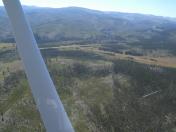
By: 61skyhawk


