Login
Register


UNO
West Plains Regional Airport
Official FAA Data Effective 2025-11-27 0901Z
Chart Supplement

VFR Chart of KUNO
Sectional Charts at SkyVector.com
IFR Chart of KUNO
Enroute Charts at SkyVector.com
Location Information for KUNO
Coordinates: N36°52.71' / W91°54.16'Located 10 miles NW of West Plains, Missouri on 250 acres of land. View all Airports in Missouri.
Surveyed Elevation is 1228 feet MSL.
Operations Data
|
|
Airport Communications
| ASOS: | 123.825 Tel. 417-257-1313 |
|---|---|
| CTAF: | 122.800 |
| UNICOM: | 122.800 |
| ASOS at BPK (41.0 SW): | 133.975 870-481-5946 |
| AWOS-3PT at FLP (48.2 SW): | 132.075 870-453-2380 |
| AWOS-3PT at 42A (48.6 S): | 121.575 870-916-2768 |
- APCH/DEP SVC PRVDD BY MEMPHIS ARTCC ON FREQS 120.075/289.4 (WALNUT RIDGE RCAG).
Nearby Navigation Aids
|
| ||||||||||||||||||||||||||||||||||||||||||


Runway 18/36
| Dimensions: | 5101 x 75 feet / 1555 x 23 meters | |
|---|---|---|
| Surface: | Asphalt in Good Condition | |
| Weight Limits: | S-30, D-39 | |
| Edge Lighting: | Medium Intensity | |
| Runway 18 | Runway 36 | |
| Coordinates: | N36°53.13' / W91°54.15' | N36°52.29' / W91°54.17' |
| Elevation: | 1225.2 | 1228.2 |
| Runway Heading: | 181° True | 1° True |
| Markings: | Non-Precision Instrument in good condition. | Non-Precision Instrument in good condition. |
| Glide Slope Indicator | P2L (3.00° Glide Path Angle) | P2L (3.00° Glide Path Angle) |
| REIL: | Yes | Yes |
Services Available
| Fuel: | 100LL (blue), Jet-A |
|---|---|
| Transient Storage: | Tiedowns |
| Airframe Repair: | NONE |
| Engine Repair: | NONE |
| Bottled Oxygen: | NOT AVAILABLE |
| Bulk Oxygen: | NOT AVAILABLE |
| Other Services: | AIR AMBULANCE SERVICES,PILOT INSTRUCTION |
Ownership Information
| Ownership: | Publicly owned | |
|---|---|---|
| Owner: | CITY OF WEST PLAINS | |
| 1910 HOLIDAY LANE-BOX 710 | ||
| WEST PLAINS, MO 65775 | ||
| 417-256-7176 | ||
| Manager: | CHRIS HENSON | |
| 4523 CO ROAD 2340 | ||
| POMONA, MO 65789 | ||
| 417-372-0119 | ||
Other Remarks
- HELICOPTER OPS ON & INVOF ARPT.
- FOR CD CTC MEMPHIS ARTCC AT 901-368-8453/8449.
- FOR ATTENDANT AFTER 1700 CALL 417-256-2244 OR 417-372-0119.
- ACTVT MIRL RY 18/36; PAPI RYS 18; 36 & REIL RYS 18 & 36 AFT 2200 - CTAF.
Weather Minimums


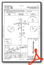
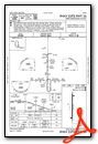
Instrument Approach Procedure (IAP) Charts
Nearby Airports with Instrument Procedures
| ID | Name | Heading / Distance | ||
|---|---|---|---|---|
 |
KMNF | Mountain View Airport | 052° | 11.4 |
|
KTVB | Cabool Memorial Airport | 330° | 17.5 |
|
1MO | Mountain Grove Memorial Airport | 306° | 24.4 |
|
M48 | Houston Memorial Airport | 352° | 27.3 |
|
KAOV | Ava Bill Martin Memorial Airport | 278° | 37.9 |
|
6M2 | Horseshoe Bend Airport | 169° | 40.0 |
|
KCVK | Sharp County Regional Airport | 155° | 40.3 |
|
KBPK | Baxter County Airport | 222° | 41.0 |
|
K33 | Salem Memorial Airport | 017° | 46.4 |
|
KFLP | Marion County Regional Airport | 223° | 48.4 |
|
42A | Melbourne Municipal/John E Miller Field Airport | 175° | 48.5 |
|
KTBN | Waynesville-St Robert Regional Forney Field Airport | 347° | 53.0 |
Airport Images
Do you have a recent image of this airport? Upload it here!


