Login
Register


AOV
Ava Bill Martin Memorial Airport
Official FAA Data Effective 2026-01-22 0901Z
Chart Supplement

VFR Chart of KAOV
Sectional Charts at SkyVector.com
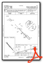
IFR Chart of KAOV
Enroute Charts at SkyVector.com
Location Information for KAOV
Coordinates: N36°58.31' / W92°40.92'Located 02 miles NW of Ava, Missouri on 62 acres of land. View all Airports in Missouri.
Surveyed Elevation is 1311 feet MSL.
Operations Data
|
|
Airport Communications
| SPRINGFIELD APPROACH: | 126.35 |
|---|---|
| SPRINGFIELD DEPARTURE: | 126.35 |
| UNICOM: | 122.700 |
| CTAF: | 122.700 |
| ATIS at BBG (36.3 SW): | 124.625 |
| AWOS-2 at BBG (36.3 SW): | 124.625 417-334-0218 |
| ASOS at SGF (37.5 NW): | 417-869-4491 |
Nearby Navigation Aids
|
| ||||||||||||||||||||||||||||||||||||||||||||||||||||||


Runway 13/31
| Dimensions: | 3634 x 50 feet / 1108 x 15 meters | |
|---|---|---|
| Surface: | Asphalt in Excellent Condition | |
| Edge Lighting: | Medium Intensity | |
| Runway 13 | Runway 31 | |
| Coordinates: | N36°58.53' / W92°41.17' | N36°58.09' / W92°40.66' |
| Elevation: | 1277.0 | 1311.0 |
| Traffic Pattern: | Left | Left |
| Runway Heading: | 137° True | 317° True |
| Markings: | Non-Precision Instrument in fair condition. | Non-Precision Instrument in fair condition. |
| Glide Slope Indicator | P2L (3.00° Glide Path Angle) | |
| Obstacles: | 37 ft Trees 235 ft from runway, 197 ft right of center TREES 10-35FT 10-175FT FROM RWY END, 150-250 FT RIGHT; TREES 10-43 FT 25-70 FT FROM RWY END, 235 FT LEFT |
|
Services Available
| Fuel: | 100LL (blue) |
|---|---|
| Transient Storage: | Tiedowns |
| Airframe Repair: | MAJOR |
| Engine Repair: | MAJOR |
| Bottled Oxygen: | NONE |
| Bulk Oxygen: | NONE |
| Other Services: | PILOT INSTRUCTION,AIRCRAFT RENTAL |
Ownership Information
| Ownership: | Publicly owned | |
|---|---|---|
| Owner: | CITY OF AVA | |
| 404 SOUTH JEFFERSON ST, P.O. BOX 967 | ||
| AVA, MO 65608 | ||
| 417-683-5516 | ||
| Manager: | DAVID DAVIDSON | |
| PO BOX 967 | ||
| AVA, MO 65608 | ||
| 417-840-2301 | ||
Other Remarks
- THIS AIRPORT HAS BEEN SURVEYED BY THE NATIONAL GEODETIC SURVEY.
- NTSD RY SAFETY AREA BYD RY 13 END, INSUF LENGTH AND LARGE DROP OFF.
- 100LL SELF SVC CREDIT CARD AVBL 24 HRS.
- CLICK PCL 5 TIMES TO UNLOCK TERMINAL DOOR.
- FOR CD CTC SPRINGFIELD APCH AT 417-868-5620/5619.
- ACTVT PAPI RWY 13; MIRL RWY 13/31 - CTAF. PAPI INTST OPER ON PHOTO CELL DAY/NGT; MIRL INTST VRBL: 3, 5, 7 CLICKS - CTAF.
Weather Minimums

Instrument Approach Procedure (IAP) Charts


Nearby Airports with Instrument Procedures
| ID | Name | Heading / Distance | ||
|---|---|---|---|---|
 |
1MO | Mountain Grove Memorial Airport | 063° | 20.0 |
|
KTVB | Cabool Memorial Airport | 071° | 30.3 |
|
3DW | Downtown Airport | 299° | 31.1 |
|
KPLK | M Graham Clark Downtown Airport | 231° | 33.5 |
|
KBBG | Branson Airport | 223° | 36.3 |
|
KBPK | Baxter County Airport | 164° | 37.5 |
|
KSGF | Springfield-Branson Ntl Airport | 296° | 37.7 |
|
KUNO | West Plains Regional Airport | 098° | 37.9 |
|
KFWB | Branson West Municipal/Emerson Field Airport | 244° | 38.4 |
|
M48 | Houston Memorial Airport | 057° | 40.2 |
|
KLBO | Floyd W Jones Lebanon Airport | 001° | 40.6 |
|
KFLP | Marion County Regional Airport | 173° | 41.0 |
Airport Images

By: Big Orange Bird


Comments
4 Experimentals
4 Experimentals, RV-7,RV-6,RV4,and an SPA Panther Ls stopped in for fuel on 6/27/2025 and found the frendliest most accomodating folks there eager to serve any need we might have had, Great People! Unfortunatly for us we were trying to stay ahead of some weather predicted to form along our route so we could only stay long enough to fuel and visit the restroom. If You are passing near by drop in and get some 100LL and if your not in a rush they have a courtesy car you can take into town.