Login
Register
X05
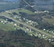
Pilot Country Airport
Official FAA Data Effective 2025-12-25 0901Z
VFR Chart of X05
Sectional Charts at SkyVector.com
IFR Chart of X05
Enroute Charts at SkyVector.com
Location Information for X05
Coordinates: N28°19.82' / W82°29.79'Located 13 miles S of Brooksville, Florida on 27 acres of land. View all Airports in Florida.
Surveyed Elevation is 80 feet MSL.
Operations Data
|
|
Airport Communications
| UNICOM: | 122.800 |
|---|---|
| CTAF: | 122.800 |
| ASOS at BKV (8.9 N): | 134.725 352-799-5881 |
| AWOS-3PT at ZPH (19.2 E): | 118.975 813-780-0031 |
| AWOS-3 at VDF (20.4 SE): | 121.125 813-630-0924 |
Nearby Navigation Aids
|
| ||||||||||||||||||||||||||||||||||||||||||
Runway 18/36
| Dimensions: | 3700 x 75 feet / 1128 x 23 meters | |
|---|---|---|
| Surface: | Asphalt in Fair Condition | |
| Edge Lighting: | Low Intensity | |
| Runway 18 | Runway 36 | |
| Traffic Pattern: | Left | Left |
| Displaced Threshold: | 300 Feet | 900 Feet |
| Markings: | Basic in fair condition. | Basic in fair condition. |
| Obstacles: | 87 ft Trees 1725 ft from runway | 10 ft Road 255 ft from runway FUEL TANK 110 FT E OF RWY 36 CNTRLN FIRST 150 FT. RWY 36 APCH RATIO 22:1 TO THE DSPLCD THR. |
Services Available
| Fuel: | 100LL (blue) |
|---|---|
| Transient Storage: | Hangars,Tiedowns |
| Airframe Repair: | MINOR |
| Engine Repair: | MINOR |
| Bottled Oxygen: | NONE |
| Bulk Oxygen: | NONE |
| Other Services: | PILOT INSTRUCTION,AIRCRAFT RENTAL |
Ownership Information
| Ownership: | Privately Owned | |
|---|---|---|
| Owner: | MARK TWAALFHOVEN | |
| 11729 DRIVER LANE | ||
| SPRING HILL, FL 34610 | ||
| 408-966-4439 | ||
| Manager: | JILL TROUGHTON | |
| 11500 PILOT COUNTRY DR | ||
| SPRINGHILL, FL 34610 | ||
| 813-235-9000 | ||
Other Remarks
- BIRDS INVOF RY.
- 18 FT FUEL TANK 90 FT FROM END OF RY 105 FT R OF CNTRLN.
- FOR CD CTC TAMPA APCH AT 813-878-2528.
- 0LL FUEL 24 HR CREDIT CARD SVC AVBL.
- ACTVT LIRL RY 18/36 - CTAF.
Nearby Airports with Instrument Procedures
| ID | Name | Heading / Distance | ||
|---|---|---|---|---|
 |
KBKV | Brooksville-Tampa Bay Regional Airport | 014° | 8.8 |
 |
KZPH | Zephyrhills Municipal Airport | 108° | 19.1 |
 |
KVDF | Tampa Exec Airport | 157° | 20.6 |
 |
KTPA | Tampa International Airport | 185° | 21.3 |
 |
KTPF | Peter O Knight Airport | 174° | 24.9 |
 |
KCLW | Clearwater Exec Airport | 213° | 25.3 |
 |
KPCM | Plant City Airport | 138° | 26.5 |
 |
KPIE | St Pete-Clearwater International Airport | 201° | 27.2 |
 |
KMCF | Macdill AFB Airport | 182° | 28.8 |
 |
KINF | Inverness Airport | 018° | 29.8 |
 |
KCGC | Crystal River/Davis Field Airport | 352° | 32.4 |
 |
KLAL | Lakeland Linder International Airport | 128° | 32.6 |


