Login
Register
Z55
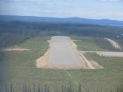
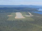
Lake Louise Airport
Official FAA Data Effective 2024-10-31 0901Z
VFR Chart of Z55
Sectional Charts at SkyVector.com
IFR Chart of Z55
Enroute Charts at SkyVector.com
Location Information for Z55
Coordinates: N62°17.50' / W146°34.64'Located 01 miles NE of Lake Louise, Alaska. View all Airports in Alaska.
Estimated Elevation is 2480 feet MSL.
Operations Data
|
|
Airport Communications
| CTAF: | 122.900 |
|---|---|
| AWOS-3P at AZK (27.0 SW): | 134.95 907-822-3011 |
| ASOS at GKN (32.5 E): | 134.85 907-822-3707 |
Nearby Navigation Aids
|
| ||||||||||||||||||
Runway 13/31
| Dimensions: | 2900 x 60 feet / 884 x 18 meters | |
|---|---|---|
| Surface: | Gravel in Excellent Condition | |
| Runway 13 | Runway 31 | |
| Coordinates: | N62°17.70' / W146°34.90' | N62°17.29' / W146°34.39' |
| Elevation: | 2480.2 | 2474.1 |
| Traffic Pattern: | Right | Left |
| Runway Heading: | 150° True | 330° True |
| Markings: | Non-Standard in good condition. | Non-Standard in good condition. |
| Obstacles: | 12 ft Brush 0 ft from runway, 85 ft left of center | 32 ft Trees 1049 ft from runway |
Services Available
| Fuel: | NONE |
|---|---|
| Transient Storage: | Tiedowns |
| Airframe Repair: | NONE |
| Engine Repair: | NONE |
| Bottled Oxygen: | NONE |
| Bulk Oxygen: | NONE |
Ownership Information
| Ownership: | Publicly owned | |
|---|---|---|
| Owner: | ALASKA DOT&PF NORTHERN REGION | |
| 2301 PEGER ROAD | ||
| FAIRBANKS, AK 99701 | ||
| 907-451-2200 | ||
| Manager: | CHAD HELLER | |
| PO BOX 7 | ||
| GLENNALLEN, AK 99588 | ||
| 907-822-3222 | ||
Other Remarks
- RY CONDITION NOT MONITORED; RECOMMEND VISUAL INSPECTION PRIOR TO LANDING.
- CARIBOU INVOF RY.
- NO RADIO AVBL FOR CLOSING FLIGHT PLANS.
- NO WINTER MAINTENANCE.
- FLOAT PLANE ACTIVITY ON LAKE LOUISE.
- RY 13/31 NSTD MKGS; RED & GREEN REFLECTIVE MKRS AT THLDS; REFLECTIVE WHITE MKRS ENTIRE RY LENGTH; REFLECTIVE BLUE MARKERS ON TWY.
Nearby Airports with Instrument Procedures
| ID | Name | Heading / Distance | ||
|---|---|---|---|---|
 |
PAGK | Gulkana Airport | 104° | 32.6 |
 |
PAVD | Valdez Pioneer Field Airport | 172° | 70.3 |
 |
PAAQ | Warren "Bud" Woods Palmer Municipal Airport | 240° | 82.6 |
 |
PAKA | Tatitlek Airport | 182° | 85.5 |
 |
PAWS | Wasilla Airport | 244° | 94.5 |
 |
PABI | Allen AAF Airport | 012° | 105.1 |
 |
PACV | Merle K (Mudhole) Smith Airport | 163° | 112.9 |
 |
PAHV | Healy River Airport | 326° | 115.1 |


