Login
Register
S37
Smoketown Airport
Official FAA Data Effective 2024-11-28 0901Z
VFR Chart of S37
Sectional Charts at SkyVector.com
IFR Chart of S37
Enroute Charts at SkyVector.com
Location Information for S37
Coordinates: N40°2.50' / W76°12.11'Located 00 miles N of Smoketown, Pennsylvania on 49 acres of land. View all Airports in Pennsylvania.
Estimated Elevation is 370 feet MSL.
Operations Data
|
|
Airport Communications
| UNICOM: | 123.050 |
|---|---|
| CTAF: | 123.050 |
| ATIS at LNS (6.4 NW): | 125.675 |
| ASOS at LNS (6.4 NW): | 125.675 717-569-8860 |
| AWOS-3 at MQS (15.9 E): | 126.25 610-384-6132 |
Nearby Navigation Aids
|
| ||||||||||||||||||||||||||||||||||||||||||||||||||||||||||||
Runway 10/28
| Dimensions: | 2750 x 50 feet / 838 x 15 meters | |
|---|---|---|
| Surface: | Asphalt in Good Condition | |
| Weight Limits: | S-12, D-12 | |
| Edge Lighting: | Low Intensity | |
| Runway 10 | Runway 28 | |
| Coordinates: | N40°2.48' / W76°12.41' | N40°2.51' / W76°11.82' |
| Elevation: | 370.0 | 333.0 |
| Traffic Pattern: | Left | Left |
| Displaced Threshold: | 517 Feet | 110 Feet |
| Markings: | Basic in good condition. | Basic in good condition. |
| Obstacles: | 44 ft Road 567 ft from runway APCH SLP 24:1 TO DTHR. RWY 10 +10 FT PRIVATE ROAD 50 FT FROM RWY END ACROSS CENTERLINE. |
RY 28 HAS +9 FT PUBLIC ROAD 85 FT FM RY END ACROSS CNTRLN. |
Services Available
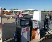
| Fuel: | 100LL (blue), UL94 |
|---|---|
| Transient Storage: | Tiedowns |
| Airframe Repair: | MAJOR |
| Engine Repair: | MAJOR |
| Bottled Oxygen: | NOT AVAILABLE |
| Bulk Oxygen: | NOT AVAILABLE |
| Other Services: | CHARTER SERVICE,PILOT INSTRUCTION |
Ownership Information
| Ownership: | Privately Owned | |
|---|---|---|
| Owner: | G. MARLIN HORST | |
| 110 SHORT STREET | ||
| NEW HOLLAND, PA 17557 | ||
| 717-354-3059 | ||
| Manager: | DOUG FRETZ | |
| 311 AIRPORT DR | ||
| SMOKETOWN, PA 17576 | ||
| 717-394-6476 | ||
Other Remarks
- FOR CD CTC HARRISBURG APCH AT 800-932-0712.
- RWY 28 PREFERRED RWY FOR LNDG IN LIGHT WIND CONDITIONS
Nearby Airports with Instrument Procedures
| ID | Name | Heading / Distance | ||
|---|---|---|---|---|
 |
KLNS | Lancaster Airport | 318° | 6.4 |
 |
KMQS | Chester County G O Carlson Airport | 103° | 16.0 |
 |
08N | Keller Brothers Airport | 338° | 16.1 |
 |
N71 | Donegal Springs Airpark Airport | 280° | 17.4 |
 |
9D4 | Deck Airport | 342° | 19.5 |
 |
58N | Reigle Field Airport | 310° | 22.7 |
 |
KRDG | Reading Regional/Carl A Spaatz Field Airport | 028° | 22.9 |
 |
N57 | New Garden Airport | 122° | 23.6 |
 |
KMDT | Harrisburg International Airport | 289° | 27.4 |
 |
N47 | Pottstown Municipal Airport | 061° | 27.7 |
 |
0W3 | Harford County Airport | 180° | 28.4 |
 |
KOQN | Brandywine Regional Airport | 095° | 28.7 |


