Login
Register


06C
Schaumburg Regional Airport
Official FAA Data Effective 2024-05-16 0901Z
Chart Supplement

VFR Chart of 06C
Sectional Charts at SkyVector.com
IFR Chart of 06C
Enroute Charts at SkyVector.com
Location Information for 06C
Coordinates: N41°59.36' / W88°6.07'Located 22 miles NW of Chicago/Schaumburg, Illinois on 120 acres of land. View all Airports in Illinois.
Estimated Elevation is 801 feet MSL.
Operations Data
|
|
Airport Communications
| AWOS-3: | 128.275 Tel. (847) 895-2887 |
|---|---|
| UNICOM: | 123.000 |
| CTAF: | 123.000 |
| ATIS at DPA (8.2 SW): | 132.075 |
| ASOS at DPA (8.3 SW): | 630-587-3668 |
| ASOS at ORD (8.6 E): | 773-462-0118 |
Nearby Navigation Aids
|
| ||||||||||||||||||||||||||||||||||||||||||||||||||||||||||||


Runway 11/29
| Dimensions: | 3800 x 100 feet / 1158 x 30 meters HAS 100 FT STWY ON EACH END. | |
|---|---|---|
| Surface: | Concrete in Good Condition | |
| Weight Limits: | S-12, D-12 | |
| Edge Lighting: | Medium Intensity | |
| Runway 11 | Runway 29 | |
| Coordinates: | N41°59.44' / W88°6.48' | N41°59.28' / W88°5.67' |
| Elevation: | 801.0 | 801.0 |
| Markings: | Basic in good condition. | Basic in good condition. |
| Glide Slope Indicator | P2R (3.25° Glide Path Angle) | P2L (3.00° Glide Path Angle) |
| REIL: | Yes | Yes |
| Obstacles: | 22 ft Brush 251 ft from runway, 92 ft right of center | |
Services Available
| Fuel: | 100LL (blue), Jet-A |
|---|---|
| Transient Storage: | Hangars,Tiedowns |
| Airframe Repair: | MAJOR |
| Engine Repair: | MAJOR |
| Bottled Oxygen: | HIGH/LOW |
| Bulk Oxygen: | HIGH/LOW |
| Other Services: | AIR FREIGHT SERVICES,AIR AMBULANCE SERVICES,CHARTER SERVICE,PILOT INSTRUCTION,AIRCRAFT RENTAL,AIRCRAFT SALES |
Ownership Information
| Ownership: | Publicly owned | |
|---|---|---|
| Owner: | VILLAGE OF SCHAUMBURG | |
| 101 SCHAUMBURG CT | ||
| SCHAUMBURG, IL 60193-1899 | ||
| 847-895-0007 | ||
| Manager: | ERIC TRYDAL | ARPT ADMINISTRATOR. |
| 101 SCHAUMBURG COURT | EMAIL ADDRESS: ETRYDAL@SCHAUMBURG.COM (ALL LWR CASE) | |
| SCHAUMBURG, IL 60193 | ||
| 847-923-3859 | EMERG CTC: 630-600-1439. | |
Operational Statistics
| Single Engine Aircraft Based on Field: | 50 | Statistics collected for 12 month period ending 2022-06-30 | |
|---|---|---|---|
| Multi-Engine Aircraft Based on Field: | 4 | Annual Commercial Operations: | none |
| Jet Aircraft Based on Field: | 3 | Annual Commuter Operations: | none |
| Helicopters Based on Field: | 9 | Annual Air Taxi Operations: | 450 |
| Military Aircraft Based on Field: | none | Annual Military Operations: | none |
| Gliders Based on Field: | none | Annual GA Local Operations: | 20800 |
| Ultralights Based on Field: | none | Annual GA Itinerant Operations: | 23750 |
Other Remarks
- FOR NOISE ABATEMENT PROCEDURES CTC AMGR 847-923-3778.
- WATER FOWL ON & INVOF RY 11/29.
- RY 29 PREFERED RY IN CALM & DIRECT CROSSWINDS. DEP ACFT FLY RY HEADING TO 1400 FT MSL BEFORE STARTING CROSSWIND TURN.
- BANNER TOWING PROHIBITED WITH IN 2 NM RADIUS OF ARPT.
- FOR CD CTC CHICAGO APCH AT 847-289-0926.
- AND COOK COUNTY.
- 0LL 100LL SELF SRVC FUEL AVAILABLE AFTER HRS.
- MIRL RY 11/29 PRESET LOW INTST; TO INCR INTST & ACTVT TWY LGTS & REILS RY 11 & RY 29 - CTAF.
Nearby Airports with Instrument Procedures
| ID | Name | Heading / Distance | ||
|---|---|---|---|---|
 |
KDPA | Dupage Airport | 233° | 8.2 |
|
KORD | Chicago O'Hare International Airport | 094° | 8.7 |
|
KPWK | Chicago Exec Airport | 049° | 11.7 |
|
3CK | Lake In The Hills Airport | 322° | 16.4 |
|
1C5 | Bolingbrook's Clow International Airport | 184° | 17.6 |
|
KMDW | Chicago Midway International Airport | 127° | 19.8 |
|
C81 | Campbell Airport | 003° | 20.1 |
|
KARR | Aurora Municipal Airport | 232° | 21.3 |
|
KLOT | Lewis University Airport | 179° | 22.9 |
|
KDKB | De Kalb Taylor Municipal Airport | 263° | 27.3 |
|
10C | Galt Field Airport | 333° | 27.6 |
|
KUGN | Waukegan Ntl Airport | 021° | 28.0 |
Airport Images
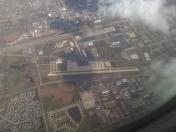
By: jkempher52


