Login
Register
15G
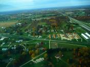
Weltzien Skypark Airport
Official FAA Data Effective 2026-01-22 0901Z
VFR Chart of 15G
Sectional Charts at SkyVector.com
IFR Chart of 15G
Enroute Charts at SkyVector.com
Location Information for 15G
Coordinates: N41°1.69' / W81°47.89'Located 03 miles W of Wadsworth, Ohio on 26 acres of land. View all Airports in Ohio.
Estimated Elevation is 1210 feet MSL.
Operations Data
|
|
Airport Communications
| UNICOM: | 123.050 |
|---|---|
| CTAF: | 123.050 |
| ASOS at BJJ (10.2 SW): | 118.075 330-669-9105 |
| ASOS at AKR (15.2 E): | 126.825 330-724-4237 |
| ATIS at CAK (17.4 SE): | 121.05 |
Nearby Navigation Aids
|
| ||||||||||||||||||||||||||||||||||||||||||||||||||||||||||||
Runway 03/21
| Dimensions: | 2410 x 37 feet / 735 x 11 meters | |
|---|---|---|
| Surface: | Asphalt in Fair Condition | |
| Edge Lighting: | Non-Standard NSTD LIRL DUE TO INCOR COLORS & MOUNTING ON 6 IN PVC PIPE. | |
| Runway 03 | Runway 21 | |
| Coordinates: | N41°1.51' / W81°48.00' | N41°1.87' / W81°47.78' |
| Elevation: | 1210.0 | 1210.0 |
| Traffic Pattern: | Left | Left |
| Runway Heading: | 25° True | 205° True |
| Displaced Threshold: | 178 Feet | 50 Feet |
| Markings: | Basic in fair condition. | Basic in fair condition. |
| Glide Slope Indicator | PSIL | PSIL |
| Obstacles: | 8 ft Crops 201 ft from runway, 85 ft right of center APCH RATIO 0:1 TO DTHR OVR 25 FT HNGR, 0 FT DIST, 100 FT L. 15 FT ROAD, 0 FT DIST, 55 FT R; +8 FT SIGN, 85 FT L; 25 FT PLINE, 105 FT L/R. |
55 ft Trees 385 ft from runway OBSTN CLNC SLP 0:1 TO DTHR OVR 25 FT TREES, 0 FT DIST, 45 FT L. 10-15 FT BRUSH & TREES, 0 FT DIST FM RWY END; 25-30 FT TREES, L/R; 1 FT GUARD RAIL, ACRS RWY END. |
Services Available
| Fuel: | 100LL (blue) |
|---|---|
| Transient Storage: | Hangars,Tiedowns PRIOR CDN RQRD FOR TSNT HNGR. |
| Airframe Repair: | MAJOR |
| Engine Repair: | MAJOR |
| Bottled Oxygen: | NONE |
| Bulk Oxygen: | NONE |
| Other Services: | CHARTER SERVICE,PILOT INSTRUCTION,AIRCRAFT RENTAL |
Ownership Information
| Ownership: | Privately Owned | |
|---|---|---|
| Owner: | SKYPARK INC | WELTZIENSKYPARK@GMAIL.COM. |
| 3071 GREENWICH RD | ||
| WADSWORTH, OH 44281-9516 | ||
| 330-573-6437 | ||
| Manager: | JOEL KULL | |
| 3071 GREENWICH RD | ||
| WADSWORTH, OH 44281-9516 | ||
| 330-573-6437 | ||
Other Remarks
- TGL PROHIBITED.
- OCNL BIRDS & WILDLIFE ON & INVOF ARPT.
- FOR CD CTC CLEVELAND APCH AT 216-352-2323.
- PRIOR CDN RQRD FOR TSNT TIEDOWN.
- ACTVT NSTD LIRL RWY 03/21 - CTAF.
Nearby Airports with Instrument Procedures
| ID | Name | Heading / Distance | ||
|---|---|---|---|---|
 |
3G3 | Wadsworth Municipal Airport | 128° | 2.4 |
 |
1G5 | Medina Municipal Airport | 013° | 6.4 |
 |
KBJJ | Wayne County Airport | 204° | 10.1 |
 |
KAKR | Akron Fulton International Airport | 087° | 15.0 |
 |
KCAK | Akron-Canton Regional Airport | 112° | 17.5 |
 |
1G3 | Kent State University Airport | 066° | 18.9 |
 |
3G4 | Ashland County Airport | 250° | 22.1 |
 |
1G1 | Elyria Airport | 323° | 22.8 |
 |
KCLE | Cleveland-Hopkins International Airport | 353° | 23.0 |
 |
KLPR | Lorain County Regional Airport | 317° | 25.6 |
 |
KPOV | Portage County Airport | 066° | 27.1 |
 |
KBKL | Burke Lakefront Airport | 010° | 29.8 |


