Login
Register
1MI5
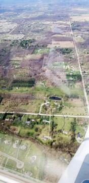
Mckenzie's Landing Airport
Official FAA Data Effective 2025-12-25 0901Z
VFR Chart of 1MI5
Sectional Charts at SkyVector.com
IFR Chart of 1MI5
Enroute Charts at SkyVector.com
Location Information for 1MI5
Coordinates: N42°36.18' / W83°51.58'Located 04 miles E of Howell, Michigan on 9 acres of land. View all Airports in Michigan.
Estimated Elevation is 955 feet MSL.
Operations Data
|
|
Airport Communications
| AWOS-3P at OZW (5.8 W): | 118.875 517-546-4450 |
|---|---|
| ASOS at PTK (19.8 E): | 125.025 248-886-8551 |
| ATIS at PTK (19.8 E): | 125.025 |
Nearby Navigation Aids
|
| ||||||||||||||||||||||||||||||||||||||||||||||||||||||||||||
Runway 09/27
| Dimensions: | 2450 x 60 feet / 747 x 18 meters | |
|---|---|---|
| Surface: | Turf in Good Condition | |
| Runway 09 | Runway 27 | |
| Traffic Pattern: | Right | |
| Displaced Threshold: | 1850 Feet | |
| Obstacles: | 25 ft Power Line 500 ft from runway | |
Ownership Information
| Ownership: | Privately Owned | |
|---|---|---|
| Owner: | DAVID E MCKENZIE | |
| 152 GULLY RD | ||
| HOWELL, MI 48843 | ||
| 517-545-8888 | ||
| Manager: | DAVID E MCKENZIE | |
| 152 GULLY RD | ||
| HOWELL, MI 48843 | ||
| 517-545-8888 | ||
Other Remarks
- FOR CD CTC DETROIT APCH AT 734-955-1404.
- 09/27 EDGES & DSPLCD THLDS MKD WITH TIRES PAINTED YELLOW.
Nearby Airports with Instrument Procedures
| ID | Name | Heading / Distance | ||
|---|---|---|---|---|
 |
KOZW | Livingston County/Spencer J Hardy Airport | 286° | 5.7 |
 |
Y47 | Oakland Southwest Airport | 119° | 12.1 |
 |
9G2 | Prices Airport | 018° | 12.9 |
 |
KPTK | Oakland County International Airport | 078° | 19.8 |
 |
KFNT | Bishop International Airport | 013° | 22.3 |
 |
KARB | Ann Arbor Municipal Airport | 167° | 23.4 |
 |
1D2 | Canton-Plymouth-Mettetal Airport | 130° | 23.6 |
 |
KTEW | Mason Jewett Field Airport | 265° | 25.1 |
 |
KYIP | Willow Run Airport | 146° | 26.2 |
 |
KRNP | Owosso Community Airport | 332° | 26.4 |
 |
KVLL | Oakland/Troy Airport | 096° | 30.4 |
 |
KDTW | Detroit Metro Wayne County Airport | 135° | 32.5 |


