Login
Register
2G9
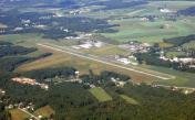
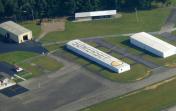
Somerset County Airport
Official FAA Data Effective 2025-12-25 0901Z
VFR Chart of 2G9
Sectional Charts at SkyVector.com
IFR Chart of 2G9
Enroute Charts at SkyVector.com
Location Information for 2G9
Coordinates: N40°2.31' / W79°0.92'Located 03 miles NE of Somerset, Pennsylvania on 231 acres of land. View all Airports in Pennsylvania.
Surveyed Elevation is 2275 feet MSL.
Operations Data
|
|
Airport Communications
| AWOS-3P: | 133.8 Tel. 814-443-2114 |
|---|---|
| JOHNSTOWN APPROACH: | 121.2 299.2 |
| JOHNSTOWN DEPARTURE: | 121.2 299.2 |
| CTAF: | 122.800 |
| UNICOM: | 122.800 |
| ATIS at JST (18.6 NE): | 118.325 |
| ASOS at JST (18.6 NE): | 814-535-3511 |
| AWOS-3 at LBE (22.9 NW): | 724-537-0671 |
- APCH/DEP SVC PRVDD BY CLEVELAND ARTCC (ZOB) ON FREQS 124.4/327.1 (ALTOONA RCAG) WHEN JOHNSTOWN APCH CTL CLSD.
Nearby Navigation Aids
|
| ||||||||||||||||||||||||||||||||||||||||||||||||||||||
Runway 07/25
| Dimensions: | 5002 x 75 feet / 1525 x 23 meters | |
|---|---|---|
| Surface: | Asphalt in Good Condition | |
| Weight Limits: | S-18 | |
| Edge Lighting: | Medium Intensity | |
| Runway 07 | Runway 25 | |
| Coordinates: | N40°2.10' / W79°1.35' | N40°2.56' / W79°0.45' |
| Elevation: | 2275.0 | 2201.6 |
| Traffic Pattern: | Left | Left |
| Runway Heading: | 56° True | 236° True |
| Markings: | Non-Precision Instrument in fair condition. | Non-Precision Instrument in fair condition. |
| Glide Slope Indicator | P2L (3.00° Glide Path Angle) | PSIL (3.00° Glide Path Angle) |
| REIL: | Yes | Yes |
| Obstacles: | 18 ft Pole 544 ft from runway, 180 ft left of center | |
Runway 14/32
617 FT BY 60 FT ASPH AT INTXN WITH RWY 07/25 & PARL TWY. | ||
| Dimensions: | 2729 x 150 feet / 832 x 46 meters | |
|---|---|---|
| Surface: | Turf in Good Condition | |
| Runway 14 | Runway 32 | |
| Coordinates: | N40°2.42' / W79°1.17' | N40°2.12' / W79°0.73' |
| Elevation: | 2227.8 | 2255.4 |
| Traffic Pattern: | Left | Left |
| Runway Heading: | 131° True | 311° True |
| Displaced Threshold: | 335 Feet 335 FT DTHR MKD WITH YELLOW CONES. |
|
| Markings: | Non-Standard in good condition. | Non-Standard in good condition. |
| Obstacles: | 16 ft Road 40 ft from runway, 124 ft left of center ROAD ANGLES ACRS RCL. 41 FT TREES; 578 FT FM DER, 9 FT LEFT. APCH SLP 22:1 FM DTHR. |
26 ft Trees 352 ft from runway, 74 ft left of center |
Services Available
| Fuel: | 100LL (blue), Jet-A, Jet A+ |
|---|---|
| Transient Storage: | Hangars,Tiedowns |
| Airframe Repair: | NONE |
| Engine Repair: | NONE |
| Bottled Oxygen: | NONE |
| Bulk Oxygen: | NONE |
Ownership Information
| Ownership: | Publicly owned | |
|---|---|---|
| Owner: | BD OF CO COMMISSIONERS | |
| SOMERSET COUNTY COURTHOUSE | ||
| SOMERSET, PA 15501 | ||
| 814-445-1400 | ||
| Manager: | DAVID WRIGHT | |
| 159 AIRPORT LANE | ||
| FRIEDENS, PA 15541 | ||
| 814-445-1599 | ||
Other Remarks
- FOR CD CTC JOHNSTOWN APCH AT 814-532-5960, WHEN APCH CLSD CTC CLEVELAND ARTCC AT 440-774-0213.
- RWY 14/32 UNUSBL DURING SPRING THAW, WET PERIODS & SNOW; CHECK NOTAMS.
- YELLOW CONES
- YELLOW CONES
- 0LL 24 HR SELF-SERVICE FUELING AVBL.
- SINGLE POINT REFUELING AVBL UPON REQUEST.
- MIRL RWY 07/25 & TWY LGTS ON DUSK-0000; ACTVT REIL RWY 07/25, PAPI RWY 07; PVASI RWY 25; - CTAF.
Weather Minimums
Instrument Approach Procedure (IAP) Charts
Nearby Airports with Instrument Procedures
| ID | Name | Heading / Distance | ||
|---|---|---|---|---|
 |
KJST | John Murtha Johnstown/Cambria County Airport | 026° | 18.6 |
 |
KLBE | Arnold Palmer Regional Airport | 307° | 23.0 |
 |
KHMZ | Bedford County Airport | 082° | 23.3 |
 |
9G8 | Ebensburg Airport | 023° | 27.6 |
 |
KCBE | Greater Cumberland Regional Airport | 155° | 28.0 |
 |
KVVS | Joseph A Hardy Connellsville Airport | 261° | 30.0 |
 |
2G4 | Garrett County Airport | 208° | 31.2 |
 |
KAOO | Altoona/Blair County Airport | 063° | 35.5 |
 |
KIDI | Indiana County/Jimmy Stewart Field Airport | 353° | 35.7 |
 |
KFWQ | Rostraver Airport | 285° | 38.9 |
 |
W35 | Potomac Airpark Airport | 117° | 44.4 |
 |
KAGC | Allegheny County Airport | 294° | 46.1 |


