Login
Register
6GA0
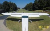
Stoney Point Field Airport
Official FAA Data Effective 2026-01-22 0901Z
VFR Chart of 6GA0
Sectional Charts at SkyVector.com
IFR Chart of 6GA0
Enroute Charts at SkyVector.com
Location Information for 6GA0
Coordinates: N34°7.96' / W84°11.96'Located 05 miles SW of Cumming, Georgia on 75 acres of land. View all Airports in Georgia.
Estimated Elevation is 1150 feet MSL.
Operations Data
|
|
Airport Communications
| CTAF: | 122.900 |
|---|---|
| AWOS-3PT at LZU (15.0 SE): | 770-339-7753 |
| ATIS at LZU (15.0 SE): | 132.275 |
| AWOS-3PT at CNI (15.4 NW): | 119.825 678-454-2065 |
Nearby Navigation Aids
|
| ||||||||||||||||||||||||||||||||||||||||||||||||||||||||||||
Runway 15/33
| Dimensions: | 2500 x 100 feet / 762 x 30 meters | |
|---|---|---|
| Surface: | Turf | |
| Edge Lighting: | Medium Intensity | |
| Runway 15 | Runway 33 | |
| Glide Slope Indicator | V2L | V2L |
Ownership Information
| Ownership: | Privately Owned | |
|---|---|---|
| Owner: | STONEY POINT HOMEOWNERS ASSOC. | |
| 2144 STONEY POINT RD | ||
| CUMMING, GA 30041 | ||
| 404-787-7472 | ||
| Manager: | JOHN BERNDSEN | |
| 2144 STONEY POINT RD | ||
| CUMMING, GA 30041 | ||
| 404-787-7472 | ||
Other Remarks
- HANG GLIDER ACTIVITIES INVOF ARPT.
- FOR CD CTC ATLANTA APCH AT 678-364-6131.
- ACTVT VASI RWY 15 & 33; MIRL RWY 15/33 - CTAF.
- ACTVT BEACON - CTAF.
Nearby Airports with Instrument Procedures
| ID | Name | Heading / Distance | ||
|---|---|---|---|---|
 |
KLZU | Gwinnett County/Briscoe Field Airport | 128° | 15.0 |
 |
KCNI | Cherokee County Regional Airport | 314° | 15.4 |
 |
KPDK | Dekalb-Peachtree Airport | 198° | 16.2 |
 |
KGVL | Lee Gilmer Memorial Airport | 065° | 20.2 |
 |
KMGE | Dobbins Arb Airport | 230° | 20.4 |
 |
KRYY | Cobb County International/Mccollum Field Airport | 250° | 21.1 |
 |
KJZP | Pickens County Airport | 326° | 23.1 |
 |
KFTY | Fulton County Exec/Charlie Brown Field Airport | 217° | 26.5 |
 |
KWDR | Barrow County Airport | 108° | 28.0 |
 |
KJCA | Jackson County Airport | 085° | 31.9 |
 |
KATL | Hartsfield/Jackson Atlanta International Airport | 201° | 31.8 |
 |
KVPC | Cartersville Airport | 269° | 32.3 |


