Login
Register
6PA5
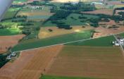
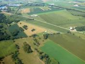
Botsford Aerodrome Airport
Official FAA Data Effective 2024-10-31 0901Z
VFR Chart of 6PA5
Sectional Charts at SkyVector.com
IFR Chart of 6PA5
Enroute Charts at SkyVector.com
Location Information for 6PA5
Coordinates: N40°6.81' / W77°27.25'Located 05 miles NE of Shippensburg, Pennsylvania on 6 acres of land. View all Airports in Pennsylvania.
Estimated Elevation is 615 feet MSL.
Operations Data
|
|
Airport Communications
| AWOS-3 at N68 (12.1 SW): | 120.725 717-261-1943 |
|---|---|
| ASOS at HGR (27.4 SW): | 126.375 301-745-3497 |
| ASOS at CXY (28.2 E): | 717-770-0880 |
Nearby Navigation Aids
|
| ||||||||||||||||||||||||||||||||||||||||||||||||||||||||||||
Runway 04/22
| Dimensions: | 2400 x 30 feet / 732 x 9 meters | |
|---|---|---|
| Surface: | Asphalt | |
| Runway 04 | Runway 22 | |
| Displaced Threshold: | 200 Feet | 200 Feet |
Ownership Information
| Ownership: | Privately Owned | |
|---|---|---|
| Owner: | THOMAS TREZ | |
| 797 NEWVILLE RD. | ||
| SHIPPENSBURG, PA 17257-9510 | ||
| 717-776-3679 | ||
| Manager: | THOMAS TREZ | |
| 797 NEWVILLE RD. | ||
| SHIPPENSBURG, PA 17257-9510 | ||
| 717-776-3679 | ||
Other Remarks
- FOR CD CTC HARRISBURG APCH AT 800-932-0712.
Nearby Airports with Instrument Procedures
| ID | Name | Heading / Distance | ||
|---|---|---|---|---|
 |
N68 | Franklin County Regional Airport | 226° | 12.1 |
 |
N94 | Carlisle Airport | 070° | 13.6 |
 |
W05 | Gettysburg Regional Airport | 153° | 18.3 |
 |
KHGR | Hagerstown Regional/Richard A Henson Field Airport | 207° | 27.3 |
 |
KCXY | Capital City Airport | 077° | 28.4 |
 |
KTHV | York Airport | 113° | 29.3 |
 |
P34 | Mifflintown Airport | 004° | 29.2 |
 |
KMDT | Harrisburg International Airport | 081° | 32.2 |
 |
KRVL | Mifflin County Airport | 346° | 34.7 |
 |
KDMW | Carroll County Regional/Jack B Poage Field Airport | 145° | 36.6 |
 |
N71 | Donegal Springs Airpark Airport | 091° | 40.5 |
 |
KAOO | Altoona/Blair County Airport | 285° | 41.3 |


