Login
Register
78A
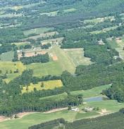
Swan Creek Airport
Official FAA Data Effective 2026-01-22 0901Z
VFR Chart of 78A
Sectional Charts at SkyVector.com
IFR Chart of 78A
Enroute Charts at SkyVector.com
Location Information for 78A
Coordinates: N36°12.17' / W80°52.06'Located 03 miles SW of Jonesville, North Carolina on 35 acres of land. View all Airports in North Carolina.
Surveyed Elevation is 1137 feet MSL.
Operations Data
|
|
Airport Communications
| CTAF: | 122.900 |
|---|---|
| AWOS-3 at UKF (11.3 W): | 126.625 336-696-3788 |
| AWOS-3 at MWK (21.7 NE): | 121.125 336-789-2299 |
| AWOS-3 at SVH (26.7 S): | 119.225 704-873-1978 |
Nearby Navigation Aids
|
| ||||||||||||||||||||||||||||||||||||||||||||||||||||||||||||
Runway 10/28
| Dimensions: | 2600 x 125 feet / 792 x 38 meters | |
|---|---|---|
| Surface: | Turf in Good Condition | |
| Runway 10 | Runway 28 | |
| Coordinates: | N36°12.16' / W80°52.38' | N36°12.15' / W80°51.85' |
| Elevation: | 1090.1 | 1136.8 |
| Traffic Pattern: | Left | Right |
| Runway Heading: | 92° True | 272° True |
| Obstacles: | 65 ft Trees 74 ft from runway, 115 ft right of center | 34 ft Trees 376 ft from runway, 47 ft left of center |
Runway 02/20
| Dimensions: | 921 x 125 feet / 281 x 38 meters | |
|---|---|---|
| Surface: | Turf in Good Condition | |
| Runway 02 | Runway 20 | |
| Coordinates: | N36°12.14' / W80°51.93' | N36°12.29' / W80°51.88' |
| Elevation: | 1132.6 | 1128.5 |
| Traffic Pattern: | Left | Left |
| Runway Heading: | 15° True | 195° True |
| Obstacles: | 56 ft Trees 218 ft from runway, 47 ft right of center CTLNG OBSTN EXCEEDS A 45 DEG SLP. |
58 ft Trees 32 ft from runway, 119 ft left of center RWY 20 HAS 11-60 FT TREES 0-50 FT FROM THR BOTH SIDES OF CNTRLN WHICH HIDE +3 FT FENCE 20 FT FROM THR 0 FT LEFT & RIGHT OF CNTRLN. |
Services Available
| Fuel: | NONE |
|---|---|
| Transient Storage: | Tiedowns |
| Airframe Repair: | NONE |
| Engine Repair: | NONE |
| Bottled Oxygen: | NONE |
| Bulk Oxygen: | NONE |
| Other Services: | GLIDER SERVICE |
Ownership Information
| Ownership: | Privately Owned | |
|---|---|---|
| Owner: | HOLLIDAY AND SHELLY OBRECHT | |
| P. O. BOX 675 | ||
| JONESVILLE, NC 28642 | ||
| 704-495-9784 | ||
| Manager: | HOLLIDAY H OBRECHT III | |
| P.O. BOX 675 | ||
| JONESVILLE, NC 28642 | ||
| 704-495-9784 | ||
Other Remarks
- FOR CD CTC ATLANTA ARTCC AT 770-210-7692.
- TWR INVOF RWY 28 LEFT BASE.
- 4 FT FENCE ALONG LEFT EDGE RWY 10.
- 10 FT WIDE GRVL DRIVEWAY CROSSES RWY 02/20.
- NO LINE-OF-SIGHT BTN RWY ENDS.
- RWY 10 SLPS UPHILL.
- FARM EQUIP ON AND INVOF ARPT.
Nearby Airports with Instrument Procedures
| ID | Name | Heading / Distance | ||
|---|---|---|---|---|
 |
KZEF | Elkin Municipal Airport | 040° | 6.1 |
 |
KUKF | Wilkes County Airport | 276° | 11.3 |
 |
KMWK | Mount Airy/Surry County Airport | 044° | 21.7 |
 |
8A7 | Twin Lakes Airport | 130° | 26.4 |
 |
KSVH | Statesville Regional Airport | 189° | 26.6 |
 |
KGEV | Ashe County Airport | 297° | 30.0 |
 |
KINT | Smith Reynolds Airport | 097° | 31.6 |
 |
KHLX | Twin County Airport | 003° | 33.8 |
 |
N63 | Meadow Brook Field Airport | 080° | 35.3 |
 |
14A | Lake Norman Airpark Airport | 182° | 35.3 |
 |
KEXX | Davidson County Exec Airport | 132° | 37.3 |
 |
KRUQ | Mid-Carolina Regional Airport | 152° | 37.4 |


