Login
Register


7M4
Osceola Municipal Airport
Official FAA Data Effective 2024-04-18 0901Z
Chart Supplement

VFR Chart of 7M4
Sectional Charts at SkyVector.com
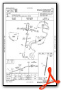
IFR Chart of 7M4
Enroute Charts at SkyVector.com
Location Information for 7M4
Coordinates: N35°41.47' / W90°0.61'Located 02 miles SW of Osceola, Arkansas on 110 acres of land. View all Airports in Arkansas.
Surveyed Elevation is 234 feet MSL.
Operations Data
|
|
Airport Communications
| MEMPHIS APPROACH: | 119.1 291.6 |
|---|---|
| MEMPHIS DEPARTURE: | 119.1 291.6 |
| UNICOM: | 122.800 |
| CTAF: | 122.800 |
| ASOS at HKA (17.2 NE): | 135.025 870-763-8206 |
| AWOS-3 at NQA (21.1 S): | 118.925 901-873-3630 |
| AWOS-3 at M04 (21.7 E): | 118.575 901-476-1705 |
Nearby Navigation Aids
|
| ||||||||||||||||||||||||||||||||||||||||||||||||||||||||||||


Runway 01/19
| Dimensions: | 3799 x 75 feet / 1158 x 23 meters | |
|---|---|---|
| Surface: | Asphalt in Good Condition | |
| Weight Limits: | S-8 | |
| Edge Lighting: | Medium Intensity | |
| Runway 01 | Runway 19 | |
| Coordinates: | N35°41.16' / W90°0.67' | N35°41.78' / W90°0.55' |
| Elevation: | 234.3 | 234.1 |
| Traffic Pattern: | Left | Left |
| Runway Heading: | 9° True | 189° True |
| Markings: | Basic in good condition. | Non-Precision Instrument in good condition. |
| REIL: | Yes | Yes |
| Obstacles: | 25 ft Tree 815 ft from runway, 275 ft left of center | 31 ft Pole 550 ft from runway, 380 ft left of center |
Services Available
| Fuel: | 100LL (blue) |
|---|---|
| Transient Storage: | Hangars,Tiedowns |
| Airframe Repair: | NONE |
| Engine Repair: | NONE |
| Bottled Oxygen: | NONE |
| Bulk Oxygen: | NONE |
| Other Services: | CROP DUSTING SERVICES |
Ownership Information
| Ownership: | Publicly owned | |
|---|---|---|
| Owner: | CITY OF OSCEOLA | |
| PO BOX 403 | ||
| OSCEOLA, AR 72370 | ||
| 870-563-5245 | ||
| Manager: | RAY FULMER | |
| 200 AIRPORT ROAD | ||
| OSCEOLA, AR 72370 | ||
| 479-522-1150 | ||
Operational Statistics
| Single Engine Aircraft Based on Field: | 14 | Statistics collected for 12 month period ending 2020-09-30 | |
|---|---|---|---|
| Multi-Engine Aircraft Based on Field: | none | Annual Commercial Operations: | none |
| Jet Aircraft Based on Field: | none | Annual Commuter Operations: | none |
| Helicopters Based on Field: | none | Annual Air Taxi Operations: | none |
| Military Aircraft Based on Field: | none | Annual Military Operations: | none |
| Gliders Based on Field: | none | Annual GA Local Operations: | 12000 |
| Ultralights Based on Field: | none | Annual GA Itinerant Operations: | 1000 |
Other Remarks
- FOR CD CTC MEMPHIS APCH AT 901-842-8457.
- 0LL FUEL AVBL 24 HRS WITH CREDIT CARD.
- ACTVT REIL RWY 19; MIRL RWY 01/19 - CTAF.
Weather Minimums

Instrument Approach Procedure (IAP) Charts
Nearby Airports with Instrument Procedures
| ID | Name | Heading / Distance | ||
|---|---|---|---|---|
 |
KMXA | Manila Municipal Airport | 329° | 14.1 |
|
KBYH | Arkansas International Airport | 011° | 16.7 |
|
KHKA | Blytheville Municipal Airport | 030° | 17.3 |
|
KNQA | Millington/Memphis Airport | 161° | 21.2 |
|
M04 | Covington Municipal Airport | 107° | 21.7 |
|
2M8 | Charles W Baker Airport | 171° | 25.0 |
|
M12 | Steele Municipal Airport | 016° | 25.3 |
|
M01 | General Dewitt Spain Airport | 184° | 29.5 |
|
KJBR | Jonesboro Municipal Airport | 285° | 32.2 |
|
KTKX | Kennett Memorial Airport | 357° | 32.1 |
|
M05 | Caruthersville Memorial Airport | 029° | 32.9 |
|
KPGR | Kirk Field Airport | 312° | 33.0 |
Airport Images
Do you have a recent image of this airport? Upload it here!


Comments
Fuel sales expected to resume
Fuel sales expected to resume by the end of Oct 2022.
JM
Admin
Fuel available
Fuel should now be available on field.
JM
Admin