Login
Register


BXK
Buckeye Municipal Airport
Official FAA Data Effective 2026-02-19 0901Z
Chart Supplement

VFR Chart of KBXK
Sectional Charts at SkyVector.com
IFR Chart of KBXK
Enroute Charts at SkyVector.com
Location Information for KBXK
Coordinates: N33°25.35' / W112°41.17'Located 06 miles NW of Buckeye, Arizona on 706 acres of land. View all Airports in Arizona.
Surveyed Elevation is 1033 feet MSL.
Operations Data
|
|
Airport Communications
| AWOS-3: | 119.625 Tel. 623-386-7627 |
|---|---|
| UNICOM: | 122.975 |
| CTAF: | 122.975 |
| ATIS at GYR (15.6 E): | 118.35 |
| ATIS at LUF (16.6 NE): | 134.925 |
| AWOS-3 at GEU (20.6 E): | 623-877-8609 |
Nearby Navigation Aids
|
| ||||||||||||||||||||||||||||||||||||

Runway 17/35
RWY 17 CALM WIND RWY. | ||
| Dimensions: | 5500 x 75 feet / 1676 x 23 meters | |
|---|---|---|
| Surface: | Asphalt in Good Condition | |
| Weight Limits: | S-30 | |
| Edge Lighting: | Medium Intensity | |
| Runway 17 | Runway 35 | |
| Coordinates: | N33°25.81' / W112°41.16' | N33°24.90' / W112°41.19' |
| Elevation: | 1033.0 | 994.5 |
| Traffic Pattern: | Right | |
| Runway Heading: | 182° True | 2° True |
| Markings: | Basic in good condition. | Basic in good condition. |
| Glide Slope Indicator | P2L (3.13° Glide Path Angle) | P4L |
Services Available
| Fuel: | 100LL (blue), Jet A-1 |
|---|---|
| Transient Storage: | Tiedowns |
| Airframe Repair: | MAJOR |
| Engine Repair: | MAJOR |
| Bottled Oxygen: | NOT AVAILABLE |
| Bulk Oxygen: | NOT AVAILABLE |
| Other Services: | GLIDER SERVICE,PARACHUTE JUMP ACTIVITY |
Ownership Information
| Ownership: | Publicly owned | |
|---|---|---|
| Owner: | CITY OF BUCKEYE | |
| 530 MONROE | ||
| BUCKEYE, AZ 85326 | ||
| 623-349-6650 | ||
| Manager: | DANIEL WEIMER | |
| 3000 S. PALO VERDE ROAD | ||
| BUCKEYE, AZ 85326 | ||
| 623-349-6880 | ||
Other Remarks
- LOW LEVEL JET TFC, PAJA & WILDLIFE ON & INVOF ARPT.
- FOR CD CTC LUKE APCH AT 623-856-7361. IF UNABLE, CTC PHOENIX APCH AT 602-306-2565.
- PAJA DROP ZONE E OF RWY; APCH FM W; OVERFLIGHT OF ARPT OR E OF RWY NA.
- TSNT PRKG N OF TWY C. TENANT PRKG S OF TWY C.
- 0LL FUEL SVC AVBL H24 VIA CREDIT CARD.
- PPR - 623-295-9776.
- ACTVT MIRL RWY 17/35 - CTAF.
Nearby Airports with Instrument Procedures
| ID | Name | Heading / Distance | ||
|---|---|---|---|---|
 |
KGYR | Phoenix Goodyear Airport | 089° | 15.6 |
|
KLUF | Luke AFB Airport | 066° | 16.6 |
|
KGEU | Glendale Regional Airport | 072° | 20.6 |
|
KPHX | Phoenix Sky Harbor International Airport | 088° | 33.9 |
|
KDVT | Phoenix Deer Valley Airport | 062° | 34.2 |
|
P19 | Stellar Airpark Airport | 100° | 39.4 |
|
KSDL | Scottsdale Airport | 072° | 40.7 |
|
KCHD | Chandler Municipal Airport | 101° | 44.9 |
|
KFFZ | Falcon Field Airport | 087° | 48.1 |
|
KIWA | Mesa Gateway Airport | 097° | 52.3 |
|
KCGZ | Casa Grande Municipal Airport | 120° | 54.1 |
|
P08 | Coolidge Municipal Airport | 114° | 69.8 |
Airport Images

By: rreeves@buckeye...
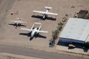
By: AirplaneMart.com
- 1 of 2
- next ›


Comments
Buckeye Municipal Airport Misc. Information
Self-serve fuel available 24/7 year-round. Credit card reader located at rear of Pilot's Lounge adjacent to bathrooms. Ground airplane prior to purchase.
Fuel price as of July 18, 2014: $5.45/gal.
Airport well maintained. Skydiving operations in effect with dropzone east of field (using a C206 Stationair [Reg# 41X on Luke Approach 125.45, callsign Skydive 1 on CTAF] as of July 18).
NO FBOs OR SERVICES ON FIELD. Transportation is hard to get, but try 1-800-TAXICAB (829-4222) if you need a ride. Address is 3000 S Palo Verde Road. Expect it to range between $80-125 to get to Phoenix.
Pilot's lounge has cold drinks/water + snacks. Supplied only through donations, please bring your own to replinsh if able.
New CTAF as of March, 2014 is 122.97. Also monitor 122.8 if you have two radios in case people have not yet switched over.
Pages