Login
Register


C17
Marion Airport
Official FAA Data Effective 2024-04-18 0901Z
Chart Supplement

VFR Chart of C17
Sectional Charts at SkyVector.com
IFR Chart of C17
Enroute Charts at SkyVector.com
Location Information for C17
Coordinates: N42°1.79' / W91°31.90'Located 03 miles E of Marion, Iowa on 40 acres of land. View all Airports in Iowa.
Estimated Elevation is 860 feet MSL.
Operations Data
|
|
Airport Communications
| CEDAR RAPIDS APPROACH: | 134.05 266.8 |
|---|---|
| CEDAR RAPIDS DEPARTURE: | 134.05 266.8 |
| UNICOM: | 122.700 |
| CTAF: | 122.700 |
| ATIS at CID (11.8 SW): | 124.15 |
| ASOS at CID (11.8 SW): | 319-558-5153 |
| AWOS-3 at MXO (20.1 NE): | 119.275 319-465-6155 |
- APCH/DEP SVC PRVDD BY CHICAGO ARTCC ON FREQS 132.8/328.4 (CEDAR RAPIDS RCAG) WHEN CEDAR RAPIDS APCH CTL CLSD.
Nearby Navigation Aids
|
| ||||||||||||||||||||||||||||||||||||||||||


Runway 17/35
| Dimensions: | 3776 x 60 feet / 1151 x 18 meters | |
|---|---|---|
| Surface: | Asphalt in Good Condition | |
| Edge Lighting: | Medium Intensity | |
| Runway 17 | Runway 35 | |
| Coordinates: | N42°2.10' / W91°31.95' | N42°1.48' / W91°31.86' |
| Elevation: | 860.5 | 854.0 |
| Traffic Pattern: | Left | Right |
| Displaced Threshold: | 244 Feet | |
| Markings: | Non-Precision Instrument in good condition. | Non-Precision Instrument in good condition. |
| Obstacles: | 16 ft Trees 275 ft from runway, 44 ft right of center 18 FT ROAD, 145 FT FM RWY END ON RWY CNTRLN. APCH SLOPE 20:1 TO DTHR. |
|
Services Available
| Fuel: | 100LL (blue), Jet-A, Automotive Gasoline |
|---|---|
| Transient Storage: | Hangars,Tiedowns |
| Airframe Repair: | MAJOR |
| Engine Repair: | MAJOR |
| Bottled Oxygen: | NONE |
| Bulk Oxygen: | NONE |
| Other Services: | CHARTER SERVICE,PILOT INSTRUCTION,AIRCRAFT RENTAL,ANNUAL SURVEYING |
Ownership Information
| Ownership: | Publicly owned | |
|---|---|---|
| Owner: | CITY OF MARION | MICHAEL BARKALOW - CITY ENGINEER; PHONE 319-743-6340 |
| 1225 6TH AVENUE | ||
| MARION, IA 52302 | ||
| (319) 743-6300 | ||
| Manager: | STEVE MORTON | |
| 1690 MARION AIRPORT ROAD | ||
| MARION, IA 52302 | ||
| (844) 589-2376 | ||
Operational Statistics
| Single Engine Aircraft Based on Field: | 30 | Statistics collected for 12 month period ending 2022-06-09 | |
|---|---|---|---|
| Multi-Engine Aircraft Based on Field: | 1 | Annual Commercial Operations: | none |
| Jet Aircraft Based on Field: | none | Annual Commuter Operations: | none |
| Helicopters Based on Field: | 2 | Annual Air Taxi Operations: | 86 |
| Military Aircraft Based on Field: | none | Annual Military Operations: | 171 |
| Gliders Based on Field: | none | Annual GA Local Operations: | 12027 |
| Ultralights Based on Field: | 4 | Annual GA Itinerant Operations: | 2566 |
Other Remarks
- DEER & WATERFOWL ON & INVOF ARPT.
- OCCASIONAL SKYDIVING AND BALLOON LAUNCHES MAY-SEP
- FOR CD CTC CHICAGO ARTCC AT 630-906-8921.
- ACTVT MIRL 17/35 - CTAF.
Weather Minimums
Instrument Approach Procedure (IAP) Charts
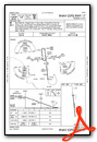
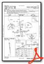
Nearby Airports with Instrument Procedures
| ID | Name | Heading / Distance | ||
|---|---|---|---|---|
 |
KCID | The Eastern Iowa Airport | 222° | 11.8 |
|
KMXO | Monticello Regional Airport | 055° | 20.0 |
|
8C4 | Mathews Memorial Airport | 133° | 23.3 |
|
KIOW | Iowa City Municipal Airport | 181° | 23.4 |
|
KVTI | Vinton Veterans Memorial Airpark Airport | 297° | 24.8 |
|
KIIB | James H Connell Field At Independence Municipal Airport | 324° | 31.6 |
|
KTZT | Belle Plaine Municipal Airport | 255° | 34.9 |
|
KOQW | Maquoketa Municipal Airport | 087° | 35.5 |
|
KDBQ | Dubuque Regional Airport | 058° | 42.9 |
|
KMUT | Muscatine Municipal Airport | 156° | 43.3 |
|
KOLZ | Oelwein Municipal Airport | 333° | 43.7 |
|
KAWG | Washington Municipal Airport | 188° | 45.7 |
Airport Images

By: colenorton


