Login
Register


CGB4
Nanaimo/Gabriola Island (Health Airport
VFR Chart of CGB4
Sectional Charts at SkyVector.com
IFR Chart of CGB4
Enroute Charts at SkyVector.com
Location Information for CGB4
Coordinates: N49°10.73' / W123°50.15'View all Airports in British Columbia, Canada.
Elevation is 321 feet MSL.
Magnetic Variation from 2014 is 17° East
Time Zone is UTC-8(7).
Operations Data
|
|
Airport Communications
| Remote Communications Outlet (RCO) | Pacific Radio 126.0 (FISE) |
|---|---|
| Mandatory Frequency (MF) | traffic 122.9 5NM centred on Nanaimo Harbour water A/D 4.5NM WSW 1200 ASL exc area within Nanaimo land A/D CZ (CAR 602.98) |
Nearby Navigation Aids
|
| ||||||||||||||||||||||||||||||||||||||||||||||||||||||||||||


Helipad Information
FATO 78' dia GRASS
TLOF 32' dia CONC
Safety Area 110' dia
Max heli overall length 55'
Runway Conditions Reporting Source
Operator
Public Facilities
| Location | Facilities | Remarks |
|---|---|---|
| In Terminal Building | Telephone, Medical Aid | |
| Within 5 NM | Food, Taxi, Accomodations, Car Rental |
Flight Planning
| Flight Information Centre (FIC) | Kamloops 866-WXBRIEF (Toll free within Canada) or 866-541-4101 (Toll free within Canada & USA) |
|---|
Aerodrome Operator
Gabriola Health Care Foundation
(Gabriola Fire Dept) 250-325-7215,
250-755-9289 Reg PPR for non
MEDEVAC flt
Nearby Airports with Instrument Procedures
| ID | Name | Heading / Distance | ||
|---|---|---|---|---|
 |
CYCD | Nanaimo Airport | 173° | 7.6 |
|
CYVR | Vancouver International Airport | 070° | 25.7 |
|
CYYJ | Victoria International Airport | 135° | 35.8 |
|
KORS | Orcas Island Airport | 110° | 46.2 |
|
KFHR | Friday Harbor Airport | 123° | 50.9 |
|
CYQQ | Comox Airport | 291° | 52.1 |
|
KBLI | Bellingham International Airport | 096° | 56.3 |
|
CYXX | Abbotsford Airport | 081° | 58.9 |
|
KNOW | Port Angeles CGAS Airport | 147° | 64.5 |
|
KCLM | William R Fairchild International Airport | 150° | 65.0 |
|
KNUW | Whidbey Island NAS (Ault Field) Airport | 119° | 68.3 |
|
KBVS | Skagit Regional Airport | 109° | 70.4 |
Airport Images
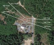
By: Dieselhead


