Login
Register


GAO
South Lafourche Leonard Miller Jr Airport
Official FAA Data Effective 2024-04-18 0901Z
Chart Supplement

VFR Chart of KGAO
Sectional Charts at SkyVector.com
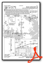
IFR Chart of KGAO
Enroute Charts at SkyVector.com
Location Information for KGAO
Coordinates: N29°26.47' / W90°15.67'Located 01 miles E of Galliano, Louisiana on 390 acres of land. View all Airports in Louisiana.
Surveyed Elevation is 0 feet MSL.
Operations Data
|
|
Airport Communications
| AWOS-3PT: | 118.175 Tel. 985-475-5178 |
|---|---|
| NEW ORLEANS APPROACH: | 120.85 256.9 |
| NEW ORLEANS DEPARTURE: | 120.85 256.9 |
| CLEARANCE DELIVERY: | 120.85 |
| UNICOM: | 123.000 |
| CTAF: | 123.000 |
| AWOS-3PT at 2LS (2.4 SW): | 118.175 985-475-5178 |
| AWOS-3PT at HUM (22.2 W): | 120.25 985-876-4055 |
| ATIS at HUM (22.2 W): | 120.25 |
Nearby Navigation Aids
|
| ||||||||||||||||||||||||||||||||||||||||||||||||


Runway 18/36
| Dimensions: | 6500 x 100 feet / 1981 x 30 meters | |
|---|---|---|
| Surface: | Asphalt in Good Condition | |
| Weight Limits: | S-60, D-75 | |
| Edge Lighting: | Medium Intensity | |
| Runway 18 | Runway 36 | |
| Coordinates: | N29°27.00' / W90°15.66' | N29°25.93' / W90°15.67' |
| Elevation: | 0.0 | -2.0 |
| Runway Heading: | 180° True | 360° True |
| Markings: | Non-Precision Instrument in good condition. | Precision Instrument in good condition. |
| Glide Slope Indicator | P4L (3.00° Glide Path Angle) | P4L (3.00° Glide Path Angle) |
| Approach Lights: | SSALR Simplified Short Approach Lighting System with runway alignment indicator lights. | |
| REIL: | Yes | |
| Obstacles: | 70 ft Trees 2306 ft from runway, 540 ft left of center | |
Helipad H1
H1 CLSD INDEFLY. | ||
| Dimensions: | 60 x 60 feet / 18 x 18 meters | |
|---|---|---|
| Surface: | Concrete in Good Condition | |
Services Available
| Fuel: | 100LL (blue), Jet A-1+ |
|---|---|
| Transient Storage: | Hangars,Tiedowns |
| Airframe Repair: | NONE |
| Engine Repair: | NONE |
| Bottled Oxygen: | NONE |
| Bulk Oxygen: | NONE |
| Other Services: | AVIONICS |
Ownership Information
| Ownership: | Publicly owned | |
|---|---|---|
| Owner: | GREATER LAFOURCHE PORT COMMISSION | |
| 16829 EAST MAIN | ||
| CUTOFF, LA 70345 | ||
| 985-632-6701 | ||
| Manager: | GWAYNE GAUTREAUX | |
| 16829 EAST MAIN | ||
| CUTOFF, LA 70345 | ||
| 985-291-0818 | AFT HRS PHONE 985-475-6701. | |
Operational Statistics
| Single Engine Aircraft Based on Field: | 4 | Statistics collected for 12 month period ending 2020-07-16 | |
|---|---|---|---|
| Multi-Engine Aircraft Based on Field: | none | Annual Commercial Operations: | none |
| Jet Aircraft Based on Field: | 3 | Annual Commuter Operations: | none |
| Helicopters Based on Field: | 37 | Annual Air Taxi Operations: | none |
| Military Aircraft Based on Field: | none | Annual Military Operations: | 50 |
| Gliders Based on Field: | none | Annual GA Local Operations: | 18956 |
| Ultralights Based on Field: | none | Annual GA Itinerant Operations: | 5083 |
Other Remarks
- ALL SFC WORK IN PROG MOWING. BIRD ACTY INVOF RWY 18/36.
- FOR CD CTC NEW ORLEANS APCH AT 504-471-4350 OR 120.85.
- 0LL FUEL AVBL 24/7 WITH CC.
- SSALR RWY 36; REIL RWY 18 AND MIRL RWY 18/36 PRESET LOW INTST DUSK-DAWN; TO INCR INTST ACTVT - CTAF.
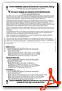
Weather Minimums
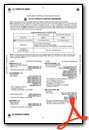
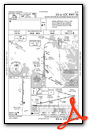
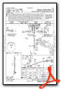
Instrument Approach Procedure (IAP) Charts
Nearby Airports with Instrument Procedures
| ID | Name | Heading / Distance | ||
|---|---|---|---|---|
 |
KHUM | Houma-Terrebonne Airport | 289° | 22.2 |
|
KNBG | New Orleans NAS Jrb (Alvin Callender Field) Airport | 027° | 26.2 |
|
KMSY | Louis Armstrong New Orleans International Airport | 000° | 33.0 |
|
L83 | Thibodaux Municipal Airport | 301° | 35.1 |
|
KNEW | Lakefront Airport | 018° | 38.0 |
|
KAPS | Port of South Louisiana Exec Regional Airport | 336° | 42.2 |
|
KREG | Louisiana Regional Airport | 321° | 56.3 |
|
KPTN | Harry P Williams Memorial Airport | 286° | 58.6 |
|
KASD | Slidell Airport | 022° | 58.8 |
|
KHDC | Hammond Northshore Regional Airport | 352° | 65.2 |
|
KHSA | Stennis International Airport | 036° | 69.6 |
|
KMJD | Picayune Municipal Airport | 026° | 70.2 |
Airport Images
Do you have a recent image of this airport? Upload it here!


