Login
Register


MOR
Moore-Murrell Airport
Official FAA Data Effective 2024-04-18 0901Z
Chart Supplement

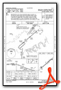
VFR Chart of KMOR
Sectional Charts at SkyVector.com
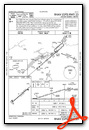
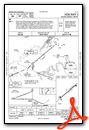
IFR Chart of KMOR
Enroute Charts at SkyVector.com
Location Information for KMOR
Coordinates: N36°10.76' / W83°22.53'Located 04 miles SW of Morristown, Tennessee on 160 acres of land. View all Airports in Tennessee.
Surveyed Elevation is 1313 feet MSL.
Operations Data
|
|
Airport Communications
| AWOS-3: | 126.725 Tel. 423-587-5886 |
|---|---|
| KNOXVILLE APPROACH: | 132.8 360.8 |
| KNOXVILLE DEPARTURE: | 132.8 360.8 |
| UNICOM: | 122.800 |
| CTAF: | 122.800 |
| AWOS-3 at GKT (20.8 S): | 126.875 865-429-5401 |
| AWOS-3 at GCY (27.2 E): | 128.425 423-639-5081 |
| AWOS-3 at DKX (27.3 SW): | 125.375 865-579-6151 |
Nearby Navigation Aids
|
| ||||||||||||||||||||||||||||||||||||||||||||||||||||||||||||


Runway 05/23
| Dimensions: | 5717 x 100 feet / 1743 x 30 meters | |
|---|---|---|
| Surface: | Asphalt in Good Condition | |
| Weight Limits: | 174/F/C/X/T, S-25 | |
| Edge Lighting: | Medium Intensity | |
| Runway 05 | Runway 23 | |
| Coordinates: | N36°10.46' / W83°22.97' | N36°11.07' / W83°22.09' |
| Elevation: | 1312.9 | 1274.4 |
| Traffic Pattern: | Left | Left |
| Runway Heading: | 49° True | 229° True |
| Markings: | Basic in good condition. | Non-Precision Instrument in good condition. |
| Glide Slope Indicator | V4L (3.00° Glide Path Angle) | P2L (3.00° Glide Path Angle) |
| Approach Lights: | MALSF 1,400 Foot Medium-intensity Approach Lighting System with sequenced flashers. MALSF OTS INDEFLY. | |
| REIL: | Yes | Yes |
| Obstacles: | 84 ft Tree 2636 ft from runway, 476 ft left of center | 33 ft Tree 705 ft from runway, 192 ft right of center |
Services Available
| Fuel: | 100LL (blue), Jet-A |
|---|---|
| Transient Storage: | Tiedowns |
| Airframe Repair: | MAJOR |
| Engine Repair: | MAJOR |
| Bottled Oxygen: | NONE |
| Bulk Oxygen: | NONE |
| Other Services: | AIR FREIGHT SERVICES,CHARTER SERVICE,PILOT INSTRUCTION,AIRCRAFT RENTAL |
Ownership Information
| Ownership: | Publicly owned | |
|---|---|---|
| Owner: | CITY OF MORRISTOWN | |
| CITY HALL PO BOX 1499 | ||
| MORRISTOWN, TN 37816 | ||
| 423-581-0100 | ||
| Manager: | ANDREW ELLARD | |
| 100 WEST FIRST NORTH STREET | ||
| MORRISTOWN, TN 37816 | ||
| (423) 585-4614 | ||
Operational Statistics
| Single Engine Aircraft Based on Field: | 44 | Statistics collected for 12 month period ending 2018-05-31 | |
|---|---|---|---|
| Multi-Engine Aircraft Based on Field: | 4 | Annual Commercial Operations: | none |
| Jet Aircraft Based on Field: | 5 | Annual Commuter Operations: | none |
| Helicopters Based on Field: | 2 | Annual Air Taxi Operations: | 1000 |
| Military Aircraft Based on Field: | none | Annual Military Operations: | 500 |
| Gliders Based on Field: | none | Annual GA Local Operations: | 23000 |
| Ultralights Based on Field: | none | Annual GA Itinerant Operations: | 25000 |
Other Remarks
- DEER ON & INVOF ARPT.
- FOR CD CTC KNOXVILLE APCH AT 865-980-3034; IF UNA FOR CD CTC KNOXVILLE APCH AT 865-980-3033.
- (PAY PHONE) PAY PHONE AVAILABLE.
- ACTVT VASI RWY 05; PAPI RWY 23 - CTAF.
Weather Minimums
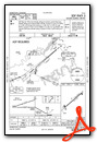
Instrument Approach Procedure (IAP) Charts
Nearby Airports with Instrument Procedures
| ID | Name | Heading / Distance | ||
|---|---|---|---|---|
 |
3A2 | New Tazewell Municipal Airport | 327° | 16.3 |
|
KGKT | Gatlinburg-Pigeon Forge Airport | 201° | 20.7 |
|
KGCY | Greeneville Municipal Airport | 087° | 27.4 |
|
KDKX | Knoxville Downtown Island Airport | 242° | 27.5 |
|
KRVN | Hawkins County Airport | 054° | 29.0 |
|
0VG | Lee County Airport | 014° | 29.4 |
|
1A6 | Middlesboro/Bell County Airport | 325° | 31.2 |
|
KTYS | Mc Ghee Tyson Airport | 233° | 37.3 |
|
KJAU | Colonel Tommy C Stiner Airfield Airport | 283° | 39.3 |
|
I35 | Tucker-Guthrie Memorial Airport | 001° | 40.7 |
|
KTRI | Tri-Cities Airport | 069° | 50.2 |
|
24A | Jackson County Airport | 171° | 52.3 |
Airport Images

By: Big Orange Bird


