Login
Register


RYY
Cobb County International/Mccollum Field Airport
Official FAA Data Effective 2025-12-25 0901Z
Chart Supplement

KRYY Airport Diagram

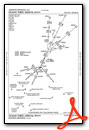
VFR Chart of KRYY
Sectional Charts at SkyVector.com
IFR Chart of KRYY
Enroute Charts at SkyVector.com
Location Information for KRYY
Coordinates: N34°0.79' / W84°35.82'Located 21 miles NW of Atlanta, Georgia on 309 acres of land. View all Airports in Georgia.
Surveyed Elevation is 1040 feet MSL.
Operations Data
|
|
Airport Communications
| ATIS: | 128.125 |
|---|---|
| AWOS-3PT: | Tel. 770-425-3406 |
| MC COLLUM TOWER: | 125.9 |
| MC COLLUM GROUND: | 119.0 |
| ATLANTA APPROACH: | 121.0 268.7 |
| ATLANTA DEPARTURE: | 121.0 268.7 |
| CLEARANCE DELIVERY: | 119.0 121.0 ;WHEN TWR CLSD 268.7 ;WHEN TWR CLSD |
| BOKRT STAR: | 119.8 354.125 |
| UNICOM: | 122.700 |
| WRGNZ STAR: | 128.575 343.675 |
| CTAF: | 125.900 |
| ATIS at MGE (7.2 SE): | 269.5 |
| AWOS-3PT at VPC (14.0 NW): | 120.525 770-607-7782 |
| ASOS at FTY (14.5 S): | 404-696-5660 |
Nearby Navigation Aids
|
| ||||||||||||||||||||||||||||||||||||||||||||||||||||||||||||


Runway 09/27
| Dimensions: | 6295 x 100 feet / 1919 x 30 meters | |
|---|---|---|
| Surface: | Concrete / Grooved in Good Condition | |
| Weight Limits: | 50 /R/C/W/T | |
| Edge Lighting: | High Intensity | |
| Runway 09 | Runway 27 | |
| Coordinates: | N34°0.78' / W84°36.44' | N34°0.80' / W84°35.20' |
| Elevation: | 1040.4 | 998.2 |
| Traffic Pattern: | Right | Left |
| Runway Heading: | 89° True | 269° True |
| Displaced Threshold: | 1062 Feet | |
| Declared Distances: | TORA:6311 TODA:6311 ASDA:6311 LDA:5233 | TORA:6311 TODA:6311 ASDA:5374 LDA:5374 |
| Markings: | Non-Precision Instrument in good condition. | Precision Instrument in good condition. |
| Glide Slope Indicator | P4L (4.00° Glide Path Angle) | P4L (3.00° Glide Path Angle) |
| Approach Lights: | MALSF 1,400 Foot Medium-intensity Approach Lighting System with sequenced flashers. | |
| Obstacles: | 26 ft Road 1 ft from runway, 381 ft right of center RY 09 APCH RATIO 34:1 TO DSPLCD THLD. +89FT TREES, 3,226FT 0B LEFT OR RIGHT. ROAD 0-200 FROM RUNWAY END, 380' RIGHT AND 180' LEFT. |
37 ft Trees 722 ft from runway, 314 ft right of center |
Services Available
| Fuel: | 100LL (blue), Jet A+ |
|---|---|
| Transient Storage: | Hangars,Tiedowns |
| Airframe Repair: | MAJOR |
| Engine Repair: | MAJOR |
| Bottled Oxygen: | NONE |
| Bulk Oxygen: | HIGH/LOW |
| Other Services: | AIR AMBULANCE SERVICES,AVIONICS,CHARTER SERVICE,PILOT INSTRUCTION,AIRCRAFT RENTAL,AIRCRAFT SALES |
Ownership Information
| Ownership: | Publicly owned | |
|---|---|---|
| Owner: | COBB COUNTY | |
| 100 CHEROKEE STREET | ||
| MARIETTA, GA 30060 | ||
| 770-528-1615 | ||
| Manager: | STEVEN SPENCER | |
| 1723 MCCOLLUM PKWY BLDG 100 | ||
| KENNESAW, GA 30144 | ||
| 770-528-8220 | ||
Other Remarks
- BLASTING SR-SS MON-FRI 2000 FT AER 27.
- TWY B CLSD FM TWY B5 TO B6 TO ACFT WITH WINGSPANS OF 79 FT OR GTR.
- TURBINE/JET AIRCRAFT OPERATORS ARE REQUESTED TO USE NBAA NOISE ABATEMENT PROGRAM PROCEDURES OR COMPARABLE PROCEDURES OF AIRCRAFT MANUFACTURER.
- INT'L OPS ARPT OF ENTRY - USER FEE AIRPORT
- ARPT MOWING IN PROGRESS SPRING THRU AUTUMN.
- COYOTES ON & INVOF ARPT.
- RY 9 IS CALM WIND RY IN VFR CONDS.
- NORTH APRON AT TWY A-1 CONNECTOR IS RESTRICTED TO GROUP 1 AFCT ONLY.
- INDEX B AIRCRAFT RESCUE AND FIRE FIGHTING EQUIPMENT AVAILABLE UPON REQUEST. 24 HOUR PRIOR PERMISSION REQUIRED. CONTACT AIRPORT MANAGER 770-528-1615.
- WHEN ATCT CLSD, ACTVT MALSF RWY 27; HIRL RWY 09/27 - CTAF.
Weather Minimums
Standard Terminal Arrival (STAR) Charts


Instrument Approach Procedure (IAP) Charts


Nearby Airports with Instrument Procedures
| ID | Name | Heading / Distance | ||
|---|---|---|---|---|
 |
KMGE | Dobbins Arb Airport | 145° | 7.2 |
|
KVPC | Cartersville Airport | 297° | 14.2 |
|
KFTY | Fulton County Exec/Charlie Brown Field Airport | 165° | 14.5 |
|
KPDK | Dekalb-Peachtree Airport | 119° | 16.9 |
|
KPUJ | Paulding Northwest Atlanta Airport | 250° | 18.2 |
|
KCNI | Cherokee County Regional Airport | 025° | 19.9 |
|
KATL | Hartsfield/Jackson Atlanta International Airport | 159° | 24.1 |
|
4A4 | Polk County/Cornelius Moore Field Airport | 270° | 27.3 |
|
KJZP | Pickens County Airport | 014° | 27.3 |
|
KCZL | Tom B David Field Airport | 327° | 31.5 |
|
KLZU | Gwinnett County/Briscoe Field Airport | 093° | 31.7 |
|
KRMG | Richard B Russell Regional - J H Towers Field Airport | 306° | 34.5 |
Airport Images
Do you have a recent image of this airport? Upload it here!


