Login
Register


UT68
Caveman Ranch Airport
Official FAA Data Effective 2025-12-25 0901Z
VFR Chart of UT68
Sectional Charts at SkyVector.com
IFR Chart of UT68
Enroute Charts at SkyVector.com
Location Information for UT68
Coordinates: N38°28.37' / W109°39.60'Located 08 miles SW of Moab, Utah on 10 acres of land. View all Airports in Utah.
Estimated Elevation is 3940 feet MSL.
Operations Data
|
|
Airport Communications
| ASOS at CNY (17.3 N): | 118.525 435-259-8576 |
|---|---|
| AWOS-3PT at U64 (35.7 SE): | 121.025 435-298-8856 |
| AWOS-3 at HVE (49.2 W): | 120.0 435-542-1020 |
Nearby Navigation Aids
|
| ||||||||||||||||||||||||||||||||||||


Runway 07/25
| Dimensions: | 3000 x 50 feet / 914 x 15 meters | |
|---|---|---|
| Surface: | Gravel | |
| Runway 07 | Runway 25 | |
| Traffic Pattern: | Left | |
| Obstacles: | 12 ft Brush ft from runway | |
Ownership Information
| Ownership: | Privately Owned | |
|---|---|---|
| Owner: | JAMES MABEY | |
| 1900 POTASH RD | ||
| MOAB, UT 84532 | ||
| Manager: | ALVIN CHUNG | |
| 1900 POTASH RD | ||
| MOAB, UT 84532 | ||
| 385-461-7502 | ||
Other Remarks
- FOR CD CTC DENVER ARTCC AT 303-651-4257.
Nearby Airports with Instrument Procedures
| ID | Name | Heading / Distance | ||
|---|---|---|---|---|
 |
KCNY | Canyonlands Regional Airport | 345° | 17.6 |
|
U64 | Monticello Airport | 154° | 35.7 |
|
U34 | Green River Municipal Airport | 317° | 39.6 |
|
KAIB | Hopkins Field Airport | 104° | 53.6 |
|
KBDG | Blanding Municipal Airport | 171° | 54.0 |
|
KGJT | Grand Junction Regional Airport | 053° | 65.9 |
|
KAJZ | Blake Field Airport | 075° | 77.4 |
|
69V | Huntington Municipal Airport | 312° | 79.4 |
|
KMTJ | Montrose Regional Airport | 087° | 83.2 |
|
KPUC | Carbon County Regional/Buck Davis Field Airport | 323° | 85.3 |
|
KCEZ | Cortez Municipal Airport | 144° | 85.5 |
|
KTEX | Telluride Regional Airport | 110° | 88.5 |
Airport Images
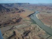
By: 61skyhawk


