Login
Register


05U
Eureka Airport
Official FAA Data Effective 2026-02-19 0901Z
Chart Supplement

VFR Chart of 05U
Sectional Charts at SkyVector.com
IFR Chart of 05U
Enroute Charts at SkyVector.com
Location Information for 05U
Coordinates: N39°36.22' / W116°0.22'Located 06 miles NW of Eureka, Nevada on 800 acres of land. View all Airports in Nevada.
Surveyed Elevation is 5957 feet MSL.
Operations Data
|
|
Airport Communications
| AWOS-3: | 128.325 Tel. 775-237-6133 |
|---|---|
| CTAF: | 122.900 |
| AWOS-3PT at TMT (55.9 W): | 132.925 775-964-1144 |
| ASOS at ELY (56.7 E): | 120.625 775-210-5681 |
- APCH/DEP CTL SVC PRVDD BY SALT LAKE ARTCC (ZLC) ON FREQS 132.25/338.35 (BATTLE MOUNTAIN RCAG).
- COMMUNICATIONS PRVDD BY RENO RADIO ON FREQ 122.3 (EUREKA RCO).
Nearby Navigation Aids
|
| ||||||||||||||||||||||||||||||


Runway 18/36
| Dimensions: | 7300 x 60 feet / 2225 x 18 meters | |
|---|---|---|
| Surface: | Asphalt / Aggregate Friction Seal Coated in Excellent Condition | |
| Weight Limits: | S-30 | |
| Edge Lighting: | High Intensity | |
| Runway 18 | Runway 36 | |
| Coordinates: | N39°36.82' / W116°0.07' | N39°35.64' / W116°0.36' |
| Elevation: | 5939.5 | 5957.8 |
| Traffic Pattern: | Left | Left |
| Runway Heading: | 191° True | 11° True |
| Markings: | Non-Precision Instrument in good condition. | Non-Precision Instrument in good condition. |
| Glide Slope Indicator | P2L (3.00° Glide Path Angle) | P2L (3.00° Glide Path Angle) |
| REIL: | Yes | Yes |
| Obstacles: | UNLGTD PLINES & POLES. UNLGTD PLINES & POLES PENETRATE 20 - 1 APCH SFC. |
35 ft Power Line 800 ft from runway |
Services Available
| Fuel: | 100LL (blue), Jet-A, Jet A+ |
|---|---|
| Transient Storage: | Hangars,Tiedowns |
| Airframe Repair: | NOT AVAILABLE |
| Engine Repair: | NOT AVAILABLE |
| Bottled Oxygen: | NOT AVAILABLE |
| Bulk Oxygen: | NOT AVAILABLE |
| Other Services: | CROP DUSTING SERVICES,AIR AMBULANCE SERVICES |
Ownership Information
| Ownership: | Publicly owned | |
|---|---|---|
| Owner: | COUNTY OF EUREKA | COUNTY OF EUREKA |
| COUNTY COURT HOUSE BOX 677 | ||
| EUREKA, NV 89316 | ||
| 775-237-5372 | ||
| Manager: | JEB ROWLEY | |
| 701 S MAIN STREET, PO BOX 714 | ||
| EUREKA, NV 89316 | ||
| 775-237-5372 | ||
Other Remarks
- FOR CD IF UNA TO CTC ON FSS FREQ, CTC SALT LAKE ARTCC AT 801-320-2568.
- COLD TEMPERATURE AIRPORT. ALTITUDE CORRECTION REQUIRED AT OR BELOW -17C.
- (PAY PHONE) PAY PHONE AVAILABLE.
- ACTVT REIL RWY 18 & 36; PAPI RWY 18 & 36; HIRL RWY 18/36 - CTAF. DUSK-DAWN; REIL RWY 18 & 36; PAPI RWY 18 & 36; HIRL RWY 18/36 PRESET LOW INTST; INCR INTST - CTAF.
Weather Minimums


Instrument Approach Procedure (IAP) Charts
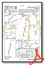
Departure Procedure Obstacles (DPO) Charts
Nearby Airports with Instrument Procedures
| ID | Name | Heading / Distance | ||
|---|---|---|---|---|
 |
KELY | Ely/Yelland Field Airport | 108° | 57.0 |
|
KBAM | Battle Mountain Airport | 326° | 71.9 |
|
KEKO | Elko Regional Airport | 007° | 73.9 |
|
KTPH | Tonopah Airport | 209° | 105.6 |
|
KENV | Wendover Airport | 053° | 112.8 |
|
KWMC | Winnemucca Municipal Airport | 313° | 113.4 |
|
KTNX | Tonopah Test Range Airport | 198° | 114.2 |
|
KLOL | Derby Field Airport | 284° | 121.6 |
|
KFLX | Fallon Municipal Airport | 268° | 127.6 |
|
KHTH | Hawthorne Industrial Airport | 243° | 138.2 |
|
KMLF | Milford Municipal/Ben and Judy Briscoe Field Airport | 115° | 156.6 |
|
KCDC | Cedar City Regional Airport | 128° | 177.9 |
Airport Images
Do you have a recent image of this airport? Upload it here!


Comments
Great place to avoid
AWOS was 1/2 function. Couldn't hear wind or density alt, critical on hot-humid summer day w/scattered convective.
"Self-serve", but an employee watched/crowded the process, basically looked over my shoulder while filling; distracted into too much fuel in one tank; close to max takeoff weight w/o cushion.
Hungry, asked if anything to eat: "No".
2 other people on bench outside office, unfriendly and sarcastic.
No trashcan outside. OK, but the office was open & we had a few little things we wanted to dispose of due to weight etc; handlebar (?) mustache guy tells them, "you fly it in, you fly it out", like backpacking. When I heard that & peeked in, handlebar says (laughing sarcastically) "just throw it on the floor". I didn't do that, but on looking in I noticed what looked a lot like snacks, coffee... We left.
Never seen anything like it in 31yrs/1500hrs of flying to many small fields.
Not so bad
Night had fallen early due to the the winter solstice. Found the fuel and filled up. Lights were off, but I checked the doors and found that there were people attending the FBO. I think they were closing up for the day, but I found them reasonably friendly. Clean restroom and comfortable facility.
2NinerRomeo
Ambushed.