Login
Register


15ME
Eagle Field Airport
Official FAA Data Effective 2026-02-19 0901Z
VFR Chart of 15ME
Sectional Charts at SkyVector.com
IFR Chart of 15ME
Enroute Charts at SkyVector.com
Location Information for 15ME
Coordinates: N43°48.92' / W70°13.75'Located 02 miles S of North Yarmouth, Maine. View all Airports in Maine.
Estimated Elevation is 150 feet MSL.
Operations Data
|
|
Airport Communications
| ATIS at PWM (10.8 S): | 119.05 |
|---|---|
| ASOS at PWM (10.9 S): | 119.05 207-419-5584 |
| AWOS-3PT at BXM (13.4 E): | 134.875 207-409-1747 |
Nearby Navigation Aids
|
| ||||||||||||||||||||||||||||||||||||||||||||||||||||||||||||


Runway 07/25
| Dimensions: | 2600 x 60 feet / 792 x 18 meters | |
|---|---|---|
| Surface: | Turf | |
| Runway 07 | Runway 25 | |
| Coordinates: | N43°48.92' / W70°13.75' | N0°0.00' / E0°0.00' |
| Elevation: | 150.0 | |
| Obstacles: | 25 ft Trees 200 ft from runway | 40 ft Power Line 30 ft from runway |
Ownership Information
| Ownership: | Privately Owned | |
|---|---|---|
| Owner: | KENNETH L. CIANCHETTE | |
| 51 PRINCE WELL ROAD | ||
| NORTH YARMOUTH, ME 04097 | ||
| 207-829-3260 | ||
| Manager: | KENNETH L. CIANCHETTE | |
| 51 PRINCE WELL ROAD | ||
| NORTH YARMOUTH, ME 04097 | ||
| 207-829-3260 | ||
Other Remarks
- FOR CD CTC PORTLAND APCH AT 207-874-7320, WHEN APCH CLSD CTC BOSTON ARTCC AT 603-879-6859.
Nearby Airports with Instrument Procedures
| ID | Name | Heading / Distance | ||
|---|---|---|---|---|
 |
KPWM | Portland International Jetport Airport | 198° | 10.7 |
|
KBXM | Brunswick Exec Airport | 069° | 13.4 |
|
KLEW | Auburn/Lewiston Municipal Airport | 350° | 14.2 |
|
81B | Oxford County Regional Airport | 332° | 23.3 |
|
B19 | Biddeford Municipal Airport | 206° | 23.6 |
|
KIWI | Wiscasset Airport | 068° | 24.1 |
|
KSFM | Sanford Seacoast Regional Airport | 219° | 32.8 |
|
KIZG | White Mountain Regional Airport | 288° | 32.9 |
|
KAUG | Augusta State Airport | 031° | 35.6 |
|
KDAW | Skyhaven Airport | 224° | 44.1 |
|
0B1 | Bethel Regional Airport | 325° | 44.4 |
|
3B4 | Seacoast Airfield Airport | 210° | 46.8 |
Airport Images
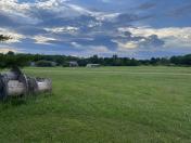
By: newtestleper


