Login
Register


1QK
Gove County Airport
Official FAA Data Effective 2026-02-19 0901Z
Chart Supplement

VFR Chart of 1QK
Sectional Charts at SkyVector.com
IFR Chart of 1QK
Enroute Charts at SkyVector.com
Location Information for 1QK
Coordinates: N39°2.32' / W100°14.03'Located 02 miles S of Quinter, Kansas on 142 acres of land. View all Airports in Kansas.
Estimated Elevation is 2637 feet MSL.
Operations Data
|
|
Airport Communications
| CTAF: | 122.900 |
|---|---|
| ASOS at HLC (27.6 NE): | 118.425 785-421-3471 |
| AWOS-3 at OEL (27.6 W): | 118.325 785-671-4194 |
| AWOS-3PT at 48K (37.1 SE): | 118.575 785-261-2002 |
- APCH/DEP CTL SVC PRVDD BY DENVER ARTCC (ZDV) ON 132.7/226.675 (HILL CITY RCAG).
Nearby Navigation Aids
|
| ||||||||||||||||||||||||||||||||||||||||||||||||||||||||||||


Runway 17/35
| Dimensions: | 4000 x 60 feet / 1219 x 18 meters | |
|---|---|---|
| Surface: | Concrete in Excellent Condition | |
| Weight Limits: | S-30, D-30 | |
| Edge Lighting: | Medium Intensity | |
| Runway 17 | Runway 35 | |
| Coordinates: | N39°2.64' / W100°14.03' | N39°1.99' / W100°14.04' |
| Elevation: | 2637.1 | 2613.1 |
| Traffic Pattern: | Right | |
| Markings: | Non-Precision Instrument in good condition. | Non-Precision Instrument in good condition. |
| Obstacles: | 60 ft Tree 1320 ft from runway, 420 ft right of center | |
Services Available
| Fuel: | NONE |
|---|---|
| Transient Storage: | Tiedowns |
| Airframe Repair: | NONE |
| Engine Repair: | NONE |
| Bottled Oxygen: | NONE |
| Bulk Oxygen: | NONE |
Ownership Information
| Ownership: | Publicly owned | |
|---|---|---|
| Owner: | GOVE COUNTY | |
| PO BOX 120, 520 WASHINGTON | ||
| GOVE, KS 67736 | ||
| 785-938-2305 | ||
| Manager: | PATRICK RICHMEIER | |
| PO BOX 413, 312 LINCOLN ST | ||
| QUINTER, KS 67752 | ||
| 785-299-0219 | ||
Other Remarks
- FOR CD CTC DENVER ARTCC 303-651-4257.
- ACTVT MIRL RWY 17/35 - CTAF.
Weather Minimums

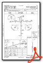
Instrument Approach Procedure (IAP) Charts

Nearby Airports with Instrument Procedures
| ID | Name | Heading / Distance | ||
|---|---|---|---|---|
 |
0H1 | Trego Wakeeney Airport | 096° | 16.1 |
|
KOEL | Oakley Municipal Airport | 279° | 27.6 |
|
KHLC | Hill City Municipal Airport | 042° | 27.8 |
|
48K | Ness City Municipal Airport | 155° | 37.1 |
|
KCBK | Shalz Field Airport | 301° | 44.5 |
|
KTQK | Scott City Municipal Airport | 222° | 45.5 |
|
KHYS | Hays Regional Airport | 104° | 46.5 |
|
KRCP | Rooks County Regional Airport | 066° | 47.1 |
|
KOIN | Oberlin Municipal Airport | 343° | 49.8 |
|
KNRN | Norton Municipal Airport | 017° | 51.2 |
|
KPHG | Phillipsburg Municipal Airport | 045° | 59.7 |
|
KADT | Atwood-Rawlins County City-County Airport | 322° | 61.0 |
Airport Images
Do you have a recent image of this airport? Upload it here!


