Login
Register


OEL
Oakley Municipal Airport
Official FAA Data Effective 2026-02-19 0901Z
Chart Supplement

VFR Chart of KOEL
Sectional Charts at SkyVector.com
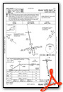
IFR Chart of KOEL
Enroute Charts at SkyVector.com
Location Information for KOEL
Coordinates: N39°6.71' / W100°49.00'Located 02 miles SE of Oakley, Kansas on 282 acres of land. View all Airports in Kansas.
Surveyed Elevation is 3045 feet MSL.
Operations Data
|
|
Airport Communications
| AWOS-3: | 118.325 Tel. 785-671-4194 |
|---|---|
| UNICOM: | 122.800 |
| CTAF: | 122.800 |
| AWOS-3P at CBK (21.8 NW): | 118.175 785-460-4499 |
| AWOS-3P at TQK (38.2 S): | 120.00 620-872-2233 |
| ASOS at GLD (43.5 W): | 121.025 785-576-2383 |
- APCH/DEP CTL SVC PRVDD BY DENVER ARTCC (ZDV) ON FREQS 132.7/226.675 (GOODLAND RCAG).
Nearby Navigation Aids
|
| ||||||||||||||||||||||||||||||||||||||||||||||||||||||||||||


Runway 16/34
| Dimensions: | 5000 x 75 feet / 1524 x 23 meters | |
|---|---|---|
| Surface: | Concrete in Excellent Condition | |
| Weight Limits: | S-30 | |
| Edge Lighting: | Medium Intensity | |
| Runway 16 | Runway 34 | |
| Coordinates: | N39°7.00' / W100°49.09' | N39°6.19' / W100°48.88' |
| Elevation: | 3045.2 | 3020.3 |
| Runway Heading: | 169° True | 349° True |
| Declared Distances: | TORA:5000 TODA:5000 ASDA:5000 LDA:5000 | TORA:5000 TODA:5000 ASDA:5000 LDA:5000 |
| Markings: | Non-Precision Instrument in good condition. | Non-Precision Instrument in good condition. |
| Glide Slope Indicator | P2L (3.00° Glide Path Angle) PAPI UNUSBL BYD 8 DEG RIGHT & 6 DEG LEFT OF CNTRLN. | P2L (3.00° Glide Path Angle) PAPI UNUSBL BYD 8 DEG LEFT OF CNTRLN. |
| REIL: | Yes | Yes |
| Obstacles: | 20 ft Building 670 ft from runway, 280 ft left of center | |
Runway 08/26
| Dimensions: | 2153 x 110 feet / 656 x 34 meters | |
|---|---|---|
| Surface: | Turf in Good Condition | |
| Runway 08 | Runway 26 | |
| Coordinates: | N39°6.96' / W100°49.28' | N39°6.95' / W100°48.82' |
| Elevation: | 3042.0 | 3039.9 |
| Traffic Pattern: | Left | Left |
| Runway Heading: | 91° True | 271° True |
| Markings: | None in fair condition. | None in fair condition. |
| Obstacles: | 14 ft Road 375 ft from runway, 145 ft right of center | |
Services Available
| Fuel: | 100LL (blue), Jet-A, Jet A-1+ |
|---|---|
| Transient Storage: | Hangars,Tiedowns |
| Airframe Repair: | MAJOR |
| Engine Repair: | MAJOR |
| Bottled Oxygen: | NOT AVAILABLE |
| Bulk Oxygen: | NOT AVAILABLE |
| Other Services: | CROP DUSTING SERVICES,PILOT INSTRUCTION |
Ownership Information
| Ownership: | Publicly owned | |
|---|---|---|
| Owner: | CITY OF OAKLEY | |
| CITY HALL, 209 HUDSON AVE | ||
| OAKLEY, KS 67748 | ||
| 785-671-3136 | ||
| Manager: | JOHN HOLZMEISTER | |
| CITY HALL, 209 HUDSON AVE | ||
| OAKLEY, KS 67748-6016 | ||
| 785-672-0147 | ||
Other Remarks
- FUEL H24 SELF SVC.
- SVC AFTER HR - 785-672-0147.
- FOR CD CTC DENVER ARTCC AT 303-651-4257.
- ACTVT REIL RWY 16 & 34; PAPI RWY 16 & 34; MIRL RWY 16/34 - CTAF.
Weather Minimums


Instrument Approach Procedure (IAP) Charts
Nearby Airports with Instrument Procedures
| ID | Name | Heading / Distance | ||
|---|---|---|---|---|
 |
KCBK | Shalz Field Airport | 330° | 21.7 |
|
1QK | Gove County Airport | 098° | 27.6 |
|
KTQK | Scott City Municipal Airport | 184° | 38.3 |
|
0H1 | Trego Wakeeney Airport | 098° | 43.6 |
|
KGLD | Renner Field/Goodland Municipal Airport | 290° | 43.9 |
|
KADT | Atwood-Rawlins County City-County Airport | 346° | 44.9 |
|
KOIN | Oberlin Municipal Airport | 016° | 45.2 |
|
3K7 | Mark Hoard Memorial Airport | 212° | 46.5 |
|
KHLC | Hill City Municipal Airport | 070° | 48.7 |
|
48K | Ness City Municipal Airport | 131° | 57.2 |
|
5K2 | Tribune Municipal Airport | 228° | 59.0 |
|
KSYF | Cheyenne County Municipal Airport | 310° | 59.8 |
Airport Images
Do you have a recent image of this airport? Upload it here!


