Login
Register
28AR
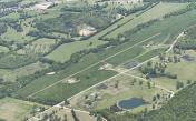
Henley Aerodrome Airport
Official FAA Data Effective 2024-04-18 0901Z
VFR Chart of 28AR
Sectional Charts at SkyVector.com
IFR Chart of 28AR
Enroute Charts at SkyVector.com
Location Information for 28AR
Coordinates: N35°50.00' / W91°26.00'Located 12 miles W of Charlotte, Arkansas. View all Airports in Arkansas.
Estimated Elevation is 377 feet MSL.
Operations Data
|
|
Airport Communications
| AWOS-3PT at BVX (12.2 SW): | 126.375 870-251-1369 |
|---|---|
| AWOS-3PT at M19 (17.2 SE): | 118.15 870-523-2189 |
| AWOS-3PT at 42A (23.9 NW): | 121.575 870-916-2768 |
Nearby Navigation Aids
|
| ||||||||||||||||||||||||||||||||||||||||||||||||||||||||||||
Runway 18/36
| Dimensions: | 3100 x 75 feet / 945 x 23 meters | |
|---|---|---|
| Surface: | Turf | |
| Runway 18 | Runway 36 | |
| Obstacles: | 50 ft Power Line 1000 ft from runway | |
Ownership Information
| Ownership: | Privately Owned | |
|---|---|---|
| Owner: | MARK HENLEY SR. | |
| 230 N. CHARLOTTE ROAD | ||
| SULPHER ROCK, AR 72579 | ||
| (870) 262-9975 | ||
| Manager: | MARK HENLEY | |
| 230 N. CHARLOTTE ROAD | ||
| SULPHER ROCK, AR 72579 | ||
| (870) 262-9975 | ||
Other Remarks
- FOR CD CTC MEMPHIS ARTCC AT 901-368-8453/8449.
Nearby Airports with Instrument Procedures
| ID | Name | Heading / Distance | ||
|---|---|---|---|---|
 |
KBVX | Batesville Regional Airport | 238° | 12.3 |
 |
M19 | Newport Regional Airport | 132° | 17.2 |
 |
42A | Melbourne Municipal - John E Miller Field Airport | 306° | 24.0 |
 |
KCVK | Sharp County Regional Airport | 346° | 26.6 |
 |
6M2 | Horseshoe Bend Airport | 326° | 28.0 |
 |
KARG | Walnut Ridge Regional Airport | 054° | 30.3 |
 |
7M2 | Mountain View Wilcox Memorial Field Airport | 273° | 32.1 |
 |
M70 | Pocahontas Municipal Airport | 043° | 33.9 |
 |
KHBZ | Heber Springs Municipal Airport | 235° | 34.3 |
 |
M60 | Woodruff County Airport | 166° | 34.6 |
 |
KJBR | Jonesboro Municipal Airport | 089° | 38.4 |
 |
KSRC | Searcy Regional Airport | 201° | 40.2 |


