Login
Register
7M2
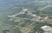
Mountain View Wilcox Memorial Field Airport
Official FAA Data Effective 2026-01-22 0901Z
VFR Chart of 7M2
Sectional Charts at SkyVector.com
IFR Chart of 7M2
Enroute Charts at SkyVector.com
Location Information for 7M2
Coordinates: N35°51.87' / W92°5.42'Located 02 miles E of Mountain View, Arkansas on 102 acres of land. View all Airports in Arkansas.
Estimated Elevation is 805 feet MSL.
Operations Data
|
|
Airport Communications
| UNICOM: | 122.700 |
|---|---|
| CTAF: | 122.700 |
| AWOS-3PT at 42A (17.8 NE): | 121.575 870-916-2768 |
| AWOS-3PT at BVX (23.1 E): | 126.375 870-251-1369 |
| AWOS-3 at CCA (23.7 SW): | 118.725 501-745-5000 |
- APCH/DEP SVC PRVDD BY MEMPHIS ARTCC ON FREQS 126.85/281.55(HARRISON RCAG).
Nearby Navigation Aids
|
| ||||||||||||||||||||||||||||||||||||||||||||||||
Runway 09/27
| Dimensions: | 4502 x 70 feet / 1372 x 21 meters | |
|---|---|---|
| Surface: | Asphalt in Fair Condition | |
| Edge Lighting: | Medium Intensity | |
| Runway 09 | Runway 27 | |
| Coordinates: | N35°51.89' / W92°5.88' | N35°51.85' / W92°4.96' |
| Elevation: | 804.0 | 780.0 |
| Traffic Pattern: | Left | Left |
| Runway Heading: | 93° True | 273° True |
| Markings: | Non-Precision Instrument in fair condition. | Non-Precision Instrument in fair condition. |
| Obstacles: | 21 ft Building 435 ft from runway, 110 ft right of center | 355 ft Tower 5280 ft from runway 6-8 FT BRUSH APRX 50 FT FM RWY END. |
Services Available
| Fuel: | 100LL (blue) |
|---|---|
| Transient Storage: | Hangars,Tiedowns |
| Airframe Repair: | NONE |
| Engine Repair: | NONE |
| Bottled Oxygen: | NONE |
| Bulk Oxygen: | NOT AVAILABLE |
Ownership Information
| Ownership: | Publicly owned | |
|---|---|---|
| Owner: | CITY OF MOUNTAIN VIEW | |
| CITY HALL | ||
| MOUNTAIN VIEW, AR 72560 | ||
| 870-269-3804 | ||
| Manager: | LARRY SNYDER | |
| 1501 AIRPORT LANE | ||
| MOUNTAIN VIEW, AR 72560 | ||
| 501-203-8644 | ||
Other Remarks
- (E81) TWY EXIT LIGHT AT END RWY 09.
- RY 27 HAS A 15 FT DROPOFF 400 FT FM THLD.
- DEER & COYOTES ON & INVOF ARPT.
- FOR CD CTC MEMPHIS ARTCC AT 901-368-8453/8449.
- (TDZ ELEV SOURCE, RWY 09) FTW FPO.
- (TDZ ELEV SOURCE, RWY 27) FTW FPO.
- 0LL SELF-SERVICE FUEL AVBL 24 HRS WITH CREDIT CARD.
- MIRL RWY 09/27 -CTAF (3 - LOW, 5- MED, 7 - HIGH)
Weather Minimums
Instrument Approach Procedure (IAP) Charts
Nearby Airports with Instrument Procedures
| ID | Name | Heading / Distance | ||
|---|---|---|---|---|
 |
42A | Melbourne Municipal/John E Miller Field Airport | 045° | 17.7 |
 |
2A2 | Holley Mountain Airpark Airport | 230° | 20.0 |
 |
KHBZ | Heber Springs Municipal Airport | 169° | 21.5 |
 |
KBVX | Batesville Regional Airport | 110° | 23.2 |
 |
KCCA | Clinton Municipal Airport | 227° | 23.8 |
 |
6M2 | Horseshoe Bend Airport | 037° | 26.9 |
 |
4A5 | Searcy County Airport | 274° | 27.7 |
 |
KCVK | Sharp County Regional Airport | 046° | 35.1 |
 |
KFLP | Marion County Regional Airport | 316° | 35.3 |
 |
KBPK | Baxter County Airport | 328° | 35.4 |
 |
KSRC | Searcy Regional Airport | 156° | 42.8 |
 |
M19 | Newport Regional Airport | 106° | 46.7 |


