Login
Register
2O8
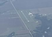
Hinton Municipal Airport
Official FAA Data Effective 2026-01-22 0901Z
VFR Chart of 2O8
Sectional Charts at SkyVector.com
IFR Chart of 2O8
Enroute Charts at SkyVector.com
Location Information for 2O8
Coordinates: N35°30.43' / W98°20.55'Located 02 miles NE of Hinton, Oklahoma on 80 acres of land. View all Airports in Oklahoma.
Surveyed Elevation is 1587 feet MSL.
Operations Data
|
|
Airport Communications
| CTAF: | 123.050 |
|---|---|
| UNICOM: | 123.050 |
| AWOS-3PT at OJA (16.1 W): | 118.575 580-772-7020 |
| AWOS-3 at RQO (16.6 E): | 118.475 405-262-0087 |
| AWOS-3 at JWG (21.8 N): | 134.175 580-623-7388 |
- APCH/DEP CTL SVC PRVDD BY FORT WORTH ARTCC (ZFW) ON FREQS 128.4/269.375 (CLINTON-SHERMAN RCAG).
Nearby Navigation Aids
|
| ||||||||||||||||||||||||||||||||||||||||||||||||||||||
Runway 18/36
| Dimensions: | 4001 x 60 feet / 1220 x 18 meters | |
|---|---|---|
| Surface: | Asphalt in Good Condition | |
| Edge Lighting: | Medium Intensity | |
| Runway 18 | Runway 36 | |
| Coordinates: | N35°30.76' / W98°20.56' | N35°30.10' / W98°20.55' |
| Elevation: | 1577.4 | 1586.9 |
| Runway Heading: | 180° True | 360° True |
| Markings: | Non-Precision Instrument in good condition. | Non-Precision Instrument in good condition. |
| Glide Slope Indicator | P2L (3.00° Glide Path Angle) | P2L (3.00° Glide Path Angle) |
Services Available
| Fuel: | 100LL (blue) |
|---|---|
| Transient Storage: | Hangars,Tiedowns |
| Airframe Repair: | NONE |
| Engine Repair: | NONE |
| Bottled Oxygen: | NONE |
| Bulk Oxygen: | NONE |
| Other Services: | GLIDER SERVICE |
Ownership Information
| Ownership: | Publicly owned | |
|---|---|---|
| Owner: | TOWN OF HINTON | |
| PO BOX 159 | ||
| HINTON, OK 73047 | ||
| 405-542-3253 | ||
| Manager: | SHRIEE FURROW | |
| PO BOX 67, 611 E AIRPORT RD. | ||
| HINTON, OK 73047 | ||
| 405-542-3993 | ||
Other Remarks
- GLIDER ACT ON & INVOF ARPT.
- FOR CD CTC FORT WORTH ARTCC AT 817-858-7584.
- 0LL AVBL 24 HR WITH ADP SYS.
- PAPI RWY 18 & 36 ON CONSLY, PRESET LOW INTST AT NGT. INCR INTST 5 OR 7 MIC CLICKS - CTAF; MIRL RWY 18/36 SS-SR PRESET LOW INTST. INCR INTST 5 OR 7 MIC CLICKS - CTAF.
Weather Minimums
Instrument Approach Procedure (IAP) Charts
Nearby Airports with Instrument Procedures
| ID | Name | Heading / Distance | ||
|---|---|---|---|---|
 |
KOJA | Weatherford Stafford Airport | 278° | 16.1 |
 |
KRQO | El Reno Regional Airport | 097° | 16.6 |
 |
KJWG | Watonga Regional Airport | 349° | 21.7 |
 |
1O4 | Thomas Municipal Airport | 305° | 23.3 |
 |
KRCE | Clarence E Page Municipal Airport | 092° | 25.5 |
 |
KCLK | Clinton Regional Airport | 273° | 29.0 |
 |
KCHK | Chickasha Municipal Airport | 143° | 30.7 |
 |
KHSD | Sundance Airport | 079° | 31.7 |
 |
KPWA | Wiley Post Airport | 087° | 34.1 |
 |
KOKC | Okc Will Rogers International Airport | 100° | 37.0 |
 |
KCSM | Clinton/Sherman Airport | 256° | 43.2 |
 |
KOUN | University of Oklahoma Westheimer Airport | 109° | 45.5 |


