Login
Register
CHK
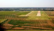
Chickasha Municipal Airport
Official FAA Data Effective 2025-12-25 0901Z
VFR Chart of KCHK
Sectional Charts at SkyVector.com
IFR Chart of KCHK
Enroute Charts at SkyVector.com
Location Information for KCHK
Coordinates: N35°5.83' / W97°58.06'Located 03 miles NW of Chickasha, Oklahoma on 720 acres of land. View all Airports in Oklahoma.
Surveyed Elevation is 1151 feet MSL.
Operations Data
|
|
Airport Communications
| AWOS-3: | 118.175 Tel. 405-574-1016 |
|---|---|
| OKE CITY APPROACH: | 124.6 266.8 |
| OKE CITY DEPARTURE: | 124.6 266.8 |
| UNICOM: | 123.000 |
| CTAF: | 123.000 |
| AWOS-3 at RQO (22.6 N): | 118.475 405-262-0087 |
| AWOS-3 at RCE (25.0 N): | 125.05 405-354-2617 |
| ASOS at OKC (25.1 NE): | 405-674-4013 |
Nearby Navigation Aids
|
| ||||||||||||||||||||||||||||||||||||||||||||||||||||||
Runway 18/36
| Dimensions: | 5101 x 100 feet / 1555 x 30 meters | |
|---|---|---|
| Surface: | Concrete in Good Condition | |
| Weight Limits: | S-40, D-52 | |
| Edge Lighting: | Medium Intensity | |
| Runway 18 | Runway 36 | |
| Coordinates: | N35°6.21' / W97°58.15' | N35°5.36' / W97°58.15' |
| Elevation: | 1150.3 | 1129.8 |
| Traffic Pattern: | Right | Left |
| Runway Heading: | 180° True | 0 |
| Markings: | Non-Precision Instrument in fair condition. | Non-Precision Instrument in fair condition. |
| Glide Slope Indicator | P4L (3.00° Glide Path Angle) | P4L (3.00° Glide Path Angle) |
| Obstacles: | 43 ft Trees 944 ft from runway, 276 ft right of center | |
Runway 03/21
| Dimensions: | 2404 x 100 feet / 733 x 30 meters | |
|---|---|---|
| Surface: | Turf in Fair Condition | |
| Runway 03 | Runway 21 | |
| Coordinates: | N35°5.66' / W97°58.04' | N35°5.99' / W97°57.78' |
| Elevation: | 1136.0 | 1142.7 |
| Traffic Pattern: | Right | Left |
| Runway Heading: | 33° True | 213° True |
| Markings: | Non-Standard in fair condition. | Non-Standard in fair condition. |
| Obstacles: | 49 ft Tree 914 ft from runway, 145 ft left of center | |
Runway 01/19
| Dimensions: | 2232 x 100 feet / 680 x 30 meters | |
|---|---|---|
| Surface: | Turf in Fair Condition | |
| Runway 01 | Runway 19 | |
| Coordinates: | N35°5.75' / W97°58.01' | N35°6.12' / W97°58.01' |
| Elevation: | 1137.2 | 1144.4 |
| Traffic Pattern: | Right | Left |
| Runway Heading: | 0 | 180° True |
| Markings: | Non-Standard in fair condition. | Non-Standard in fair condition. |
Services Available
| Fuel: | 100LL (blue), Jet A+ |
|---|---|
| Transient Storage: | Hangars,Tiedowns |
| Airframe Repair: | MINOR |
| Engine Repair: | MINOR |
| Bottled Oxygen: | NONE |
| Bulk Oxygen: | NONE |
| Other Services: | AVIONICS,PILOT INSTRUCTION,AIRCRAFT RENTAL |
Ownership Information
| Ownership: | Publicly owned | |
|---|---|---|
| Owner: | CITY OF CHICKASHA | |
| CITY HALL 117 N 4TH STREET | ||
| CHICKASHA, OK 73018 | ||
| (405) 222-6020 | ||
| Manager: | DARREN MARTIN | ON SITE CTC: DARREN MARTIN, 405-320-0274. 2344 BEECHCRAFT RD. |
| CITY HALL 117 N 4TH STREET | ||
| CHICKASHA, OK 73018 | ||
| 405-222-6010 | ||
Other Remarks
- FOR CD CTC OKE CITY APCH AT 405-681-5683.
- 0LL AVBL H24 WITH CREDIT CARD.
- ACTVT MIRL RWY 18/36 - CTAF. MIRL RWY 18/36 PRESET LOW INTST; INCR INTST - CTAF.
Weather Minimums
Standard Terminal Arrival (STAR) Charts
Instrument Approach Procedure (IAP) Charts
Nearby Airports with Instrument Procedures
| ID | Name | Heading / Distance | ||
|---|---|---|---|---|
 |
KRQO | El Reno Regional Airport | 355° | 22.6 |
 |
KRCE | Clarence E Page Municipal Airport | 016° | 24.5 |
 |
1K4 | David Jay Perry Airport | 081° | 24.7 |
 |
KOKC | Okc Will Rogers International Airport | 045° | 25.3 |
 |
KOUN | University of Oklahoma Westheimer Airport | 069° | 25.9 |
 |
KPWA | Wiley Post Airport | 030° | 30.5 |
 |
2O8 | Hinton Municipal Airport | 323° | 30.7 |
 |
KHSD | Sundance Airport | 022° | 32.8 |
 |
KTIK | Tinker AFB Airport | 056° | 34.3 |
 |
KDUC | Halliburton Field Airport | 179° | 37.5 |
 |
KLAW | Lawton-Fort Sill Regional Airport | 215° | 38.7 |
 |
KPVJ | Pauls Valley Municipal Airport | 122° | 43.5 |


