Login
Register


59B
Newton Field Airport
Official FAA Data Effective 2025-12-25 0901Z
Chart Supplement

VFR Chart of 59B
Sectional Charts at SkyVector.com
IFR Chart of 59B
Enroute Charts at SkyVector.com
Location Information for 59B
Coordinates: N45°37.95' / W70°14.85'Located 01 miles W of Jackman, Maine on 132 acres of land. View all Airports in Maine.
Surveyed Elevation is 1177 feet MSL.
Operations Data
|
|
Airport Communications
| AWOS-3: | 122.9 |
|---|---|
| CTAF: | 122.900 |
| AWOS-A at 3B1 (30.8 E): | 124.175 207-695-2581 |
| AWOS-AV at B21 (32.9 S): | 120.0 |
| AWOS-3PT at 8B0 (42.4 SW): | 118.000 207-864-5250 |
- APCH/DEP SVC PRVDD BY BOSTON ARTCC ON FREQS 120.25/346.4 (BANGOR RCAG).
Nearby Navigation Aids
|
| ||||||||||||||||||||||||||||||||||||||||||||||||


Runway 13/31
| Dimensions: | 3601 x 75 feet / 1098 x 23 meters | |
|---|---|---|
| Surface: | Asphalt in Good Condition | |
| Edge Lighting: | Medium Intensity | |
| Runway 13 | Runway 31 | |
| Coordinates: | N45°38.05' / W70°15.25' | N45°37.85' / W70°14.45' |
| Elevation: | 1177.9 | 1171.0 |
| Runway Heading: | 110° True | 290° True |
| Markings: | Non-Precision Instrument in good condition. | Non-Precision Instrument in good condition. |
| REIL: | Yes | |
| Obstacles: | 12 ft Tree 221 ft from runway, 179 ft right of center +4 FT GRASS 50-200 FT FM THR, 80 FT R OF CNTRLN. |
11 ft Tree 208 ft from runway, 115 ft left of center +12 FT TREE AND BRUSH 0-20 FT FM THR, 120 FT R OF CNTRLN; +4 FT TREE 10 FT FM THR, 150 FT L OF CNTRLN. |
Helipad H1
| Dimensions: | 125 x 80 feet / 38 x 24 meters | |
|---|---|---|
| Surface: | Turf | |
| Coordinates: | N45°37.97' / W70°14.93' | N0°0.00' / E0°0.00' |
| Elevation: | 1178.0 | |
Services Available
| Fuel: | 100LL (blue) |
|---|---|
| Transient Storage: | Hangars,Tiedowns CALL 207-668-2111 FOR AVBL. |
| Airframe Repair: | NONE |
| Engine Repair: | NONE |
| Bottled Oxygen: | NONE |
| Bulk Oxygen: | NONE |
Ownership Information
| Ownership: | Publicly owned | |
|---|---|---|
| Owner: | TOWN OF JACKMAN | |
| TOWN OFFICE, 569 MAIN ST | ||
| JACKMAN, ME 04945 | ||
| 207-668-2111 | ||
| Manager: | KIRSTIE HALE | |
| TOWN OFFICE, 569 MAIN ST | ||
| JACKMAN, ME 04945 | ||
| 207-668-2111 | ||
Other Remarks
- GEESE, DEER & MOOSE ON & INVOF ARPT.
- ARPT PHONE AVBL FOR LOCAL CALLS ONLY.
- FOR CD CTC BOSTON ARTCC AT 603-879-6859.
- COLD TEMPERATURE AIRPORT. ALTITUDE CORRECTION REQUIRED AT OR BELOW -23C.
- 0LL FUEL AVBL 24 HRS WITH MAJOR CREDIT CARD.
- ACTVT REIL RWY 31; MIRL RWY 13/31 - CTAF.
- MNTN 122.9 WI VCNTY OF ARPT. 3 CLICKS ADZY & WX.
Weather Minimums
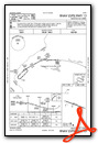
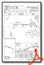
Instrument Approach Procedure (IAP) Charts
Nearby Airports with Instrument Procedures
| ID | Name | Heading / Distance | ||
|---|---|---|---|---|
 |
52B | Moosehead Aero Marine Seaplane Base | 109° | 28.7 |
|
3B1 | Greenville Municipal Airport | 108° | 31.1 |
|
B21 | Sugarloaf Regional Airport | 177° | 32.9 |
|
CYSG | St Georges Airport | 325° | 34.0 |
|
8B0 | Stephen A Bean Municipal Airport | 204° | 42.3 |
|
M57 | Rangeley Lake Seaplane Base | 203° | 44.4 |
|
1B0 | Dexter Regional Airport | 131° | 57.0 |
|
KOWK | Central Maine/Norridgewock Airport | 163° | 57.4 |
|
CYSC | Sherbrooke Airport | 259° | 62.0 |
|
2B7 | Pittsfield Municipal Airport | 144° | 63.7 |
|
KMLT | Millinocket Municipal Airport | 088° | 65.8 |
|
KWVL | Waterville Regional Airport | 159° | 70.3 |
Airport Images
Do you have a recent image of this airport? Upload it here!


