Login
Register


65S
Boundary County Airport
Official FAA Data Effective 2025-12-25 0901Z
Chart Supplement

VFR Chart of 65S
Sectional Charts at SkyVector.com
IFR Chart of 65S
Enroute Charts at SkyVector.com
Location Information for 65S
Coordinates: N48°43.56' / W116°17.71'Located 02 miles NE of Bonners Ferry, Idaho on 183 acres of land. View all Airports in Idaho.
Surveyed Elevation is 2337 feet MSL.
Operations Data
|
|
Airport Communications
| AWOS-3PT: | 132.575 Tel. 208-267-3995 |
|---|---|
| CTAF: | 123.000 |
| UNICOM: | 123.000 |
| AWOS-2 at SZT (27.7 SW): | 135.425 208-263-3074 |
| AWOS-A at S59 (41.6 SE): | 118.575 406-293-4631 |
| AWOS-3PT at COE (60.9 S): | 135.075 208-772-8215 |
- APCH/DEP CTL SVC PRVDD BY SEATTLE ARTCC (ZSE) ON FREQS 123.95/290.55 (LAKESIDE RCAG).
Nearby Navigation Aids
|
| ||||||||||||||||||||||||||||||||||||||||||||||||


Runway 02/20
| Dimensions: | 4002 x 75 feet / 1220 x 23 meters | |
|---|---|---|
| Surface: | Asphalt in Good Condition | |
| Weight Limits: | S-25 | |
| Edge Lighting: | Medium Intensity | |
| Runway 02 | Runway 20 | |
| Coordinates: | N48°43.30' / W116°18.02' | N48°43.82' / W116°17.40' |
| Elevation: | 2315.5 | 2336.9 |
| Traffic Pattern: | Left | Left |
| Runway Heading: | 38° True | 218° True |
| Markings: | Non-Precision Instrument in good condition. | Non-Precision Instrument in good condition. |
| Glide Slope Indicator | P2L (3.50° Glide Path Angle) | |
| Obstacles: | +85 FT TREES AT 800 FT 375 FT L. |
7 ft Fence 200 ft from runway, 240 ft right of center +85 FT TREES AT 1200 FT 300 FT L; +75 FT TREES AT 1600 FT ON CNTRLN. |
Services Available
| Fuel: | 100LL (blue), Jet-A |
|---|---|
| Transient Storage: | Hangars,Tiedowns |
| Airframe Repair: | MAJOR |
| Engine Repair: | MINOR |
| Bottled Oxygen: | LOW |
| Bulk Oxygen: | NONE |
| Other Services: | CHARTER SERVICE,PILOT INSTRUCTION,AIRCRAFT RENTAL,AIRCRAFT SALES |
Ownership Information
| Ownership: | Publicly owned | |
|---|---|---|
| Owner: | BOUNDARY COUNTY | |
| PO BOX 419 | ||
| BONNERS FERRY, ID 83805 | ||
| 208-267-7723 | ||
| Manager: | DAVE PARKER | |
| 64602 HIGHWAY 2 | ||
| BONNERS FERRY, ID 83805 | ||
| 208-267-3711 | ||
Other Remarks
- COLD TEMPERATURE AIRPORT. ALTITUDE CORRECTION REQUIRED AT OR BELOW -6C.
- FOR CD CTC SEATTLE ARTCC AT 253-351-3694.
- ACTVT MIRL RWY 02/20 - CTAF; PAPI RWY 02 OPR CONSLY.
Weather Minimums

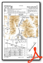
Instrument Approach Procedure (IAP) Charts
Departure Procedure Obstacles (DPO) Charts

Nearby Airports with Instrument Procedures
| ID | Name | Heading / Distance | ||
|---|---|---|---|---|
 |
KSZT | Sandpoint Airport | 202° | 27.7 |
|
S59 | Libby Airport | 129° | 41.7 |
|
KCOE | Coeur D'Alene/Pappy Boyington Field Airport | 200° | 60.9 |
|
KDEW | Deer Park Airport | 225° | 64.3 |
|
KSFF | Felts Field Airport | 213° | 75.0 |
|
KGEG | Spokane International Airport | 217° | 83.0 |
|
KGPI | Glacier Park International Airport | 106° | 85.1 |
|
KSKA | Fairchild AFB Airport | 219° | 86.2 |
|
CZPC | Pincher Creek Airport | 061° | 102.4 |
|
8S1 | Polson Airport | 125° | 104.9 |
|
7S0 | Ronan Airport | 127° | 112.3 |
|
2S8 | Wilbur Airport | 240° | 114.3 |
Airport Images
Do you have a recent image of this airport? Upload it here!


