Login
Register


6A1
Butler Municipal Airport
Official FAA Data Effective 2026-02-19 0901Z
Chart Supplement

VFR Chart of 6A1
Sectional Charts at SkyVector.com
IFR Chart of 6A1
Enroute Charts at SkyVector.com
Location Information for 6A1
Coordinates: N32°34.09' / W84°14.80'Located 01 miles NW of Butler, Georgia on 183 acres of land. View all Airports in Georgia.
Estimated Elevation is 667 feet MSL.
Operations Data
|
|
Airport Communications
| AWOS-3: | 119.525 Tel. 478-862-2966 |
|---|---|
| ATLANTA APPROACH: | 124.2 279.6 388.2 ;7000 FT & ABV |
| ATLANTA DEPARTURE: | 124.2 279.6 388.2 ;7000 FT & ABV |
| CTAF: | 122.900 |
| AWOS-3 at OPN (23.2 N): | 133.975 706-646-4123 |
| AWOS-3 at PXE (24.6 E): | 123.825 478-987-8768 |
| AWOS-3 at ACJ (27.6 S): | 128.375 770-847-7993 |
- APCH/DEP SVC PRVDD BY ATLANTA LARGE TRACON 0615-2300; APCH/DEP SVC PRVDD BY ATLANTA ARTCC APCH/DEP SVC 2300-0615 ON FREQS 120.45/298.850 (COLUMBUS RCAG).
Nearby Navigation Aids
|
| ||||||||||||||||||||||||||||||||||||||||||||||||||||||||||||


Runway 01/19
| Dimensions: | 5002 x 75 feet / 1525 x 23 meters | |
|---|---|---|
| Surface: | Asphalt in Good Condition | |
| Weight Limits: | S-17 | |
| Edge Lighting: | Medium Intensity | |
| Runway 01 | Runway 19 | |
| Coordinates: | N32°33.77' / W84°14.71' | N32°34.60' / W84°14.71' |
| Elevation: | 659.2 | 620.6 |
| Traffic Pattern: | Left | Left |
| Runway Heading: | 0 | 180° True |
| Markings: | Non-Precision Instrument in good condition. | Non-Precision Instrument in good condition. |
| Glide Slope Indicator | P2L (3.00° Glide Path Angle) | P2L (3.00° Glide Path Angle) |
| Obstacles: | 39 ft Trees 980 ft from runway, 150 ft right of center | |
Runway 06/24
| Dimensions: | 2405 x 180 feet / 733 x 55 meters | |
|---|---|---|
| Surface: | Turf in Good Condition | |
| Runway 06 | Runway 24 | |
| Coordinates: | N32°33.81' / W84°15.20' | N32°33.99' / W84°14.78' |
| Elevation: | 662.0 | 655.0 |
| Traffic Pattern: | Left | Left |
| Runway Heading: | 63° True | 243° True |
| Markings: | Non-Standard in fair condition. | Non-Standard in fair condition. |
| Obstacles: | 36 ft Trees 216 ft from runway, 130 ft right of center RWY 06 APCH RATIO 20:1 TO DSPLCD THLD, 54 FT TREE, 1280 FT FROM DSPLCD THLD, 160 FT RIGHT. |
56 ft Trees 728 ft from runway, 146 ft left of center |
Services Available
| Fuel: | 100LL (blue) |
|---|---|
| Transient Storage: | Tiedowns |
| Airframe Repair: | MAJOR |
| Engine Repair: | MAJOR |
| Bottled Oxygen: | NONE |
| Bulk Oxygen: | NONE |
| Other Services: | GLIDER SERVICE |
Ownership Information
| Ownership: | Publicly owned | |
|---|---|---|
| Owner: | TAYLOR COUNTY | |
| BOX 278 | ||
| BUTLER, GA 31006 | ||
| 478-862-3336 | ||
| Manager: | CODY RUSTIN | |
| BOX 553 | ||
| BUTLER, GA 31006 | ||
| 478-837-5490 | ||
Other Remarks
- FOR CD CTC ATLANTA APCH AT 678-364-6132, WHEN APCH CLSD CTC ATLANTA ARTCC AT 770-210-7692.
- RWY 06/24 ENDS AND EDGES MKD WITH INGROUND CONCRETE PADS.
- MIRL RWY 01/19 OPER DUSK-2400; AFT 2400 ACTVT - CTAF. PAPI RWY 01 & 19 OPER CONSLY.
Weather Minimums


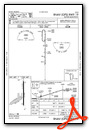
Instrument Approach Procedure (IAP) Charts

Nearby Airports with Instrument Procedures
| ID | Name | Heading / Distance | ||
|---|---|---|---|---|
 |
53A | Dr C P Savage Sr Airport | 142° | 20.0 |
|
KOPN | Thomaston-Upson County Airport | 357° | 23.2 |
|
KPXE | Perry-Houston County Airport | 097° | 24.6 |
|
KACJ | Jimmy Carter Regional Airport | 173° | 27.5 |
|
KMCN | Middle Georgia Regional Airport | 075° | 31.2 |
|
KWRB | Robins AFB Airport | 082° | 33.5 |
|
KCSG | Columbus Airport | 265° | 35.2 |
|
KPIM | Harris County Airport | 297° | 36.1 |
|
KMAC | Macon Downtown Airport | 066° | 37.8 |
|
6A2 | Griffin-Spalding County Airport | 357° | 39.5 |
|
KLSF | Lawson AAF (Fort Benning) Airport | 249° | 40.2 |
|
KCKF | Crisp County-Cordele Airport | 145° | 42.2 |
Airport Images
Do you have a recent image of this airport? Upload it here!


Comments
Glider Ops @ Southern Eagle Soaring
Wally Berry (berrywd@auburn.edu) 334-740-1994
Tim McGowin (TJJMcGowin@aol.com) 334-703-3984
Basil Dale V. HAMILTON
Correction to glider Ops Info
My Correction. They are actually located on (5A9) which is Rooselvelt Meml.
Basil Dale V. HAMILTON
Operations for SES are at
Operations for SES are at Butler in 2022. There is a paved and a grass runway so there is plenty of space for everyone.