Login
Register


79D
Philippi/Barbour County Regional Airport
Official FAA Data Effective 2026-02-19 0901Z
Chart Supplement

VFR Chart of 79D
Sectional Charts at SkyVector.com
IFR Chart of 79D
Enroute Charts at SkyVector.com
Location Information for 79D
Coordinates: N39°9.97' / W80°3.74'Located 02 miles NW of Philippi, West Virginia on 78 acres of land. View all Airports in West Virginia.
Estimated Elevation is 1755 feet MSL.
Operations Data
|
|
Airport Communications
| CLARKSBURG APPROACH: | 121.15 284.65 |
|---|---|
| CLARKSBURG DEPARTURE: | 121.15 284.65 |
| CTAF: | 122.900 |
| ATIS at CKB (11.0 NW): | 127.825 |
| ASOS at CKB (11.0 NW): | 304-842-9240 |
| AWOS-3 at W22 (14.0 SW): | 119.975 304-472-9428 |
- APCH/DEP SVC PRVDD BY WASHINGTON ARTCC ON FREQS 128.6/226.675 (ELKINS RCAG) WHEN CLARKSBURG APCH CTL CLSD.
Nearby Navigation Aids
|
| ||||||||||||||||||||||||||||||||||||||||||||||||||||||||||||


Runway 08/26
| Dimensions: | 3275 x 60 feet / 998 x 18 meters | |
|---|---|---|
| Surface: | Asphalt in Good Condition | |
| Edge Lighting: | Medium Intensity | |
| Runway 08 | Runway 26 | |
| Coordinates: | N39°9.90' / W80°4.07' | N39°10.05' / W80°3.41' |
| Elevation: | 1713.1 | 1755.4 |
| Traffic Pattern: | Left | Left |
| Runway Heading: | 74° True | 254° True |
| Displaced Threshold: | 140 Feet | 225 Feet |
| Markings: | Basic in fair condition. | Basic in fair condition. |
| Glide Slope Indicator | P2L (3.00° Glide Path Angle) | P2L (3.00° Glide Path Angle) |
| REIL: | Yes OMNIDIRECTIONAL REILS. | OMNIDIRECTIONAL REILS. |
| Obstacles: | 20 ft Tree 208 ft from runway, 70 ft left of center APCH RATIO 0:1 AT DSPLCD THR OVR 30 FT TREES, 0 FT DSTC, 45 FT L. 20 FT TREES, 0-120 FT DSTC, 45 FT L. |
156 ft Ground 3200 ft from runway, 550 ft right of center 186 FT RIDGE APRXLY 3200 FT FM THR; 550 FT R. APCH RATIO 0:1 AT DSPLCD THR OVR 30 FT TREES, 0 FT DSTC 199 FT R, 245 FT L. 20 FT TREES 0-30 FT DSTC 50 FT R/L. |
Services Available
| Fuel: | 100LL (blue) |
|---|---|
| Transient Storage: | Tiedowns |
| Airframe Repair: | NONE |
| Engine Repair: | NONE |
| Bottled Oxygen: | NONE |
| Bulk Oxygen: | NONE |
Ownership Information
| Ownership: | Publicly owned | |
|---|---|---|
| Owner: | PHILIPPI/BARBOUR CO. ARPT AUTHORITY | |
| 26 N. MAIN ST. | ||
| PHILIPPI, WV 26416 | ||
| 304-457-4339 | EXT 2 | |
| Manager: | VERLE BROWN | |
| 26 N. MAIN ST | ||
| PHILIPPI, WV 26416 | ||
| 304-695-0125 | ||
Other Remarks
- RWY 26 500 FT DROP-OFF 50 FT FM THR.
- RWY 08 150 FT DROP-OFF 112 FT FM THR.
- WILDLIFE INVOF ARPT.
- AIRPORT FENCED. VEHICLE GATE LOCKED. ONLY ACCESS VIA PEDESTRIAN GATE.
- FOR CD CTC WASHINGTON ARTCC AT 703-771-3587.
- 0LL 24 HR. SELF SERVE.
- DUSK-DAWN. ACTIVATE REIL RWY 08; PAPI RWYS 08 & 26; MIRL RWY 08/26 - CTAF.
Weather Minimums
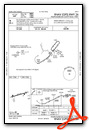
Instrument Approach Procedure (IAP) Charts
Nearby Airports with Instrument Procedures
| ID | Name | Heading / Distance | ||
|---|---|---|---|---|
 |
KCKB | North Central West Virginia Airport | 315° | 11.0 |
|
W22 | Upshur County Regional Airport | 225° | 14.0 |
|
4G7 | Fairmont Municipal-Frankman Field Airport | 343° | 17.6 |
|
KEKN | Elkins/Randolph County (Jennings Randolph Field) Airport | 149° | 19.2 |
|
KMGW | Morgantown Municipal/Walter L Bill Hart Field Airport | 013° | 29.4 |
|
48I | Braxton County Airport | 224° | 39.8 |
|
2G4 | Garrett County Airport | 053° | 42.0 |
|
W99 | Grant County Airport | 103° | 44.0 |
|
KWAY | Greene County Airport | 355° | 44.2 |
|
KVVS | Joseph A Hardy Connellsville Airport | 021° | 51.1 |
|
KMPG | Marshall County Airport | 324° | 53.0 |
|
KAFJ | Washington County Airport | 349° | 59.1 |
Airport Images
Do you have a recent image of this airport? Upload it here!


