Login
Register


48I
Braxton County Airport
Official FAA Data Effective 2025-12-25 0901Z
Chart Supplement

VFR Chart of 48I
Sectional Charts at SkyVector.com
IFR Chart of 48I
Enroute Charts at SkyVector.com
Location Information for 48I
Coordinates: N38°41.23' / W80°39.12'Located 03 miles E of Sutton, West Virginia on 76 acres of land. View all Airports in West Virginia.
Estimated Elevation is 1275 feet MSL.
Operations Data
|
|
Airport Communications
| AWOS-3PT: | 118.225 Tel. 304-765-7805 |
|---|---|
| CLARKSBURG APPROACH: | 121.15 284.65 |
| CLARKSBURG DEPARTURE: | 121.15 284.65 |
| CTAF: | 122.900 |
| AWOS-3 at W22 (25.8 NE): | 119.975 304-472-9428 |
| AWOS-3 at USW (33.5 W): | 118.575 304-927-0123 |
| ASOS at EKN (39.1 E): | 119.275 304-636-5603 |
- APCH/DEP SVC PRVDD BY INDIANAPOLIS ARTCC ON FREQS 125.55/317.475 (PARKERSBURG RCAG) WHEN CLARKSBURG APCH CTL CLSD.
Nearby Navigation Aids
|
| ||||||||||||||||||||||||||||||||||||||||||||||||||||||||||||


Runway 02/20
| Dimensions: | 3995 x 60 feet / 1218 x 18 meters | |
|---|---|---|
| Surface: | Asphalt / Aggregate Friction Seal Coated in Good Condition | |
| Weight Limits: | S-12 | |
| Edge Lighting: | Medium Intensity | |
| Runway 02 | Runway 20 | |
| Coordinates: | N38°40.90' / W80°39.18' | N38°41.55' / W80°39.07' |
| Elevation: | 1252.5 | 1275.6 |
| Traffic Pattern: | Left | Left |
| Runway Heading: | 8° True | 188° True |
| Displaced Threshold: | 801 Feet | |
| Declared Distances: | TORA:3995 TODA:3995 ASDA:3995 LDA:3194 | TORA:3995 TODA:3995 ASDA:3815 LDA:3815 |
| Markings: | Basic in good condition. | Non-Precision Instrument in good condition. |
| Glide Slope Indicator | P2L (4.00° Glide Path Angle) UNUSBL BYD 6 DEG LEFT AND BYD 6 DEG RIGHT OF CNTRLN. | |
| REIL: | Yes | Yes |
| Obstacles: | 85 ft Trees 201 ft from runway, 220 ft right of center APCH RATIO 0:1 TO DSPLCD THR, 80 FT TREES, 0 FT DSTC, 210 FT L. APCH RATIO 25:1 BASED ON STRAIGHT OUT OVR 53 FT TREES, 1340 FT DSTC, 0 FT B. 26 FT TREES, 0-199, 216 FT L. |
113 ft Trees 844 ft from runway, 370 ft right of center 17 FT HILL, 0-199 FT DSTC, 247 FT R. |
Services Available
| Fuel: | 100LL (blue), Jet-A |
|---|---|
| Transient Storage: | Hangars,Tiedowns |
| Airframe Repair: | NONE |
| Engine Repair: | NONE |
| Bottled Oxygen: | NONE |
| Bulk Oxygen: | NONE |
Ownership Information
| Ownership: | Publicly owned | |
|---|---|---|
| Owner: | CO CMSN OF BRAXTON | |
| BOX 486 | ||
| SUTTON, WV 26601 | ||
| 304-765-2835 | ||
| Manager: | PATRICK O'MALLEY | |
| 106 BIRCH ST | ||
| GASAWAY, WV 26624-1102 | ||
| (304) 542-3311 | ||
Other Remarks
- 6 FT DITCH CROSSES AER 02 0-116 FT FROM THR.
- GATE ACCESS 1-2-3-4-#.
- FOR CD CTC CLARKSBURG APCH AT 304-842-2011. WHEN APP CLSD, CTC INDIANAPOLIS ARTCC AT 317-247-2411.
- DEER ON AND INVOF ARPT.
- ACTVT REIL RWY 02 & 20; PAPI RWY 20; MIRL RWY 02/20 - CTAF.
- ACTVT BEACON - CTAF.
Weather Minimums
Instrument Approach Procedure (IAP) Charts
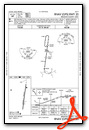
Nearby Airports with Instrument Procedures
| ID | Name | Heading / Distance | ||
|---|---|---|---|---|
 |
W22 | Upshur County Regional Airport | 043° | 25.8 |
|
KSXL | Summersville Airport | 200° | 29.2 |
|
KUSW | Boggs Field Airport | 284° | 33.7 |
|
KEKN | Elkins/Randolph County (Jennings Randolph Field) Airport | 071° | 39.2 |
|
79D | Philippi/Barbour County Regional Airport | 043° | 39.8 |
|
KCKB | North Central West Virginia Airport | 028° | 41.6 |
|
KCRW | West Virginia International Yeager Airport | 247° | 48.1 |
|
4G7 | Fairmont Municipal-Frankman Field Airport | 026° | 50.9 |
|
KLWB | Greenbrier Valley Airport | 166° | 51.1 |
|
KPKB | Mid-Ohio Valley Regional Airport | 317° | 53.9 |
|
I18 | Jackson County Airport | 285° | 56.6 |
|
KBKW | Raleigh County Memorial Airport | 202° | 58.4 |
Airport Images
Do you have a recent image of this airport? Upload it here!


