Login
Register


79VG
Perkey Airport
Official FAA Data Effective 2026-01-22 0901Z
VFR Chart of 79VG
Sectional Charts at SkyVector.com
IFR Chart of 79VG
Enroute Charts at SkyVector.com
Location Information for 79VG
Coordinates: N37°39.92' / W79°48.75'Located 25 miles SW of Eagle Rock, Virginia. View all Airports in Virginia.
Estimated Elevation is 1200 feet MSL.
Operations Data
|
|
Airport Communications
| AWOS-3 at HSP (17.3 N): | 118.8 540-839-5974 |
|---|---|
| ATIS at ROA (21.8 S): | 132.375 |
| ASOS at ROA (22.3 S): | 540-216-0158 |
Nearby Navigation Aids
|
| ||||||||||||||||||||||||||||||||||||||||||||||||||||||||||||


Runway 07/25
| Dimensions: | 2250 x 32 feet / 686 x 10 meters | |
|---|---|---|
| Surface: | Asphalt | |
| Runway 07 | Runway 25 | |
| Traffic Pattern: | Right | |
Ownership Information
| Ownership: | Privately Owned | |
|---|---|---|
| Owner: | GILBERT J. PERKEY | |
| 779 MISTY HOLLOW RD | ||
| EAGLE ROCK, VA 24085 | ||
| 540-354-3332 | ||
| Manager: | GILBERT J. PERKEY | |
| 779 MISTY HOLLOW RD | ||
| EAGLE ROCK, VA 24085 | ||
| 540-354-3332 | ||
Other Remarks
- FOR CD CTC WASHINGTON ARTCC AT 703-771-3587.
Nearby Airports with Instrument Procedures
| ID | Name | Heading / Distance | ||
|---|---|---|---|---|
 |
KHSP | Ingalls Field Airport | 356° | 17.2 |
|
KROA | Roanoke/Blacksburg Regional (Woodrum Field) Airport | 200° | 21.8 |
|
KLWB | Greenbrier Valley Airport | 292° | 30.2 |
|
W90 | New London Airport | 135° | 32.8 |
|
W91 | Smith Mountain Lake Airport | 162° | 35.0 |
|
KLYH | Lynchburg Regional/Preston Glenn Field Airport | 124° | 35.6 |
|
W24 | Falwell Airport | 117° | 37.2 |
|
KBCB | Virginia Tech/Montgomery Exec Airport | 226° | 39.6 |
|
W13 | Eagle's Nest Airport | 058° | 48.1 |
|
0V4 | Brookneal/Campbell County Airport | 129° | 49.3 |
|
KPSK | New River Valley Airport | 232° | 52.1 |
|
KSHD | Shenandoah Valley Regional Airport | 050° | 56.4 |
Airport Images
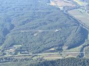
By: Big Orange Bird


