Login
Register


2A2
Holley Mountain Airpark Airport
Official FAA Data Effective 2026-02-19 0901Z
Chart Supplement

VFR Chart of 2A2
Sectional Charts at SkyVector.com
IFR Chart of 2A2
Enroute Charts at SkyVector.com
Location Information for 2A2
Coordinates: N35°39.04' / W92°24.23'Located 05 miles NE of Clinton, Arkansas on 506 acres of land. View all Airports in Arkansas.
Estimated Elevation is 1270 feet MSL.
Operations Data
|
|
Airport Communications
| CTAF: | 122.700 |
|---|---|
| UNICOM: | 122.700 |
| AWOS-3 at CCA (3.9 SW): | 118.725 501-745-5000 |
| AWOS-3PT at BVX (37.2 E): | 126.375 870-251-1369 |
| AWOS-3PT at 42A (37.7 NE): | 121.575 870-916-2768 |
- APCH/DEP SVC PRVDD BY MEMPHIS ARTCC ON FREQS 126.85/281.55 (HARRISON RCAG).
Nearby Navigation Aids
|
| ||||||||||||||||||||||||||||||||||||||||||||||||||||||||||||


Runway 05/23
| Dimensions: | 4795 x 50 feet / 1462 x 15 meters | |
|---|---|---|
| Surface: | Asphalt in Good Condition | |
| Edge Lighting: | Medium Intensity | |
| Runway 05 | Runway 23 | |
| Coordinates: | N35°38.83' / W92°24.63' | N35°39.26' / W92°23.82' |
| Elevation: | 1270.0 | 1270.0 |
| Traffic Pattern: | Right | |
| Runway Heading: | 57° True | 237° True |
| Displaced Threshold: | 398 Feet | |
| Markings: | Non-Precision Instrument in good condition. | Non-Precision Instrument in good condition. |
| Glide Slope Indicator | V2L (3.50° Glide Path Angle) VASI UNUSABLE BYD 2 DEGS LEFT & 7 DEGS RIGHT OF CENTERLINE. | P2L (3.00° Glide Path Angle) |
| REIL: | Yes | Yes |
| Obstacles: | 50 ft Trees 500 ft from runway, 35 ft right of center APCH SLOPE 18:1 TO DTHR. |
5 ft Trees 360 ft from runway, 120 ft right of center |
Ownership Information
| Ownership: | Privately Owned | |
|---|---|---|
| Owner: | HOLLEY MOUNTAIN P.O.A. | |
| 302 NORTHRIDGE RD. | ||
| CLINTON, AR 72031 | ||
| (501) 253-4590 | ||
| Manager: | MIKE FOOTE | |
| 302 NORTHRIDGE RD. | ||
| CLINTON, AR 72031 | ||
| 501-253-4590 | ||
Other Remarks
- DEER ON & INVOF RY.
- BEGINNING 10 FT BYD EAST END OF RWY 23 PAVEMENT, GND HAS APRX 10FT DROP OVER 40 FT LEN.
- BEGINNING 50 FT BYD WEST END OF RWY 5 PAVEMENT, GND HAS APRX 25 FT DROP OVER 125 FT LEN.
- RY 05/23 CLSD TO ACFT GROSS WT GREATER THAN 12,500 LBS.
- FOR CD CTC MEMPHIS ARTCC AT 901-368-8453/8449.
- WX INFO - CTAF (6 CLICKS).
- ACTVT REIL RWYS 05 & 23; VASI RWY 05; MIRL RWY 05/23 - CTAF.
Weather Minimums

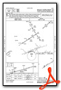
Instrument Approach Procedure (IAP) Charts

Nearby Airports with Instrument Procedures
| ID | Name | Heading / Distance | ||
|---|---|---|---|---|
 |
KCCA | Clinton Municipal Airport | 216° | 3.9 |
|
4A5 | Searcy County Airport | 320° | 19.3 |
|
7M2 | Mountain View Wilcox Memorial Field Airport | 049° | 20.0 |
|
KHBZ | Heber Springs Municipal Airport | 113° | 20.9 |
|
KBDQ | Morrilton Municipal Airport | 206° | 34.4 |
|
KBVX | Batesville Regional Airport | 082° | 37.2 |
|
42A | Melbourne Municipal/John E Miller Field Airport | 047° | 37.6 |
|
KCXW | Conway Regional Airport | 191° | 38.5 |
|
KMPJ | Petit Jean Park Airport | 219° | 39.4 |
|
KFLP | Marion County Regional Airport | 346° | 39.4 |
|
KRUE | Russellville Regional Airport | 235° | 41.1 |
|
KSRC | Searcy Regional Airport | 128° | 42.0 |
Airport Images
Do you have a recent image of this airport? Upload it here!


