Login
Register
8N1
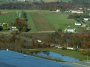
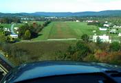
Grimes Airport
Official FAA Data Effective 2026-01-22 0901Z
VFR Chart of 8N1
Sectional Charts at SkyVector.com
IFR Chart of 8N1
Enroute Charts at SkyVector.com
Location Information for 8N1
Coordinates: N40°29.09' / W76°15.81'Located 02 miles E of Bethel, Pennsylvania on 50 acres of land. View all Airports in Pennsylvania.
Estimated Elevation is 582 feet MSL.
Operations Data
|
|
Airport Communications
| CTAF: | 122.800 |
|---|---|
| UNICOM: | 122.800 |
| AWOS-2 at 9D4 (8.5 S): | 118.45 717-866-2906 |
| ASOS at MUI (14.0 W): | 124.175 717-861-6493 |
| AWOS-3 at ZER (14.2 N): | 127.575 570-544-2778 |
Nearby Navigation Aids
|
| ||||||||||||||||||||||||||||||||||||||||||||||||||||||||||||
Runway 11/29
| Dimensions: | 2720 x 100 feet / 829 x 30 meters | |
|---|---|---|
| Surface: | Turf in Good Condition FIRST 700 FT OF RWY ON W END UNUSBL DURG ERY SPRING DUE TO WET CONDS. | |
| Runway 11 | Runway 29 | |
| Traffic Pattern: | Left | Left |
| Displaced Threshold: | 250 Feet RWYS 11 & 29 DTHR MKD BY RED DISCS. |
270 Feet |
| Obstacles: | 14 ft Road 66 ft from runway, 51 ft right of center APCH SLP 22:1 TO DTHR. |
34 ft Tree 92 ft from runway, 132 ft right of center APCH SLP 11:1 TO DTHR. |
Services Available
| Fuel: | NONE |
|---|---|
| Transient Storage: | Tiedowns |
| Airframe Repair: | NOT AVAILABLE |
| Engine Repair: | NOT AVAILABLE |
| Bottled Oxygen: | NONE |
| Bulk Oxygen: | NONE |
Ownership Information
| Ownership: | Privately Owned | |
|---|---|---|
| Owner: | PAUL D DOUGHERTY JR | |
| 371 AIRPORT RD | ||
| BETHEL, PA 19507 | ||
| 717-933-9566 | ||
| Manager: | PAUL D DOUGHERTY JR | |
| 371 AIRPORT RD | ||
| BETHEL, PA 19507 | ||
| 717-933-9566 | ||
Other Remarks
- FOR CD CTC HARRISBURG APCH AT 800-932-0712.
- AD CLSD SS-SR.
- RWYS 11 & 29 MKD WITH WHITE DISCS.
Nearby Airports with Instrument Procedures
| ID | Name | Heading / Distance | ||
|---|---|---|---|---|
 |
9D4 | Deck Airport | 200° | 8.5 |
 |
08N | Keller Brothers Airport | 194° | 12.0 |
 |
74N | Bendigo Airport | 288° | 14.3 |
 |
KZER | Schuylkill County/Joe Zerbey Airport | 339° | 14.2 |
 |
KRDG | Reading Regional/Carl A Spaatz Field Airport | 114° | 15.1 |
 |
58N | Reigle Field Airport | 230° | 18.6 |
 |
KLNS | Lancaster Airport | 183° | 21.8 |
 |
N79 | Northumberland County Airport | 328° | 24.9 |
 |
N71 | Donegal Springs Airpark Airport | 211° | 27.5 |
 |
KMDT | Harrisburg International Airport | 232° | 28.8 |
 |
22N | Jake Arner Memorial Airport | 049° | 30.1 |
 |
N47 | Pottstown Municipal Airport | 116° | 30.3 |


