Login
Register


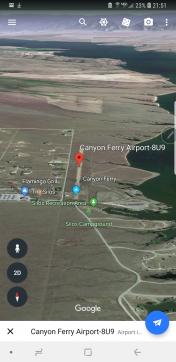
8U9
Canyon Ferry Airport
Official FAA Data Effective 2026-02-19 0901Z
Chart Supplement

VFR Chart of 8U9
Sectional Charts at SkyVector.com
IFR Chart of 8U9
Enroute Charts at SkyVector.com
Location Information for 8U9
Coordinates: N46°25.13' / W111°34.63'Located 07 miles NW of Townsend, Montana on 39 acres of land. View all Airports in Montana.
Estimated Elevation is 3840 feet MSL.
Operations Data
|
|
Airport Communications
| UNICOM: | 122.800 |
|---|---|
| CTAF: | 122.800 |
| ATIS at HLN (20.2 NW): | 120.4 |
| ASOS at HLN (20.3 NW): | 120.4 406-290-3397 |
| AWOS-3PT at 7S6 (27.8 E): | 118.525 406-547-3511 |
Nearby Navigation Aids
|
| ||||||||||||||||||||||||||||||||||||||||||


Runway 16/34
| Dimensions: | 3200 x 75 feet / 975 x 23 meters | |
|---|---|---|
| Surface: | Gravel in Good Condition RWY 16/34 LOOSE ROCK AND GRVL UP TO 3 IN. SOFT WHEN WET. | |
| Runway 16 | Runway 34 | |
| Traffic Pattern: | Left | Left |
| Displaced Threshold: | 597 Feet | |
| Markings: | Non-Standard in good condition. | |
Services Available
| Fuel: | NONE |
|---|---|
| Transient Storage: | Tiedowns |
| Airframe Repair: | NONE |
| Engine Repair: | NONE |
| Bottled Oxygen: | NONE |
| Bulk Oxygen: | NONE |
Ownership Information
| Ownership: | Publicly owned | |
|---|---|---|
| Owner: | BROADWATER COUNTY | |
| 515 BROADWAY | ||
| TOWNSEND, MT 59644 | ||
| (406) 266-9203 | ||
| Manager: | DWIGHT THOMPSON | |
| 515 BROADWAY, #16 | ||
| TOWNSEND, MT 59644 | ||
| 406-220-0736 | ||
Other Remarks
- NO SNOW REMOVAL.
- FOR CD CTC HELENA APCH AT 406-449-5756/5761, WHEN APCH CLSD CTC SALT LAKE ARTCC AT 801-320-2568.
- 16/34 MARKED WITH WHITE CONES SPACED 200 FT APART. RY 34 DSPLCD THR MARKED WITH RED CONES.
Nearby Airports with Instrument Procedures
| ID | Name | Heading / Distance | ||
|---|---|---|---|---|
 |
KHLN | Helena Regional Airport | 303° | 20.3 |
|
7S6 | White Sulphur Springs Airport | 080° | 28.0 |
|
KBZN | Bozeman Yellowstone International Airport | 155° | 42.4 |
|
KBTM | Bert Mooney Airport | 234° | 47.4 |
|
38S | Deer Lodge-City-County Airport | 268° | 49.4 |
|
3U3 | Bowman Field Airport | 253° | 56.0 |
|
KRVF | Ruby Valley Field Airport | 210° | 61.1 |
|
KLVM | Mission Field Airport | 132° | 64.0 |
|
KGTF | Great Falls International Airport | 007° | 64.4 |
|
KEKS | Ennis Big Sky Airport | 182° | 68.7 |
|
KHWQ | Wheatland County At Harlowton Airport | 087° | 71.6 |
|
6S0 | Big Timber At Howard Field Airport | 118° | 76.2 |
Airport Images
By: astopka@gmail.com


