Login
Register


LVM
Mission Field Airport
Official FAA Data Effective 2026-02-19 0901Z
Chart Supplement

VFR Chart of KLVM
Sectional Charts at SkyVector.com
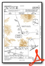
IFR Chart of KLVM
Enroute Charts at SkyVector.com
Location Information for KLVM
Coordinates: N45°41.97' / W110°26.88'Located 05 miles E of Livingston, Montana on 689 acres of land. View all Airports in Montana.
Surveyed Elevation is 4659 feet MSL.
Operations Data
|
|
Airport Communications
| ASOS: | 135.275 Tel. 406-222-2338 |
|---|---|
| BIG SKY APPROACH: | 119.55 235.775 |
| BIG SKY DEPARTURE: | 119.55 235.775 |
| UNICOM: | 123.000 |
| CTAF: | 123.000 |
| AWOS-3 at 6S0 (20.9 E): | 132.050 406-932-6051 |
| ATIS at BZN (29.8 W): | 135.425 |
| ASOS at BZN (29.9 W): | 406-388-4882 |
- COMMUNICATIONS PRVDD BY GREAT FALLS RADIO ON FREQ 122.2 (LIVINGSTON RCO).
- APCH/DEP CTL SVC PRVDD BY SALT LAKE ARTCC (ZLC) ON FREQS 119.550/235.775 (LIVINGSTON A RCAG) WHEN BIG SKY APCH CTL (BOI) IS UNAVAILABLE 0715-1300Z++.
Nearby Navigation Aids
|
| ||||||||||||||||||||||||||||||||||||||||||


Runway 04/22
| Dimensions: | 5701 x 75 feet / 1738 x 23 meters | |
|---|---|---|
| Surface: | Asphalt in Excellent Condition | |
| Weight Limits: | 24 /F/A/Y/U, S-75, D-99 | |
| Edge Lighting: | Medium Intensity | |
| Runway 04 | Runway 22 | |
| Coordinates: | N45°41.60' / W110°27.30' | N45°42.14' / W110°26.21' |
| Elevation: | 4649.6 | 4646.3 |
| Traffic Pattern: | Left | Left |
| Runway Heading: | 54° True | 234° True |
| Markings: | Non-Precision Instrument in good condition. | Non-Precision Instrument in good condition. |
| Glide Slope Indicator | P4L (3.00° Glide Path Angle) PAPI UNUSBL BYD 5 DEGS RIGHT OF CNTRLN. | |
| REIL: | Yes | |
Runway 08/26
| Dimensions: | 3762 x 125 feet / 1147 x 38 meters | |
|---|---|---|
| Surface: | Turf in Good Condition MOWING IREG. | |
| Runway 08 | Runway 26 | |
| Coordinates: | N45°42.09' / W110°27.38' | N45°42.06' / W110°26.50' |
| Elevation: | 4658.6 | 4650.2 |
| Traffic Pattern: | Left | Left |
| Runway Heading: | 93° True | 273° True |
| Markings: | in good condition. | in good condition. |
Runway 13/31
| Dimensions: | 2724 x 120 feet / 830 x 37 meters | |
|---|---|---|
| Surface: | Turf in Good Condition MOWING IREG. | |
| Runway 13 | Runway 31 | |
| Coordinates: | N45°42.20' / W110°27.23' | N45°41.82' / W110°26.88' |
| Elevation: | 4659.4 | 4651.5 |
| Traffic Pattern: | Left | Left |
| Runway Heading: | 147° True | 327° True |
| Markings: | in good condition. | in good condition. |
Services Available
| Fuel: | 100LL (blue), Jet-A |
|---|---|
| Transient Storage: | Hangars,Tiedowns |
| Airframe Repair: | NONE |
| Engine Repair: | NONE |
| Bottled Oxygen: | NONE |
| Bulk Oxygen: | NONE |
| Other Services: | CROP DUSTING SERVICES,AIR AMBULANCE SERVICES |
Ownership Information
| Ownership: | Publicly owned | |
|---|---|---|
| Owner: | LIVINGSTON CITY PARK CO | |
| COUNTY BLDG, 414 E CALLENDER | ||
| LIVINGSTON, MT 59047 | ||
| 406-222-4106 | ||
| Manager: | PAUL LYMAN | |
| COUNTY BLDG, 414 E CALLENDER | ||
| LIVINGSTON, MT 59047 | ||
| 406-451-1944 | ||
Other Remarks
- RWY 31 MTN 1 MILE AT 23:1 RATIO.
- WILDLIFE ON & INVOF ARPT.
- AG OPS APR THROUGH SEP.
- FOR CD IF UNA TO CTC ON FSS FREQ, CTC SALT LAKE ARTCC AT 801-320-2568.
- COLD TEMPERATURE AIRPORT. ALTITUDE CORRECTION REQUIRED AT OR BELOW -28C.
- PAPI RWY 22 OPR CONSLY.
- AIRFIELD SFC COND UNMONITORED 1700-0800.
- RWYS 08 & 26 THLDS & FIRST 200 FT MKD WITH W CONES.
- RWYS 13 & 31 THLDS & FIRST 200 FT MKD WITH W CONES.
- WKENDS AND AFT HRS CALL 406-222-6504.
- ACTIVATE MIRL RWY 04/22 - 123.0.
Weather Minimums


Instrument Approach Procedure (IAP) Charts

Departure Procedure Obstacles (DPO) Charts

Nearby Airports with Instrument Procedures
| ID | Name | Heading / Distance | ||
|---|---|---|---|---|
 |
6S0 | Big Timber At Howard Field Airport | 071° | 20.8 |
|
KBZN | Bozeman Yellowstone International Airport | 279° | 29.9 |
|
KHWQ | Wheatland County At Harlowton Airport | 028° | 51.4 |
|
7S6 | White Sulphur Springs Airport | 338° | 51.6 |
|
KEKS | Ennis Big Sky Airport | 243° | 56.7 |
|
KWYS | Yellowstone Airport | 205° | 67.0 |
|
6S8 | Laurel Municipal Airport | 089° | 70.9 |
|
KRVF | Ruby Valley Field Airport | 263° | 78.7 |
|
KBIL | Billings Logan International Airport | 084° | 80.3 |
|
KHLN | Helena Regional Airport | 310° | 84.1 |
|
KPOY | Powell Municipal Airport | 124° | 86.1 |
|
KBTM | Bert Mooney Airport | 280° | 87.3 |
Airport Images
Do you have a recent image of this airport? Upload it here!


