Login
Register


9M8
Sheridan-Grant County Regional Airport
Official FAA Data Effective 2025-12-25 0901Z
Chart Supplement

VFR Chart of 9M8
Sectional Charts at SkyVector.com
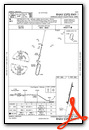
IFR Chart of 9M8
Enroute Charts at SkyVector.com
Location Information for 9M8
Coordinates: N34°19.65' / W92°21.08'Located 03 miles E of Sheridan, Arkansas on 152 acres of land. View all Airports in Arkansas.
Surveyed Elevation is 236 feet MSL.
Operations Data
|
|
Airport Communications
| LITTLE ROCK APPROACH: | 135.4 353.6 |
|---|---|
| LITTLE ROCK DEPARTURE: | 135.4 353.6 |
| CTAF: | 122.800 |
| UNICOM: | 122.800 |
| AWOS-3 at SUZ (16.9 N): | 132.125 501-847-3883 |
| ASOS at PBF (22.6 SE): | 120.775 870-536-0228 |
| ASOS at LIT (24.7 N): | 501-376-0247 |
- APCH/DEP SVC PRVDD BY LITTLE ROCK APCH (LIT) ON 135.4/353.6.
Nearby Navigation Aids
|
| ||||||||||||||||||||||||||||||||||||||||||||||||||||||||||||


Runway 01/19
| Dimensions: | 3202 x 75 feet / 976 x 23 meters | |
|---|---|---|
| Surface: | Asphalt in Good Condition | |
| Weight Limits: | S-12 | |
| Edge Lighting: | Medium Intensity | |
| Runway 01 | Runway 19 | |
| Coordinates: | N34°19.39' / W92°21.15' | N34°19.91' / W92°21.01' |
| Elevation: | 228.5 | 236.0 |
| Runway Heading: | 12° True | 192° True |
| Markings: | Non-Precision Instrument in good condition. | Non-Precision Instrument in good condition. |
| Glide Slope Indicator | P2L (3.75° Glide Path Angle) RWY 01 PAPI UNUSBL BYD 6 DEG LEFT OF CNTRLN. | P2L (3.25° Glide Path Angle) |
| Obstacles: | 60 ft Trees 1500 ft from runway | 30 ft Trees 1350 ft from runway |
Services Available
| Fuel: | 100LL (blue) |
|---|---|
| Transient Storage: | Tiedowns |
| Airframe Repair: | NONE |
| Engine Repair: | NONE |
| Bottled Oxygen: | NOT AVAILABLE |
| Bulk Oxygen: | NOT AVAILABLE |
Ownership Information
| Ownership: | Publicly owned | |
|---|---|---|
| Owner: | SHERIDAN & GRANT COUNTY | |
| 101 W. CENTER STREET, ROOM 112 | ||
| SHERIDAN, AR 72150 | ||
| 870-942-2031 | ||
| Manager: | KEVIN RUTHERFORD | |
| 233 AIRPORT ROAD | ||
| SHERIDAN, AR 72150 | ||
| 870-941-9595 | ||
Other Remarks
- FOR CD CTC LITTLE ROCK APCH 501-379-2908 OR LITTLE ROCK ATCT 501-379-2911.
- 0LL SELF SERVICE FUEL AVBL 24 HRS WITH CREDIT CARD.
- ACTVT PAPI RWYS 01 & 19; MIRL RWY 01/19 - CTAF.
Weather Minimums
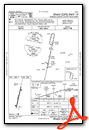
Instrument Approach Procedure (IAP) Charts
Nearby Airports with Instrument Procedures
| ID | Name | Heading / Distance | ||
|---|---|---|---|---|
 |
KSUZ | Saline County Regional Airport | 338° | 17.0 |
|
M78 | Malvern Municipal Airport | 271° | 20.4 |
|
KPBF | Pinebluff Regional/Grider Field Airport | 113° | 22.6 |
|
KLIT | Bill and Hillary Clinton Ntl/Adams Field Airport | 014° | 24.9 |
|
KORK | North Little Rock Municipal Airport | 009° | 30.7 |
|
KLRF | Little Rock AFB Airport | 016° | 36.8 |
|
KHOT | Memorial Field Airport | 283° | 38.1 |
|
KADF | Dexter B Florence Memorial Field Airport | 249° | 38.1 |
|
KSGT | Stuttgart Municipal Carl Humphrey Field Airport | 066° | 41.8 |
|
KCXW | Conway Regional Airport | 346° | 42.7 |
|
4M3 | Carlisle Municipal Airport | 047° | 42.8 |
|
M73 | Almyra Municipal Airport | 083° | 44.3 |
Airport Images
Do you have a recent image of this airport? Upload it here!


