Login
Register


9V6
Martin Municipal Airport
Official FAA Data Effective 2026-01-22 0901Z
Chart Supplement

VFR Chart of 9V6
Sectional Charts at SkyVector.com
IFR Chart of 9V6
Enroute Charts at SkyVector.com
Location Information for 9V6
Coordinates: N43°9.94' / W101°42.76'Located 01 miles SE of Martin, South Dakota on 183 acres of land. View all Airports in South Dakota.
Surveyed Elevation is 3294 feet MSL.
Operations Data
|
|
Airport Communications
| AWOS-2: | 123.0 Tel. 617-262-3825 |
|---|---|
| CTAF: | 122.900 |
| AWOS-3PT at GRN (29.9 SW): | 118.2 308-282-0127 |
| ASOS at IEN (35.9 W): | 126.775 605-867-1584 |
| AWOS-3P at SUO (37.7 E): | 119.075 605-747-2392 |
- APCH/DEP CTL SVC PRVDD BY DENVER ARTCC (ZDV) ON FREQS 127.95/338.2 (CRAWFORD RCAG).
Nearby Navigation Aids
|
| ||||||||||||||||||||||||||||||||||||||||||||||||||||||||||||


Runway 14/32
| Dimensions: | 3699 x 60 feet / 1127 x 18 meters | |
|---|---|---|
| Surface: | Asphalt in Good Condition | |
| Weight Limits: | S-12 | |
| Edge Lighting: | Medium Intensity | |
| Runway 14 | Runway 32 | |
| Coordinates: | N43°10.19' / W101°42.99' | N43°9.69' / W101°42.53' |
| Elevation: | 3294.0 | 3277.4 |
| Traffic Pattern: | Left | Left |
| Runway Heading: | 146° True | 326° True |
| Markings: | Non-Precision Instrument in good condition. | Non-Precision Instrument in good condition. |
| Glide Slope Indicator | P2L (3.00° Glide Path Angle) | P2L (3.00° Glide Path Angle) |
Services Available
| Fuel: | NONE |
|---|---|
| Transient Storage: | Tiedowns |
| Airframe Repair: | NONE |
| Engine Repair: | NONE |
| Bottled Oxygen: | NONE |
| Bulk Oxygen: | NONE |
| Other Services: | CROP DUSTING SERVICES |
Ownership Information
| Ownership: | Publicly owned | |
|---|---|---|
| Owner: | CITY OF MARTIN | |
| PO BOX 687 | ||
| MARTIN, SD 57551 | ||
| 605-685-6036 | ||
| Manager: | PAUL NOEL | |
| MARTIN, SD 57551 | ||
| 605-685-4361 | ||
Other Remarks
- WILDLIFE ON AND INVOF ARPT
- FOR CD CTC DENVER ARTCC AT 303-651-4257.
- ACTVT PAPI RWY 14 & 32, MIRL RWY 14/32 - 122.900.
Weather Minimums

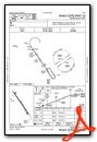
Instrument Approach Procedure (IAP) Charts
Nearby Airports with Instrument Procedures
| ID | Name | Heading / Distance | ||
|---|---|---|---|---|
 |
KGRN | Gordon Municipal Airport | 223° | 29.7 |
|
KIEN | Pine Ridge Airport | 256° | 36.0 |
|
KSUO | Rosebud Sioux Tribal Airport | 081° | 37.8 |
|
9V5 | Modisett Airport | 231° | 41.3 |
|
KPHP | Philip Airport | 005° | 53.2 |
|
KVTN | Miller Field Airport | 109° | 54.5 |
|
KCDR | Chadron Municipal Airport | 252° | 64.0 |
|
KHSR | Hot Springs Municipal Airport | 279° | 74.5 |
|
KRAP | Rapid City Regional Airport | 312° | 78.9 |
|
KAIA | Alliance Municipal Airport | 216° | 82.4 |
|
KICR | Winner Regional Airport | 080° | 83.1 |
|
KANW | Ainsworth Regional Airport | 114° | 83.6 |
Airport Images
Do you have a recent image of this airport? Upload it here!


