Login
Register
AIB
Hopkins Field Airport
Official FAA Data Effective 2025-12-25 0901Z
VFR Chart of KAIB
Sectional Charts at SkyVector.com
IFR Chart of KAIB
Enroute Charts at SkyVector.com
Location Information for KAIB
Coordinates: N38°14.34' / W108°33.77'Located 02 miles SW of Nucla, Colorado on 760 acres of land. View all Airports in Colorado.
Surveyed Elevation is 5945 feet MSL.
Operations Data
|
|
Airport Communications
| AWOS-3: | 132.525 Tel. 970-864-2325 |
|---|---|
| UNICOM: | 122.800 |
| CTAF: | 122.800 |
| AWOS-3 at TEX (35.3 SE): | 118.325 970-728-1534 |
| ASOS at MTJ (35.4 NE): | 135.225 970-249-1534 |
| AWOS-3 at AJZ (40.3 NE): | 134.0 970-874-3251 |
- APCH/DEP CTL SVC PRVDD BY DENVER ARTCC (ZDV) ON FREQS 127.1(MONTROSE RCAG).
Nearby Navigation Aids
|
| ||||||||||||||||||||||||||||||||||||
Runway 05/23
| Dimensions: | 5212 x 75 feet / 1589 x 23 meters | |
|---|---|---|
| Surface: | Asphalt in Excellent Condition | |
| Weight Limits: | S-9 | |
| Edge Lighting: | Medium Intensity | |
| Runway 05 | Runway 23 | |
| Coordinates: | N38°14.13' / W108°34.24' | N38°14.58' / W108°33.31' |
| Elevation: | 5898.1 | 5945.1 |
| Traffic Pattern: | Left | Left |
| Runway Heading: | 59° True | 239° True |
| Markings: | Non-Precision Instrument in fair condition. | Non-Precision Instrument in good condition. |
| Glide Slope Indicator | P2L (3.00° Glide Path Angle) PAPI UNUSBL BYD 5.0 NM. | P2L (3.00° Glide Path Angle) |
| REIL: | Yes | Yes |
| Obstacles: | 18 ft Road 570 ft from runway | |
Runway 11/29
| Dimensions: | 4000 x 80 feet / 1219 x 24 meters | |
|---|---|---|
| Surface: | Turf-Dirt in Poor Condition MULT LRG RODENT HOLES. | |
| Runway 11 | Runway 29 | |
| Coordinates: | N38°14.50' / W108°34.11' | N38°14.14' / W108°33.41' |
| Elevation: | 5899.4 | 5930.0 |
| Traffic Pattern: | Left | Left |
| Runway Heading: | 124° True | 304° True |
| Markings: | Non-Standard in good condition. | Non-Standard in good condition. |
| Obstacles: | 6 ft Road 100 ft from runway | 3 ft Fence 56 ft from runway |
Services Available
| Fuel: | 100LL (blue), Jet-A |
|---|---|
| Transient Storage: | Tiedowns |
| Airframe Repair: | NOT AVAILABLE |
| Engine Repair: | NOT AVAILABLE |
| Bottled Oxygen: | NONE |
| Bulk Oxygen: | NONE |
Ownership Information
| Ownership: | Publicly owned | |
|---|---|---|
| Owner: | COUNTY OF MONTROSE | |
| BOX 997 | ||
| MONTROSE, CO 81401 | ||
| 970-249-3203 | ||
| Manager: | LLOYD ARNOLD | |
| BOX 58 | ||
| NUCLA, CO 81424 | ||
| 970-864-7111 | ||
Other Remarks
- 40 FT PLINES IN HANGAR AREA.
- MIGTATORY BIRDS, WILDLIFE & DEER ON OR INVOF ARPT.
- FOR CD CTC DENVER ARTCC AT 303-651-4257.
- 0LL FUEL SELF-SERVICE AVBL 24 HRS.
- REIL RWY 05 & 23; MIRL RWY 5/23 - DUSK-DAWN, INCR INTST - CTAF. PAPI RWY 05 & 23 ON CONSLY.
Weather Minimums
Instrument Approach Procedure (IAP) Charts
Departure Procedure Obstacles (DPO) Charts
Nearby Airports with Instrument Procedures
| ID | Name | Heading / Distance | ||
|---|---|---|---|---|
 |
KTEX | Telluride Regional Airport | 118° | 35.4 |
 |
KMTJ | Montrose Regional Airport | 062° | 35.5 |
 |
KAJZ | Blake Field Airport | 035° | 40.4 |
 |
U64 | Monticello Airport | 243° | 41.2 |
 |
KGJT | Grand Junction Regional Airport | 001° | 52.9 |
 |
KCEZ | Cortez Municipal Airport | 183° | 56.2 |
 |
KBDG | Blanding Municipal Airport | 228° | 58.8 |
 |
KCNY | Canyonlands Regional Airport | 299° | 64.1 |
 |
KDRO | Durango-La Plata County Airport | 149° | 75.7 |
 |
KGUC | Gunnison-Crested Butte Regional Airport | 076° | 79.0 |
 |
KRIL | Rifle Garfield County Airport | 026° | 86.5 |
 |
U34 | Green River Municipal Airport | 299° | 89.5 |


Comments
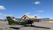
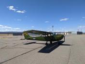
Nice Remote Airport
Good runway. Very nice terminal/lounge with bathrooms. Courtesy car available. The towns of Nucla and Naturita are close by complete with small town amenities. Beautiful area. The airport was not manned during my visit and does not appear to have any services other than self serve fuel.