Login
Register


C65
Plymouth Municipal Airport
Official FAA Data Effective 2025-12-25 0901Z
Chart Supplement

VFR Chart of C65
Sectional Charts at SkyVector.com
IFR Chart of C65
Enroute Charts at SkyVector.com
Location Information for C65
Coordinates: N41°21.91' / W86°18.02'Located 02 miles N of Plymouth, Indiana on 225 acres of land. View all Airports in Indiana.
Surveyed Elevation is 799 feet MSL.
Operations Data
|
|
Airport Communications
| AWOS-3: | 133.025 Tel. 574-935-3854 |
|---|---|
| SOUTH BEND APPROACH: | 132.05 257.8 |
| SOUTH BEND DEPARTURE: | 132.05 257.8 |
| UNICOM: | 122.975 |
| CTAF: | 122.975 |
| AWOS-3 at OXI (16.6 W): | 135.775 574-772-2041 |
| AWOS-3 at RCR (18.8 S): | 118.775 574-223-3560 |
| ASOS at SBN (20.6 N): | 120.675 574-200-0869 |
- APCH/DEP SVC PRVDD BY CHICAGO ARTCC ON FREQS 135.9/314.0 (GOSHEN RCAG) WHEN SOUTH BEND APCH CTL CLSD.
Nearby Navigation Aids
|
| ||||||||||||||||||||||||||||||||||||||||||||||||||||||||||||


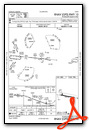
Runway 10/28
| Dimensions: | 4400 x 75 feet / 1341 x 23 meters | |
|---|---|---|
| Surface: | Asphalt in Good Condition | |
| Weight Limits: | S-25, D-40 | |
| Edge Lighting: | Medium Intensity | |
| Runway 10 | Runway 28 | |
| Coordinates: | N41°21.94' / W86°18.49' | N41°21.87' / W86°17.54' |
| Elevation: | 795.9 | 799.9 |
| Traffic Pattern: | Left | Left |
| Runway Heading: | 96° True | 276° True |
| Displaced Threshold: | 297 Feet | |
| Markings: | Non-Precision Instrument in good condition. | Non-Precision Instrument in good condition. |
| Glide Slope Indicator | P2L (3.00° Glide Path Angle) | V4L (3.30° Glide Path Angle) |
| REIL: | Yes | Yes |
| Obstacles: | 85 ft Tree 2000 ft from runway | 15 ft Road 490 ft from runway APCH RATIO 34:1 AT DSPLCD THR. |
Services Available
| Fuel: | 100LL (blue), Jet-A |
|---|---|
| Transient Storage: | Hangars,Tiedowns |
| Airframe Repair: | MAJOR |
| Engine Repair: | MAJOR |
| Bottled Oxygen: | NOT AVAILABLE |
| Bulk Oxygen: | NOT AVAILABLE |
| Other Services: | AVIONICS,PILOT INSTRUCTION,AIRCRAFT RENTAL |
Ownership Information
| Ownership: | Publicly owned | |
|---|---|---|
| Owner: | PLYMOUTH BOAC | PHIL BOCKMAN |
| 301 AIRPORT DRIVE | ||
| PLYMOUTH, IN 46563 | ||
| 574-935-5152 | ||
| Manager: | BILL SHELEY | |
| 301 AIRPORT DRIVE | ||
| PLYMOUTH, IN 46563 | ||
| (574) 320-5059 | ||
Other Remarks
- FLT TRNG & BIRDS ON & INVOF ARPT.
- WINTER SNOW REMOVAL OPS; OPR MONITOR CTAF.
- FOR CD CTC SOUTH BEND APCH AT 574-251-2609. WHEN SOUTH BEND APCH CLSD, FOR CD CTC CHICAGO ARTCC AT 630-906-8921.
- 0LL SELF SERVE AVBL H24.
- ACTVT REIL RWY 10 & 28; PAPI RWY 10; VASI RWY 28; MIRL RWY 10/28 - CTAF.
Weather Minimums
Instrument Approach Procedure (IAP) Charts

Nearby Airports with Instrument Procedures
| ID | Name | Heading / Distance | ||
|---|---|---|---|---|
 |
KOXI | Starke County Airport | 262° | 16.6 |
|
C03 | Nappanee Municipal Airport | 073° | 17.1 |
|
KRCR | Fulton County Airport | 163° | 18.7 |
|
KSBN | South Bend International Airport | 357° | 20.6 |
|
KASW | Warsaw Municipal Airport | 104° | 21.5 |
|
KRWN | Arens Field Airport | 220° | 21.6 |
|
KPPO | La Porte Municipal Airport | 302° | 23.2 |
|
KGSH | Goshen Municipal Airport | 066° | 24.8 |
|
KEKM | Elkhart Municipal Airport | 032° | 25.1 |
|
3TR | Jerry Tyler Memorial Airport | 006° | 28.4 |
|
KMGC | Michigan City Municipal-Phillips Field Airport | 310° | 31.0 |
|
KVPZ | Porter County Regional Airport | 279° | 32.4 |
Airport Images
Do you have a recent image of this airport? Upload it here!


