Login
Register


OXI
Starke County Airport
Official FAA Data Effective 2026-02-19 0901Z
Chart Supplement

VFR Chart of KOXI
Sectional Charts at SkyVector.com
IFR Chart of KOXI
Enroute Charts at SkyVector.com
Location Information for KOXI
Coordinates: N41°19.78' / W86°39.88'Located 03 miles NW of Knox, Indiana on 471 acres of land. View all Airports in Indiana.
Surveyed Elevation is 685 feet MSL.
Operations Data
|
|
Airport Communications
| AWOS-3: | 135.775 Tel. 574-772-2041 |
|---|---|
| SOUTH BEND APPROACH: | 132.05 257.8 |
| SOUTH BEND DEPARTURE: | 132.05 257.8 |
| CTAF: | 122.800 |
| UNICOM: | 122.800 |
| AWOS-3PT at PPO (14.8 N): | 119.825 219-326-6916 |
| AWOS-3 at C65 (16.6 E): | 133.025 574-935-3854 |
| ASOS at VPZ (17.1 NW): | 125.875 219-531-1770 |
- APCH/DEP SVC PRVDD BY CHICAGO ARTCC ON FREQS 135.9/314.0 (GOSHEN RCAG) WHEN SOUTH BEND APCH CTL CLSD.
Nearby Navigation Aids
|
| ||||||||||||||||||||||||||||||||||||||||||||||||||||||||||||


Runway 18/36
| Dimensions: | 5002 x 75 feet / 1525 x 23 meters | |
|---|---|---|
| Surface: | Asphalt in Good Condition | |
| Weight Limits: | S-30 | |
| Edge Lighting: | Medium Intensity | |
| Runway 18 | Runway 36 | |
| Coordinates: | N41°20.19' / W86°39.73' | N41°19.36' / W86°39.73' |
| Elevation: | 683.2 | 685.3 |
| Traffic Pattern: | Right | Left |
| Runway Heading: | 180° True | 360° True |
| Markings: | Non-Precision Instrument in good condition. | Non-Precision Instrument in good condition. |
| Glide Slope Indicator | P2L (3.00° Glide Path Angle) | P2L (3.00° Glide Path Angle) |
| REIL: | Yes | Yes |
| Obstacles: | 10 ft Crops ft from runway, 170 ft right of center 10 FT CROPS 170 FT R OF RWY END |
10 ft Crops ft from runway, 160 ft left of center 10 FT CROPS 160 FT L OF RWY END |
Runway 09/27
BOUNDARY MKD BY YELLOW CONES. | ||
| Dimensions: | 3096 x 145 feet / 944 x 44 meters | |
|---|---|---|
| Surface: | Turf in Good Condition | |
| Runway 09 | Runway 27 | |
| Coordinates: | N41°19.80' / W86°40.44' | N41°19.79' / W86°39.77' |
| Elevation: | 679.7 | 681.3 |
| Runway Heading: | 90° True | 270° True |
| Displaced Threshold: | 285 Feet | |
| Obstacles: | 10 ft Crops ft from runway APCH SLOPE 20:1 FM DSPLCD THR; 65 FT TREES 270 FT FM RWY END 100 FT L. |
28 ft Building ft from runway, 190 ft left of center |
Services Available
| Fuel: | 100LL (blue), Jet A+ |
|---|---|
| Transient Storage: | Hangars,Tiedowns |
| Airframe Repair: | NOT AVAILABLE |
| Engine Repair: | NOT AVAILABLE |
| Bottled Oxygen: | NOT AVAILABLE |
| Bulk Oxygen: | NOT AVAILABLE |
| Other Services: | CROP DUSTING SERVICES |
Ownership Information
| Ownership: | Publicly owned | |
|---|---|---|
| Owner: | STARKE COUNTY ARPT AUTH | |
| 1795 N. 200 E. | ||
| KNOX, IN 46534 | ||
| 574-772-5001 | ||
| Manager: | PAM BEHARRY | |
| 1795 N 200 E | ||
| KNOX, IN 46534 | ||
| 574-772-5001 | ||
Other Remarks
- FOR CD CTC SOUTH BEND APCH AT 574-251-2609. WHEN SOUTH BEND APCH CLSD, FOR CD CTC CHICAGO ARTCC AT 630-906-8921.
- SELF SERVICE FUEL AVBL.
- DSPLCD THR MKD BY YELLOW CONES.
- ACTVT REIL RWY 18 & 36 - CTAF; PAPI RWY 18 & 36 ON CONSLY.
Weather Minimums

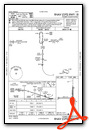
Instrument Approach Procedure (IAP) Charts
Nearby Airports with Instrument Procedures
| ID | Name | Heading / Distance | ||
|---|---|---|---|---|
 |
KRWN | Arens Field Airport | 170° | 14.4 |
|
KPPO | La Porte Municipal Airport | 347° | 14.9 |
|
C65 | Plymouth Municipal Airport | 082° | 16.6 |
|
KVPZ | Porter County Regional Airport | 295° | 17.2 |
|
KMGC | Michigan City Municipal-Phillips Field Airport | 342° | 23.5 |
|
KRCR | Fulton County Airport | 125° | 27.0 |
|
KSBN | South Bend International Airport | 034° | 27.6 |
|
3HO | Hobart Sky Ranch Airport | 296° | 30.3 |
|
KRZL | Jasper County Airport | 225° | 32.8 |
|
C03 | Nappanee Municipal Airport | 077° | 33.6 |
|
05C | Griffith-Merrillville Airport | 289° | 35.1 |
|
3TR | Jerry Tyler Memorial Airport | 032° | 36.2 |
Airport Images
Do you have a recent image of this airport? Upload it here!


Comments
Nice midwest airport
Great fuel stop! Friendly staff. Clean and well maintained terminal. You won't go wrong and will be well taken care of.