Login
Register


CA35
San Rafael Airport
Official FAA Data Effective 2026-02-19 0901Z
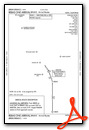
VFR Chart of CA35
Sectional Charts at SkyVector.com
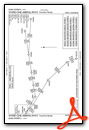
IFR Chart of CA35
Enroute Charts at SkyVector.com
Location Information for CA35
Coordinates: N38°1.01' / W122°31.25'Located 03 miles N of San Rafael, California on 100 acres of land. View all Airports in California.
Estimated Elevation is 5 feet MSL.
Operations Data
|
|
Airport Communications
| UNICOM: | 122.700 |
|---|---|
| AWOS-3P at DVO (7.7 N): | 120.675 415-897-2236 |
| AWOS-3P at O69 (15.2 N): | 132.325 707-773-1529 |
| ASOS at APC (16.1 NE): | 707-252-7916 |
Nearby Navigation Aids
|
| ||||||||||||||||||||||||||||||||||||


Runway 04/22
| Dimensions: | 2700 x 30 feet / 823 x 9 meters | |
|---|---|---|
| Surface: | Asphalt in Fair Condition | |
| Weight Limits: | S-7 | |
| Edge Lighting: | Low Intensity FAA APPROVED STD FIXTURES & THR LGTS; EACH SIDE THR. | |
| Runway 04 | Runway 22 | |
| Traffic Pattern: | Left | Right |
| Markings: | Non-Standard in fair condition. | |
| Obstacles: | 300 ft Hill 4500 ft from runway | 40 ft Pole 1150 ft from runway |
Services Available
| Fuel: | 100LL (blue), Jet-A |
|---|---|
| Transient Storage: | NONE |
| Airframe Repair: | NONE |
| Engine Repair: | NONE |
| Bottled Oxygen: | NONE |
| Bulk Oxygen: | NONE |
Ownership Information
| Ownership: | Privately Owned | |
|---|---|---|
| Owner: | SAN RAFAEL AIRPORT, LLC | |
| 2173 D FRANCISCO BLVD | ||
| SAN RAFAEL, CA 94901 | ||
| 415-472-7700 | ||
| Manager: | BOB HERBST | EMAIL: RHERBST@JHSPROPERTIES.NET |
| 2173 D FRANCISCO BLVD | ||
| SAN RAFAEL, CA 94901 | ||
| 415-472-7700 | ||
Other Remarks
- FOR CD CTC OAKLAND ARTCC AT 510-745-3380.
- FOR FUEL CALL 415-472-7700.
Standard Terminal Arrival (STAR) Charts


Nearby Airports with Instrument Procedures
| ID | Name | Heading / Distance | ||
|---|---|---|---|---|
 |
KDVO | Gnoss Field Airport | 347° | 7.8 |
|
O69 | Petaluma Municipal Airport | 344° | 15.0 |
|
KAPC | Napa County Airport | 043° | 16.4 |
|
KCCR | Buchanan Field Airport | 094° | 22.1 |
|
KOAK | Oakland San Francisco Bay Airport | 141° | 22.7 |
|
KSFO | San Francisco International Airport | 163° | 24.8 |
|
KHWD | Hayward Exec Airport | 138° | 28.6 |
|
KHAF | Half Moon Bay Airport | 178° | 30.2 |
|
KSUU | Travis AFB Airport | 062° | 31.9 |
|
KSTS | Charles M Schulz/Sonoma County Airport | 335° | 32.6 |
|
KSQL | San Carlos Airport | 156° | 32.9 |
|
KVCB | Nut Tree Airport | 050° | 34.2 |
Airport Images
Do you have a recent image of this airport? Upload it here!


