Login
Register


CIN
Arthur N Neu Airport
Official FAA Data Effective 2026-02-19 0901Z
Chart Supplement

VFR Chart of KCIN
Sectional Charts at SkyVector.com
IFR Chart of KCIN
Enroute Charts at SkyVector.com
Location Information for KCIN
Coordinates: N42°2.80' / W94°47.32'Located 04 miles SE of Carroll, Iowa on 300 acres of land. View all Airports in Iowa.
Surveyed Elevation is 1203 feet MSL.
Operations Data
|
|
Airport Communications
| AWOS-3: | 118.025 Tel. 712-792-2306 |
|---|---|
| UNICOM: | 122.800 |
| CTAF: | 122.800 |
| AWOS-3 at ADU (21.6 S): | 118.075 712-563-2101 |
| AWOS-3 at DNS (26.6 W): | 119.95 712-263-6558 |
| AWOS-3 at PRO (31.0 SE): | 118.0 515-465-2269 |
- APCH/DEP SVC PRVDD BY MINNEAPOLIS ARTCC (ZMP) ON FREQS 134.0/288.3 (FORT DODGE RCAG).
Nearby Navigation Aids
|
| ||||||||||||||||||||||||||||||||||||||||||||||||||||||


Runway 13/31
| Dimensions: | 5506 x 100 feet / 1678 x 30 meters | |
|---|---|---|
| Surface: | Concrete in Good Condition | |
| Weight Limits: | 7 /R/B/W/T, S-30 | |
| Edge Lighting: | Medium Intensity | |
| Runway 13 | Runway 31 | |
| Coordinates: | N42°3.10' / W94°47.74' | N42°2.44' / W94°46.90' |
| Elevation: | 1203.7 | 1202.9 |
| Traffic Pattern: | Left | Left |
| Runway Heading: | 137° True | 317° True |
| Displaced Threshold: | 506 Feet | |
| Markings: | Non-Precision Instrument in good condition. | Non-Precision Instrument in good condition. |
| Glide Slope Indicator | P4L (3.00° Glide Path Angle) | P4L (3.00° Glide Path Angle) |
| REIL: | Yes | Yes |
| Obstacles: | 33 ft Railroad 1329 ft from runway, 529 ft left of center APCH SLOPE 50:1 FROM DSPLCD THLD. |
|
Runway 03/21
| Dimensions: | 3301 x 60 feet / 1006 x 18 meters | |
|---|---|---|
| Surface: | Concrete in Good Condition | |
| Weight Limits: | 6 /R/D/W/T | |
| Edge Lighting: | Medium Intensity | |
| Runway 03 | Runway 21 | |
| Coordinates: | N42°2.62' / W94°47.50' | N42°3.09' / W94°47.14' |
| Elevation: | 1201.7 | 1200.5 |
| Traffic Pattern: | Left | Left |
| Runway Heading: | 30° True | 210° True |
| Markings: | Basic in good condition. | Basic in good condition. |
| Glide Slope Indicator | P2L (3.00° Glide Path Angle) | P2L (3.00° Glide Path Angle) |
| REIL: | Yes | Yes |
| Obstacles: | 14 ft Road 480 ft from runway, 140 ft right of center | 24 ft Road 700 ft from runway, 140 ft left of center |
Services Available
| Fuel: | 100LL (blue), Jet-A |
|---|---|
| Transient Storage: | Hangars,Tiedowns |
| Airframe Repair: | MAJOR |
| Engine Repair: | MAJOR |
| Bottled Oxygen: | NONE |
| Bulk Oxygen: | NONE |
| Other Services: | CHARTER SERVICE,PILOT INSTRUCTION,AIRCRAFT RENTAL,AIRCRAFT SALES |
Ownership Information
| Ownership: | Publicly owned | |
|---|---|---|
| Owner: | CITY OF CARROLL | NORMAN HUTCHESON CHMN ARPT CMSN, PHONE 792-2621. |
| 627 NORTH ADAMS | ||
| CARROLL, IA 51401 | ||
| 712-792-1000 | ||
| Manager: | DONALD MENSEN | |
| 21177 QUAIL AVE | ||
| CARROLL, IA 51401 | ||
| 712-792-4980 | ||
Other Remarks
- RY 31 IS CALM WIND RY.
- FOR CD CTC MINNEAPOLIS ARTCC AT 651-463-5588.
- DUSK-DAWN. MIRL RYS 13/31 & 03/21 PRESET ON LOW INTST; TO INCR INTST & ACTVT PAPI RYS 13/31 & 03/21 AND REIL RYS 13/31 & 03/21 - CTAF.
Weather Minimums


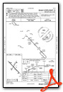
Instrument Approach Procedure (IAP) Charts

Nearby Airports with Instrument Procedures
| ID | Name | Heading / Distance | ||
|---|---|---|---|---|
 |
KEFW | Jefferson Municipal Airport | 096° | 20.1 |
|
KADU | Audubon County Airport | 195° | 21.5 |
|
KSKI | Sac City Municipal Airport | 336° | 21.7 |
|
KDNS | Denison Municipal Airport | 262° | 26.7 |
|
KGCT | Guthrie County Regional Airport | 143° | 26.8 |
|
KPRO | Perry Municipal Airport | 114° | 31.1 |
|
KHNR | Harlan Municipal Airport | 221° | 37.1 |
|
KSLB | Storm Lake Municipal Airport | 328° | 38.7 |
|
KFOD | Fort Dodge Regional Airport | 041° | 40.3 |
|
KAIO | Atlantic Municipal Airport | 196° | 40.3 |
|
KBNW | Boone Municipal Airport | 089° | 42.1 |
|
KPOH | Pocahontas Municipal Airport | 008° | 42.2 |
Airport Images

By: Bandco


