Login
Register


EFW
Jefferson Municipal Airport
Official FAA Data Effective 2026-01-22 0901Z
Chart Supplement

VFR Chart of KEFW
Sectional Charts at SkyVector.com
IFR Chart of KEFW
Enroute Charts at SkyVector.com
Location Information for KEFW
Coordinates: N42°0.59' / W94°20.51'Located 02 miles E of Jefferson, Iowa on 200 acres of land. View all Airports in Iowa.
Surveyed Elevation is 1047 feet MSL.
Operations Data
|
|
Airport Communications
| CTAF: | 122.800 |
|---|---|
| UNICOM: | 122.800 |
| AWOS-3 at PRO (13.6 SE): | 118.0 515-465-2269 |
| AWOS-3 at CIN (20.1 W): | 118.025 712-792-2306 |
| AWOS-3 at BNW (22.2 E): | 120.925 515-432-9042 |
- APCH/DEP SVC PRVDD BY MINNEAPOLIS ARTCC ON FREQS 134.0/288.3 (FORT DODGE RCAG).
Nearby Navigation Aids
|
| ||||||||||||||||||||||||||||||||||||||||||


Runway 14/32
| Dimensions: | 4100 x 75 feet / 1250 x 23 meters | |
|---|---|---|
| Surface: | Concrete in Good Condition | |
| Weight Limits: | 6 /R/C/X/T, S-11 | |
| Edge Lighting: | Medium Intensity | |
| Runway 14 | Runway 32 | |
| Coordinates: | N42°0.83' / W94°20.82' | N42°0.29' / W94°20.27' |
| Elevation: | 1043.5 | 1047.3 |
| Traffic Pattern: | Left | Left |
| Runway Heading: | 143° True | 323° True |
| Displaced Threshold: | 100 Feet | |
| Markings: | Non-Precision Instrument in good condition. | Non-Precision Instrument in good condition. |
| Glide Slope Indicator | P2L (3.00° Glide Path Angle) | P2L (3.00° Glide Path Angle) |
| REIL: | Yes | Yes |
| Obstacles: | 20 ft Road 640 ft from runway | |
Runway 18/36
| Dimensions: | 1696 x 150 feet / 517 x 46 meters | |
|---|---|---|
| Surface: | Turf in Fair Condition | |
| Runway 18 | Runway 36 | |
| Coordinates: | N42°0.80' / W94°20.38' | N42°0.53' / W94°20.46' |
| Elevation: | 1033.4 | 1038.0 |
| Traffic Pattern: | Left | Left |
| Runway Heading: | 192° True | 12° True |
| Markings: | Non-Standard in good condition. | Non-Standard in good condition. |
| Obstacles: | 19 ft Road 590 ft from runway | 42 ft Power Line 1700 ft from runway |
Services Available
| Fuel: | 100LL (blue) |
|---|---|
| Transient Storage: | Hangars,Tiedowns |
| Airframe Repair: | MINOR |
| Engine Repair: | MINOR |
| Bottled Oxygen: | NONE |
| Bulk Oxygen: | NONE |
| Other Services: | CROP DUSTING SERVICES |
Ownership Information
| Ownership: | Publicly owned | |
|---|---|---|
| Owner: | CITY OF JEFFERSON | |
| CITY HALL | ||
| JEFFERSON, IA 50129 | ||
| 515-386-3111 | ||
| Manager: | JOYCE RICHARDSON | |
| 1581 235 ST | ||
| JEFFERSON, IA 50129 | ||
| 515-386-7301 | OR 515-386-2136 (POLICE) | |
Other Remarks
- RY 32 IS CALM WIND RY.
- FOR CD CTC MINNEAPOLIS ARTCC AT 651-463-5588.
- 18/36 MKD WITH YELLOW CONES.
- RUNWAY 18/36 MARKED WITH YELLOW CONES
- DUSK-DAWN. ACTVT REIL RWY 14 & 32; MIRL RWY 14/32 - CTAF. PAPI RWY 14 & 32 OPR CONSLY
Weather Minimums

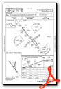
Instrument Approach Procedure (IAP) Charts

Nearby Airports with Instrument Procedures
| ID | Name | Heading / Distance | ||
|---|---|---|---|---|
 |
KPRO | Perry Municipal Airport | 143° | 13.7 |
|
KGCT | Guthrie County Regional Airport | 192° | 19.8 |
|
KCIN | Arthur N Neu Airport | 276° | 20.1 |
|
KBNW | Boone Municipal Airport | 083° | 22.2 |
|
KADU | Audubon County Airport | 234° | 31.9 |
|
KAMW | Ames Municipal Airport | 091° | 32.2 |
|
KEBS | Webster City Municipal Airport | 039° | 33.1 |
|
KFOD | Fort Dodge Regional Airport | 011° | 33.1 |
|
KSKI | Sac City Municipal Airport | 308° | 36.0 |
|
KIKV | Ankeny Regional Airport | 118° | 39.7 |
|
KGFZ | Greenfield Municipal Airport | 186° | 41.2 |
|
3Y3 | Winterset Municipal Airport | 159° | 41.4 |
Airport Images
Do you have a recent image of this airport? Upload it here!


