Login
Register


CL13
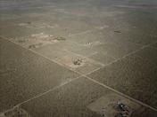
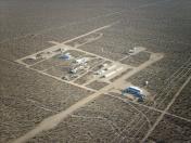
Brian Ranch Airport
Official FAA Data Effective 2022-05-19 0901Z
VFR Chart of CL13
Sectional Charts at SkyVector.com
IFR Chart of CL13
Enroute Charts at SkyVector.com
Location Information for CL13
Coordinates: N34°30.92' / W117°45.72'Located 18 miles E of Palmdale, California on 36 acres of land. View all Airports in California.
Estimated Elevation is 3230 feet MSL.
Operations Data
|
|
Airport Communications
| ASOS at GXA (5.5 NE): | 413.2 760-315-0639 |
|---|---|
| ASOS at PMD (17.3 NW): | 661-272-3798 |
| ATIS at PMD (17.4 NW): | 118.275 |
Nearby Navigation Aids
|
| ||||||||||||||||||||||||||||||||||||||||||||||||||||||


Runway 03/21
| Dimensions: | 1462 x 50 feet / 446 x 15 meters | |
|---|---|---|
| Surface: | Dirt | |
| Runway 03 | Runway 21 | |
| Displaced Threshold: | 300 Feet | |
Ownership Information
| Ownership: | Privately Owned | |
|---|---|---|
| Owner: | JACK BRIAN | |
| PO BOX 355 | ||
| LLANO, CA 93544-0355 | ||
| 661-261-3216 | ||
| Manager: | JACK BRIAN | |
| 34810 LARGO VISTA BLVD | ||
| LLANO, CA 93544-0355 | ||
| 661-261-3216 | ||
Other Remarks
- FOR CD CTC JOSHUA APCH AT 661-277-3843.
Nearby Airports with Instrument Procedures
| ID | Name | Heading / Distance | ||
|---|---|---|---|---|
 |
KPMD | Palmdale Usaf Plant 42 Airport | 293° | 17.4 |
|
KVCV | Southern California Logistics Airport | 075° | 19.4 |
|
KEDW | Edwards AFB Airport | 345° | 24.3 |
|
KCCB | Cable Airport | 171° | 24.5 |
|
KPOC | Brackett Field Airport | 182° | 25.4 |
|
KWJF | General Wm J Fox Airfield Airport | 301° | 26.3 |
|
KAPV | Apple Valley Airport | 082° | 28.8 |
|
KONT | Ontario International Airport | 163° | 28.6 |
|
KEMT | San Gabriel Valley Airport | 207° | 29.1 |
|
KCNO | Chino Airport | 169° | 33.0 |
|
KBUR | Bob Hope Airport | 237° | 35.1 |
|
KWHP | Whiteman Airport | 244° | 35.8 |